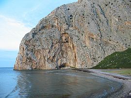
Chalkeia
Chalkeia
Χάλκεια | |
|---|---|
Settlement | |
 Limnopoula,Kato Vasiliki | |
| Country | Greece |
| Administrative region | West Greece |
| Regional unit | Aetolia-Acarnania |
| Municipality | Nafpaktia |
| Area | |
| • Municipal unit | 114.2 km2 (44.1 sq mi) |
| Population (2001)[1] | |
| • Municipal unit | 3,161 |
| • Municipal unit density | 28/km2 (72/sq mi) |
| Time zone | UTC+2 (EET) |
| • Summer (DST) | UTC+3 (EEST) |
| Postal code | 300 14 |
| Area code(s) | 26340 |
Chalkeia (Greek: Χάλκεια) is a former municipality in Aetolia-Acarnania, West Greece, Greece. Since the 2011 local government reform it is part of the municipality Nafpaktia, of which it is a municipal unit.[2] Population 3,161 (2001). The seat of the municipality was in Trikorfo.
Subdivisions
The municipal unit Chalkeia is subdivided into the following communities (constituent villages in brackets):
- Trikorfo
- Ano Vasiliki
- Vasiliki (Kato Vasiliki, Perama)
- Gavrolimni
- Galatas (Galatas, Kryoneri)
- Kalavrouza (Kato Kalavrouza, Kalavrouza)
- Perithori
Kryoneri
Kryoneri (Greek: Κρυονέρι meaning "cold water") is a settlement located east-southeast of Messolongi. Its population in 2001 was 110. It is located by the banks of the Evinos river and is a popular summer destination. The rocks of Varasova, a very steep mountain is to the east. It features owned beds and hotels. It had the old railway line of the Hellenic Railways Organisation, the Northwestern Greece Railway of the (SVDE) in which it ferried freights from the port of Patras in which is across. Its panoramic views includes the hills to the northwest, the Ionian Islands including Zante, Kefalonia, Ithaca, the Echinades and the Peloponnese to the south including the Panachaiko, Movri and the Scollis mountains. Kryoneri has a few churches and the central square (plateia), its nearest lyceum (middle school), gymnasium (secondary school) and banks are in Galatas.
References
- ^ De Facto Population of Greece Population and Housing Census of March 18th, 2001 (PDF 39 MB). National Statistical Service of Greece. 2003.
- ^ Kallikratis law Greece Ministry of Interior Template:El icon
