Chryston
Chryston
| |
|---|---|
 Chryston Parish Church | |
| Population | 2,900 [1] (mid-2012 estimate) |
| OS grid reference | [NS67SE60 NS67SE60] |
| Lieutenancy area | |
| Country | Scotland |
| Sovereign state | United Kingdom |
| Post town | GLASGOW |
| Postcode district | G69 |
| Police | Scotland |
| Fire | Scottish |
| Ambulance | Scottish |
| UK Parliament | |
| Scottish Parliament | |
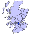
Chryston is a village in North Lanarkshire, around 7 miles (11 km) east of Glasgow, in Scotland. It lies north of its sister village, Muirhead, which is on the A80.[2] The village has around double Muirhead's population although the exact boundary between the two modern villages is difficult to find.
History


The etymology of the name is uncertain but may refer to the "town of Cristinus".[5] Several old documents show Chryston with various spellings including maps by Timothy Pont,[6] William Forrest, Thomas Richardson,[7] and William Roy.[8]
In the 18th century, Chryston had one of the four schools in the parish of Cadder. William Barclay, himself a school teacher, reported the low pay of his profession in the Old Statistical Account.[9]
One gazetteer, Samuel Lewis, from around 1846, describes a recently established library. He quotes 555 inhabitants.[10] The same publication also stated that Chyston was a quoad sacra parish including the villages of Mollinsburn, Moodiesburn, Muirhead and the hamlet of Auchinloch. Even today Moodiesburn is often included in the Chryston district: Devro headquarters has Chryston as its official address, and Moodiesburn's Stoneyetts Hospital (originally part of East Muckcroft within the "Woodilee Estate") was sometimes listed under Chryston.[11][12] As with Muirhead, children born of Moodiesburn citizens have Chryston as their birth district on their birth certificate.
Chryston Parish Church serves the villages of Chryston, Moodiesburn and Muirhead and has churches in Chryston and Moodiesburn.
On Friday 18 September, 1959, 47 miners lost their lives in the Auchengeich mining disaster at nearby Auchengeich Colliery.
Chryston High School is a six-year non-denominational secondary school situated on Lindsaybeg Road.[13]
Demography
Groome's Gazetteer gives historical statistics including population.[14] The 1891 and 1901 statistics include Muirhead.[15]
| Year | Chryston Population | Quoad Sacra Parish Population |
|---|---|---|
| 1836[16] | 374 | _ |
| 1841 | _ | 2,670 |
| 1846 | 555 | _ |
| 1861 | 582 | _ |
| 1871 | 486 | 3,203 |
| 1881 | 464 | 3,240 |
| 1891 | 899 | _ |
| 1901 | 1,102 | _ |
See also

References
- ^ "Estimated population of localities by broad age groups, mid-2012" (PDF). Retrieved 3 January 2018.
- ^ "OS 25 inch 1892-1949". National Library of Scotland. Ordnance Survey. Retrieved 26 October 2017.
- ^ Blaeu, Joan. "Glottiana Praefectura Inferior". National Library of Scotland. Retrieved 30 December 2017.
- ^ "Chryston on Pont 34". Maps of Scotland. Timothy Pont (16th century). Retrieved 31 December 2017.
- ^ Drummond, Peter, John (2014). An analysis of toponyms and toponymic patterns in eight parishes of the upper Kelvin basin (PDF). Glasgow: Glasgow University. p. 155. Retrieved 3 July 2017.
{{cite book}}: CS1 maint: multiple names: authors list (link) - ^ "Christoun on Pont's Map". NLS. Pont. Retrieved 24 February 2018.
- ^ "Old County Maps". NLS. Retrieved 27 January 2018.
- ^ "Roy's map of the Lowlands". NLS. Retrieved 27 January 2018.
- ^ Barclay, William (1791). The statistical account of Scotland. Drawn up from the communications of the ministers of the different parishes (Vol 8 ed.). Edinburgh: W. Creech. pp. 480–481. Retrieved 2 March 2018.
- ^ Lewis, Samuel (1846). A topographical dictionary of Scotland ... London: S. Lewis and Co. p. 198. Retrieved 24 February 2018.
- ^ Stoneyetts Hospital, Glasgow. The National Archives. Retrieved 23 June 2011.
- ^ Tough, Alistair (23 July 1998). "NHS Greater Glasgow and Clyde Archives: Records". University of Glasgow. Retrieved 23 June 2011.
- ^ http://www.chrystonhigh.n-lanark.sch.uk/about%20us
- ^ Groome, Francis Hindes (1882). Ordnance gazetteer of Scotland : a survey of Scottish topography, statistical, biographical, and historical (Vol 1 ed.). Edinburgh: T.C. Jack. p. 261. Retrieved 24 February 2018.
- ^ Eleventh decennial census of the population of Scotland taken 31st March 1901, with report : volume I. HMSO. 1902. p. 278. Retrieved 2 March 2018.
- ^ The new statistical account of Scotland by Society for the Benefit of the Sons and Daughters of the Clergy (Vol 6 ed.). Edinburgh and London: W. Blackwood and Sons. 1836. p. 408. Retrieved 2 March 2018.
External links


