
Continental Divide of the Americas
- This article is about the Atlantic/Pacific divide of North America. For continental divides in general, see Continental divide. For the movie, see Continental Divide (film)

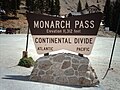
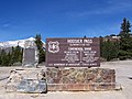
Continental Divide or Great Divide is the name given to the North American portion of the mountainous ridge which separates the watersheds that drain into the Pacific Ocean from, 1) those river systems which drain into the Atlantic Ocean (including those which drain via the Gulf of Mexico), and 2) along the northernmost reaches of the Divide, those river systems which drain into the Arctic Ocean. A secondary, non-mountainous divide further separates other river systems that drain into the Arctic Ocean (including those which drain via Hudson Bay, James Bay, and Ungava Bay) from those which drain into the Atlantic Ocean (including those which drain via the Great Lakes and Saint Lawrence Seaway).
The divide begins at Cape Prince of Wales in Alaska. It runs northeast-/eastward across the north of the state into the Yukon Territory, Canada, where it turns south and travels through British Columbia (forming part of the B.C.-Alberta boundary), in Canada; then through Montana (forming part of the Montana-Idaho boundary), Wyoming, Colorado, and New Mexico, in the United States; then along the crest of the Sierra Madre Occidental through the Mexican states of Chihuahua, Durango, Zacatecas, Aguascalientes, Jalisco, Guanajuato, México and the Distrito Federal, Morelos, Puebla, Oaxaca, and Chiapas; thence through southern Guatemala, southwestern Honduras, western Nicaragua, and western/southwestern Costa Rica, and southern Panama.
The physical divide continues (though the name "Great Divide" does not) into South America, where it follows the peaks of the Andes Mountains, traversing western Colombia, central Ecuador, western and southwestern Peru, and eastern Chile (essentially conforming to the Chile-Bolivia and Chile-Argentina boundaries), southward to the southern end of Patagonia and Tierra del Fuego.
In North America, Triple Divide Peak in Glacier National Park, in Montana, is the point at which the three principal continental divides in North America converge. From this point, waters flow to the Pacific, the Atlantic and the Arctic Oceans. Another calculation, however, puts a lesser triple divide within the Columbia Icefield in Alberta, by separating Hudson Bay (thus, the rivers that drain into it) from the Arctic Ocean.
The Continental Divide Trail follows the divide through the U.S. from the Mexican border to the Canadian border.
Exceptions
Many endorheic regions in North America complicate the simple view of east or west, "ocean-bound" water flow.
The Great Basin of the Western US, The Valley of Mexico and Bolson de Mapimi in Mexico, the Tularosa Basin in New Mexico and Texas, and the Salton Trough are examples of internally draining areas. In these cases, water often drains to low basins, where sedimentation and evaporation form salt lakes, playas, salt flats, and alkali flats.
On the Llano Estacado in Texas and New Mexico, many thousands of seasonal playa lakes form during wet months, an average of one per square mile. This region is very flat, and water mostly evaporates before draining.
Zuni Salt Lake is one example of a larger, seasonal maar which does not drain to an ocean. There are a number of seasonal lakes of this sort in North America. In areas of karst topography (such as northern Florida), isolated drainages can also occur.
The Great Divide Basin in Wyoming has no natural outlet except as groundwater, and hence it lies between the Atlantic and Pacific watersheds, being part of neither. Water from the North Two Ocean Creek in Wyoming flows into both oceans.
Additionally, although Panama's isthmus provides clear division between Atlantic and Pacific, the boundaries between the Atlantic and Arctic Oceans in Baffin Bay are not well defined, rendering the easternmost portion of this divide arbitrary.
Images
-

-
 The Continental Divide as it passes through Colorado at the Loveland Pass
 -
The Continental Divide seen from Idaho Springs, Colorado in July 2005
-
-
 The Continental Divide viewed from northwest of Winter Park, Colorado.
 -
 Divide on US 550 in New Mexico.
 -
 Divide on I-40 in New Mexico.
 -
Another Continental Divide in Central Minnesota
-
-


See also
- List of railroad crossings of the North American continental divide
- Laurentia
- Continental Divide Trail