Cuyo Basin
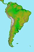
Cuyo Basin (Spanish: Cuenca Cuyana) is a sedimentary basin in Mendoza Province, western Argentina. The Cuyo Basin has a NNW-SSE elongated shape and is limited to the west by the Sierra Pintada System and to the [where?] by the Pampean pericraton. To the north the basin reaches the area around the city of Mendoza.[1] It has two major sub-basins: Cacheuta (Spanish: Subcuenca Cacheuta) in the north and Alvear (Spanish: Subcuenca Alvear) in the south. The northern fringes of Cacheuta sub-basin reaches into San Juan Province. The basin existed already during the Triassic but its current shape is derivative of the Andean orogeny.[1]
The basin originated as a rift basin in the context of extensional tectonics and crustal thinning that followed the Paleozoic Gondwanide orogeny.[note 1] Its basal part hosts deposits of the Choiyoi Group.[2]
Notes
References
- ^ a b "Cuenca Cuyana". Secretaría de Energía (in Spanish). Government of Argentina. Retrieved 30 November 2015.
- ^ a b Spalletti, L.A.; Fanning, C.M.; Rapela, C.W. (2008). "Dating the Triassic continental rift in the southern Andes: the Potrerillos Formation, Cuyo Basin, Argentina". Geologica Acta. 6 (3): 267–283.
{{cite journal}}:|access-date=requires|url=(help)

