
Dunnavant, Alabama
Dunnavant, Alabama | |
|---|---|
| Country | United States |
| State | Alabama |
| County | Shelby |
| Area | |
| • Total | 18.713 sq mi (48.47 km2) |
| • Land | 17.708 sq mi (45.86 km2) |
| • Water | 1.005 sq mi (2.60 km2) |
| Elevation | 666 ft (203 m) |
| Population | |
| • Total | 981 |
| • Density | 52/sq mi (20/km2) |
| Time zone | UTC-6 (Central (CST)) |
| • Summer (DST) | UTC-5 (CDT) |
| Area code | 205 |
| GNIS feature ID | 117649[3] |
Dunnavant, also spelled Dunavant, is a census-designated place and unincorporated community in Shelby County, Alabama, United States. Its population was 981 as of the 2010 census.[2] The community's name is probably derived from a local family.[4] A post office was established in 1897 and was in operation until it was closed in 1958.[5]
References
- ^ "US Gazetteer files: 2010, 2000, and 1990". United States Census Bureau. 2011-02-12. Retrieved 2011-04-23.
- ^ a b "American FactFinder". United States Census Bureau. Retrieved 2011-05-14.
- ^ "Dunnavant". Geographic Names Information System. United States Geological Survey, United States Department of the Interior.
- ^ Foscue, Virginia (1989). Place Names in Alabama. Tuscaloosa: The University of Alabama Press. p. 102. ISBN 0-8173-0410-X.
- ^ "Shelby County". Jim Forte Postal History. Retrieved 21 October 2014.
Municipalities and communities of Shelby County, Alabama, United States | ||
|---|---|---|
| Cities | 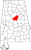 | |
| Towns | ||
| CDPs | ||
| Other unincorporated communities | ||
| Footnotes | ‡This populated place also has portions in an adjacent county or counties | |
This Alabama state location article is a stub. You can help Wikipedia by expanding it. |