Enders, Pennsylvania
Enders, Pennsylvania | |
|---|---|
| Coordinates: 40°29′30″N 76°50′59″W / 40.49167°N 76.84972°W | |
| Country | United States |
| State | Pennsylvania |
| County | Dauphin |
| Township | Jackson |
| Elevation | 669 ft (204 m) |
| Time zone | UTC-5 (Eastern (EST)) |
| • Summer (DST) | UTC-4 (EDT) |
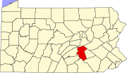
Enders is an unincorporated community located in Jackson Township, Dauphin County, just north of Harrisburg, Pennsylvania. The town lies in the Eastern Standard time zone and has an elevation of 669 feet. Although it has an official federally recognized name, it is considered to be not incorporated.[1]
Originally called Jacksonville, Enders was laid out in about 1825.[2]
References
- ^ "Enders". Geographic Names Information System. United States Geological Survey, United States Department of the Interior. Retrieved January 19, 2010.
- ^ Notes and Queries, Historical, Biographical and Genealogical, Relating Chiefly to Interior Pennsylvania. Harrisburg Publishing Company. 1895. p. 20.


