
Emerald Bay, Texas
Emerald Bay, Texas | |
|---|---|
 | |
| Coordinates: 32°9′37″N 95°26′17″W / 32.16028°N 95.43806°W | |
| Country | United States |
| State | Texas |
| County | Smith |
| Area | |
• Total | 1.5 sq mi (4 km2) |
| • Land | 0.75 sq mi (1.9 km2) |
| • Water | 0.75 sq mi (1.9 km2) |
| Population (2010) | |
• Total | 1,047 |
| • Density | 700/sq mi (270/km2) |
| Time zone | UTC-6 (Central (CST)) |
| • Summer (DST) | UTC-5 (CDT) |
| Zip Code | 75757 |
Emerald Bay is in Smith County, Texas, United States. It is a new a census-designated place (CDP) for the 2010 census with population of 1047. [1]
Geography
Emerald Bay is located at 32°9′37″N 95°26′17″W / 32.16028°N 95.43806°W (32.160166, -95.438039).[2]
References
Municipalities and communities of Smith County, Texas, United States | ||
|---|---|---|
| Cities | 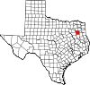 | |
| Towns | ||
| CDP | ||
| Other unincorporated communities |
| |
| Ghost towns | ||
| Footnotes | ‡This populated place also has portions in an adjacent county or counties | |