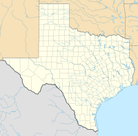
Gainesville Municipal Airport
Gainesville Municipal Airport | |||||||||||||||
|---|---|---|---|---|---|---|---|---|---|---|---|---|---|---|---|
 | |||||||||||||||
| Summary | |||||||||||||||
| Airport type | Public | ||||||||||||||
| Owner | City of Gainesville | ||||||||||||||
| Serves | Gainesville, Texas | ||||||||||||||
| Elevation AMSL | 845 ft / 258 m | ||||||||||||||
| Coordinates | 33°39′05″N 097°11′49″W / 33.65139°N 97.19694°W | ||||||||||||||
 | |||||||||||||||
| Runways | |||||||||||||||
| |||||||||||||||
| Statistics (2005) | |||||||||||||||
| |||||||||||||||
Gainesville Municipal Airport (IATA: GLE, ICAO: KGLE, FAA LID: GLE) is a public-use airport located three miles (5 km) west of the central business district of Gainesville, a city in Cooke County, Texas, United States. It is owned and operated by the City of Gainesville.[1]
History
The airport was opened in August 1941 as Gainesville Army Airfield and was used by the United States Army Air Forces Third Air Force as a training base to provide photographic intelligence for air and ground forces.
Known units which trained at Gainesville were the 8th and 426th Reconnaissance Groups. They flew a wide variety of aircraft, including the P-38 Lightning (F-5), P-51 Mustang (F-6), B-24 Liberator (F-7) and P-40 Warhawk.
The 8th Reconnaissance group was deployed to India in 1944 to support 10th and 14th Air Forces in the China-Burma-India (CBI) Theater.
Reassigned from Third Air Force in April 1944 to AAF Central Flying Training Command. Hosted AAF Pilot School (Advanced, Single Engine). At the end of the war the airfield was determined to be excess by the military and turned over to the local government for civil use.
Facilities and aircraft
Gainesville Municipal Airport covers an area of 1,336 acres (541 ha) which contains two asphalt paved runways: 17/35 measuring 6,000 x 100 ft (1,829 x 30 m) and 12/30 measuring 4,296 x 80 ft (1,309 x 24 m).[1]
For the 12-month period ending August 30, 2005, the airport had 20,200 aircraft operations, an average of 55 per day: 99.5% general aviation and 0.5% military. At that time there were 70 aircraft based at this airport: 66% single-engine, 21% multi-engine, 9% jet, 3% helicopter and 1% ultralight.[1]
See also
References
![]() This article incorporates public domain material from the Air Force Historical Research Agency
This article incorporates public domain material from the Air Force Historical Research Agency
- Shaw, Frederick J. (2004), Locating Air Force Base Sites History’s Legacy, Air Force History and Museums Program, United States Air Force, Washington DC, 2004.
- Manning, Thomas A. (2005), History of Air Education and Training Command, 1942–2002. Office of History and Research, Headquarters, AETC, Randolph AFB, Texas ASIN: B000NYX3PC
- Thole, Lou (1999), Forgotten Fields of America : World War II Bases and Training, Then and Now - Vol. 2. Publisher: Pictorial Histories Pub, ISBN 1-57510-051-7
External links
- FAA Airport Diagram (PDF), effective October 31, 2024
- Resources for this airport:
- FAA airport information for GLE
- AirNav airport information for KGLE
- ASN accident history for GLE
- FlightAware airport information and live flight tracker
- NOAA/NWS weather observations: current, past three days
- SkyVector aeronautical chart, Terminal Procedures


