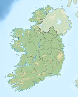
Garraunbaun
Appearance
| Garraunbaun | |
|---|---|
| Highest point | |
| Elevation | 406 m (1,332 ft) |
| Prominence | 30 m (98 ft) |
| Listing | Marilyn |
| Coordinates | 53°01′N 7°43′W / 53.01°N 7.71°W |
| Geography | |
| Location | Laois, Republic of Ireland |
| Parent range | Slieve Bloom Mountains |
| Topo map | OSi Discovery 54 |
Garraunbaun is a mountain in Laois, in the Republic of Ireland. Castleconor's summit is at an elevation of 406 metres (1,332 feet), making it the fifth-highest point in Laois, the tenth-highest point in the Slieve Bloom Mountains and the 802nd-highest summit in Ireland.


