
Gayasan National Park
| 가야산국립공원, 伽倻山國立公園 | |
|---|---|
| Gaya Mountain National Park | |
 Sanghwang peak, 2004. | |
| Nearest city | Daegu, South Korea |
| Area | 64.71 sq mi (167.6 km2)[1] |
| Established | 13 October 1972[1] |
| Governing body | Korea National Park Service |
| Gayasan National Park | |
| Hangul | 가야산 |
|---|---|
| Hanja | 伽倻山 |
| Revised Romanization | Gaya-san |
| McCune–Reischauer | Kaya-san |
Gayasan National Park, also known as Gaya Mountain National Park, and sometimes spelled Kaya Mountain National Park (Korean: 가야산국립공원, 伽倻山國立公園), is a large national park in the eastern part of South Korea. The park is named in honor of Gaya Mountain and became a National Park in 1972.
The park includes Haeinsa, which is one of the main temples of the Jogye Order of Korean Buddhism.
Geography
Gayasan National Park covers covers an area of more than 160 square kilometers. The national park extends from the northern edge of South Gyeongsang (경상남도, 慶尙南道) Province, to the southern limit of North Gyeongsang (경상북도, 慶尙北道) Province. The Sobaek Mountain range (소백산맥, 小白山脈) runs through this area.
Gaya Mountain
The national park is named in honor of Gaya Mountain. This mountain has two major peaks: one of them is Sangwangbong Peak, for which the height is 1,430 meters, and the other slightly higher peak, Chulbulbong, is 1,433 above sea level.
Special features

One significant feature of the national park is Haeinsa (해인사, 海印寺). This Buddhist temple includes in its grounds a standing Buddha figure carved into a vertical rock.
Another feature of the park is Yongmun Falls and Hongnyudong Valley. 380 different species of plant have been identified as growing there, as well as 100 species of birds, and other wild animals.
History
The area was declared Scenic Site No. 5 by the Korean government in 1966, and it became an official National Park in 1972.
The remoteness of the area has played a role in protecting it from destruction in the past, specifically during the Japanese invasions of 1592-98, when much of the country was razed.
Since that time, legend says that the area around Gaya Mountains is free from the Three Disasters: fire, floods and wind.
Gallery
-
 Gayasan from Haeinsa temple
 -
 Gayasan from Southeast
 -
 Ruins of Baekumam temple in Gayasan
 -
 Gayasan Castle in Gayasan
 -
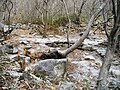
 Stone walls near Chilbulbong Peak in Gayasan (1)
 -
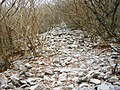
 Stone walls near Chilbulbong Peak in Gayasan (2)
 -
 Sangwangbong Peak of Gayasan
 -
 Rituals of Buddhism in Gayasan


References
- ^ a b "Gayasan: Intro". Korea National Park Service. Retrieved 18 September 2010.