Geri, Cyprus
Appearance
Geri
Γέρι (Greek) | |
|---|---|
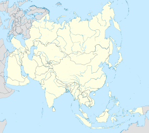
Location within Cyprus Location within the Eastern Mediterranean Location within the European Union Location within Asia | |
| Coordinates: 35°06′25″N 33°25′17″E / 35.10694°N 33.42139°E | |
| Country | |
| District | Nicosia District |
| Urban area | Nicosia |
| Area | |
| • Geri | 28.26 km2 (10.91 sq mi) |
| • Latsia-Geri | 44.81 km2 (17.30 sq mi) |
| Population (2011)[2] | |
| • Geri | 8,235 |
| • Density | 290/km2 (750/sq mi) |
| • Latsia-Geri | 25,009 |
| • Latsia-Geri density | 560/km2 (1,400/sq mi) |
| Time zone | UTC+2 (EET) |
| • Summer (DST) | UTC+3 (EEST) |
| Website | latsia-geri |

Geri, sometimes also transliterated as Yeri,[3] (Greek: Γέρι) is a settlement in Cyprus, 10 kilometres (6.2 mi) south-east of the capital Nicosia. In 2001, it had a population of 6,643. As of 2011[update], its population was 8,235. Following a referendum in 2011, Geri became a municipality. Since 2024, after local government reforms, Geri has been included in the newly created Latsia-Geri Municipality.
References
[edit]- ^ "Cyprus: Nicosia Urban Agglomeration (Municipalities, Communities and Quarters) - Population Statistics, Charts and Map". www.citypopulation.de. Retrieved 2024-10-04.
- ^ "C1. POPULATION ENUMERATED BY SEX, AGE, DISTRICT, MUNICIPALITY/COMMUNITY AND QUARTER (1.10.2011)", Population - Place of Residence, 2011, Statistical Service of the Republic of Cyprus, 2014-04-17, archived from the original on 2014-04-20, retrieved 2014-04-20
- ^ This transliteration is closer to the actual pronunciation of the Greek name and is consistently used by Cyprus Mail, the main English-language newspaper in Cyprus


