
Grand Gulf Military State Park
This article needs additional citations for verification. (May 2009) |
Grand Gulf Military State Park | |
 Confederate Memorial Chapel, built in 1869, was moved to Grand Gulf Military State Park from Rodney, Mississippi in 1983. | |
  | |
| Nearest city | Port Gibson |
|---|---|
| Coordinates | 32°2′39.7932″N 91°3′4.6692″W / 32.044387000°N 91.051297000°W |
| Area | 400 acres (160 ha) |
| NRHP reference No. | 72000689 |
| USMS No. | 021-GGF-0100-NR-ML |
| Significant dates | |
| Added to NRHP | April 11, 1972[2] |
| Designated USMS | September 28, 1987[1] |
Grand Gulf Military State Park is a Mississippi state park located 10 miles northwest of Port Gibson in the unincorporated area that is now the ghost town of Grand Gulf, in Claiborne County. It is listed on the National Register of Historic Places and is a Mississippi Landmark.
The 400-acre landmark includes Fort Cobun and Fort Wade, the Grand Gulf Cemetery, a museum, campgrounds, picnic areas, hiking trails, an observation tower, and several restored buildings dating back to Grand Gulf's heyday.
Grand Gulf was originally a port on the Mississippi River, and in the 19th century before the war shipped thousands of bales of cotton that arrived by rail from Clinton, Mississippi in Hinds County. Its population in 1858 was 1,000 to 1500, and the community had two churches, a hospital, theater, town hall, cotton press, steam saw, and grits mill.[3] It became isolated later after the Mississippi River changed its course to the west, and the town died without access to the river.[4] It became a ghost town after the turn of the 20th century.
References
- ^ "Mississippi Landmarks" (PDF). Mississippi Department of Archives and History. May 2008. Archived from the original (PDF) on October 9, 2010. Retrieved May 10, 2009.
{{cite web}}: Unknown parameter|deadurl=ignored (|url-status=suggested) (help) - ^ "National Register Information System". National Register of Historic Places. National Park Service. January 23, 2007.
- ^ Conclin, George (1854). Conclins' New River Guide, Or, A Gazetteer of All the Towns on the Western Waters: Containing Sketches of the Cities, Towns, and Countries Bordering on the Ohio and Mississippi Rivers, and Their Principal Tributaries: Together with Their Population, Products, Commerce, &c., &c., &c.: and Many Interesting Events of History Connected with Them. J.A. & U.P. James. p. 102.
- ^ Mississippi: Comprising Sketches of Counties, Towns, Events, Institutions ..., ed. by Dunbar Rowland, Southern Historical Publishing Association, 1907, pp. 455-459
External links
- Grand Gulf Military Park, official web site
Municipalities and communities of Claiborne County, Mississippi, United States | ||
|---|---|---|
| City | 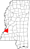 | |
| CDPs | ||
| Other communities | ||
| Ghost towns | ||
- State parks of Mississippi
- Mississippi Landmarks
- Protected areas of Claiborne County, Mississippi
- Museums in Claiborne County, Mississippi
- American Civil War museums in Mississippi
- Cemeteries in Mississippi
- Mississippi populated places on the Mississippi River
- National Register of Historic Places in Claiborne County, Mississippi
- Parks on the National Register of Historic Places in Mississippi