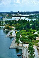
Hayy Al-Jami'a
Hay Al-Jami'a (Arabic: حي الجامعة) is a neighborhood in the Mansour district of Baghdad, Iraq.
The neighborhood was originally created during the mid-1960s, to provide housing for university professors. This is the origin of its name, since "Jamia" means "University" in Arabic. Hence, its full name is "Hay Al-Jamia" or "University Neighborhood".
During the recent sectarian troubles that plagued Baghdad, Hay Al-Jamia became one of the primary troubled areas in Western Baghdad, to the point that during the period (late 2006 - early 2007), the whole neighborhood became a de facto "ghost town". However, after the return of security in 2008, it has regained much of its former vitality.
Geography
It is bordered by the following neighborhoods: Al-Adil to the North, Al-Mansur and Al-Dawoodi to the East, Al-Shurta to the South, and Al-Khadraa and Al-Ghazaliah to the West.
Transport
Al-Rabiaa Street (Arabic: شارع الربيع) is a major access road and the main market area, and passes from north to south in the eastern half of Al-Jami'a.

