Howiri
Howiri-ouinge | |
| Nearest city | Ojo Caliente, New Mexico |
|---|---|
| Area | 25 acres (10 ha) |
| NRHP reference No. | 83001633[1] |
| Added to NRHP | April 7, 1983 |
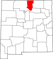
Howiri ("gray projecting-point") is a Tewa Pueblo ancestral site in Taos County, New Mexico, United States. Its ten circular kivas are located on the east bank of Rio Ojo Caliente, near Homayo.[2] It was occupied from around 1400 until around 1525.[3] In 1983, it was listed on the National Register of Historic Places listings in Taos County, New Mexico.
References
- ^ "National Register Information System". National Register of Historic Places. National Park Service. July 9, 2010.
- ^ Curtis, Edward. The North American Indian. Volume 17 - The Tewa. The Zuni. ~ Paperbound. Classic Books Company. pp. 191–. ISBN 978-0-7426-9817-8. Retrieved 27 September 2011.
- ^ Killion, Thomas W. (1992). Gardens of prehistory: the archaeology of settlement agriculture in Greater Mesoamerica. Society for American Archaeology. Meeting, University of Alabama Press. p. 56. ISBN 978-0-8173-0565-9. Retrieved 27 September 2011.
Categories:
- Archaeological sites on the National Register of Historic Places in New Mexico
- Former populated places in New Mexico
- History of Taos County, New Mexico
- Native American history of New Mexico
- Protected areas of Taos County, New Mexico
- Pueblo great houses
- Puebloan buildings and structures
- Ruins in the United States
- Tewa
- National Register of Historic Places in Taos County, New Mexico
- Pueblos on the National Register of Historic Places in New Mexico
- Populated places on the National Register of Historic Places in New Mexico

