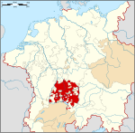
Königsegg-Rothenfels
Appearance
Barony (County) of Königsegg-Rothenfels Freiherrschaft (Grafschaft) Königsegg-Rothenfels | |||||||||
|---|---|---|---|---|---|---|---|---|---|
| 1622–1804 | |||||||||
| Status | State of the Holy Roman Empire | ||||||||
| Capital | Rothenfels | ||||||||
| Government | Principality | ||||||||
| Historical era | Middle Ages | ||||||||
| 1622 | |||||||||
• Raised to County | 1629 | ||||||||
• Mediatised to Austria | 1804 | ||||||||
• Transferred to Bavaria | 1805 | ||||||||
| |||||||||
Königsegg-Rothenfels was a German state in far southwestern Bavaria, Germany, located north of Austria and west of Baden-Württemberg. It was created as a partition of the Barony of Königsegg in 1622, and was raised to a County seven years later. It was absorbed by Austria in 1804, before being granted to Bavaria by France during the Napoleonic Wars.
Lords of Königsegg-Rothenfels
Baron of Königsegg-Rothenfels (1622–29)
- Hugh (1622–29)
Counts of Königsegg-Rothenfels (1629–1804)
- Hugh (1629–66)
- Leopold William (1666–94)
- Sigmund William (1694–1709)
- Albert Eusebius (1709–36)
- Charles Ferdinand (1736–59)
- Francis Hugh (1759–71)
- Francis Fidelis Anthony (1771–1804)
47°33′35″N 10°13′08″E / 47.5597222222°N 10.2188888889°E


