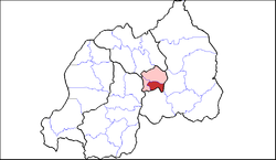
Kicukiro District
Kicukiro District | |
|---|---|
 Shown within Kigali Province and Rwanda | |
| Country | Rwanda |
| Province | Kigali |
| Capital | Kagarama |
| Area | |
| • Total | 167 km2 (64 sq mi) |
| Population (2012 census) | |
| • Total | 318,564 |
| • Density | 1,900/km2 (4,900/sq mi) |
Kicukiro is a district (akarere) in Kigali Province, Rwanda. Its headquarters is the Kigali suburb of Kicukiro. Kicukiro is home to a thriving market, a number of NGOs and the Bralirwa Brewery. In addition, it is the headquarters for the Friends Church in Rwanda. Kicukiro District is also home to two major memorial sites associated with the Rwandan genocide. These are the Rebero Genocide Memorial Site where 14,400 victims are buried, and the Nyanza-Kicukiro Genocide Memorial Site where 5,000 victims were killed after Belgian soldiers who were serving in the United Nations peacekeeping forces abandoned them, in an unprecedented act of cowardice.
Sectors
Kicukiro district is divided into 10 sectors (imirenge): Gahanga, Gatenga, Gikondo, Kagarama, Kanombe, Kicukiro, Kigarama, Masaka, Niboye and Nyarugunga.
References
- "Districts of Rwanda". Statoids.
- Inzego.doc — Province, District and Sector information from MINALOC, the Rwanda ministry of local government.
