Jump to content

Kinvara (Moycullen)

Coordinates: 53°20′21″N 9°33′06″W / 53.33918°N 9.55156°W / 53.33918; -9.55156
From Wikipedia, the free encyclopedia

This is an old revision of this page, as edited by Close-paren (talk | contribs) at 18:31, 27 May 2016 (add close-paren). The present address (URL) is a permanent link to this revision, which may differ significantly from the current revision.

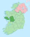
Kinvara (Irish: Cinn Mhara, meaning 'head of the sea') is the name of a townland in the Catholic parish of Cill Bhriocáin, civil parish of Kilcummin and barony of Moycullen in the west of County Galway. It is located on the R336 road north of the village of Casla and south of An Scríob. Its Irish Grid Reference is L967332.

53°20′21″N 9°33′06″W / 53.33918°N 9.55156°W / 53.33918; -9.55156