
L'Anse aux Meadows
| UNESCO World Heritage Site | |
|---|---|
 | |
| Criteria | Cultural: vi |
| Reference | 4 |
| Inscription | 1978 (2nd Session) |
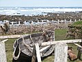
L'Anse aux Meadows (from the French L'Anse-aux-Méduses or "Jellyfish Cove") is a site on the northernmost tip of the island of Newfoundland, in Newfoundland and Labrador, Canada, where the remains of a Viking village were discovered in 1960 by the Norwegian explorer Helge Ingstad and his archaeologist wife, Anne Stine Ingstad. (Newfoundlanders pronounce the name of the site 'lancey meadows'.)
The settlement
The only authenticated Viking settlement in North America outside Greenland, it was the site of a multi-year archaeological dig that found dwellings, tools and implements that verified its time frame. The settlement, dating more than five hundred years before Christopher Columbus, contains the earliest European structures in North America. [1]Named a World Heritage site by UNESCO, it is thought by many to be the semi-legendary 'Vinland' settlement of explorer Leif Ericson around AD 1000.
The settlement at L'Anse aux Meadows consisted of at least eight buildings, including a forge and smelter, and a lumber yard that supported a shipyard. The largest house measured a spacious 28.8 by 15.6 m and consisted of several rooms[2].

History
The climate in Newfoundland then was significantly warmer than it is today. As recounted in the sagas, Leifur set forth from Greenland to search for the land Bjarni Herjólfsson had told him of. He found a land rich with grapes, salmon, and a frost free winter, and returned to harvest lumber to take back to tree-poor Greenland. L'Anse aux Meadows has been variously identified as: (a) the first camp made, (b) the camp made after fleeing hostile Skrælings, or (c) a camp not mentioned in the saga.
The saga describes a colonizing attempt led by Thorfinn Karlsefni, with as many as 135 men and fifteen women, who used Leifur's camp, perhaps L'Anse aux Meadows, as a base. Among them was Freydís Eiríksdóttir, half-sister to Leif. While it is not possible to verify that L'Anse aux Meadows is indeed the Vinland of Saga, it is certain that a group of Norse colonists lived here around the year AD 1000.[2]
L'Anse aux Meadows may have been a way station between a colony in Greenland and another settlement in the southern Gulf of Saint Lawrence region, or it may have served as an overwintering station for Norse explorers from Greenland.[3] The site was only used for two or three years. It is conjectured, based on both literary and archaeological evidence, that poor relations with natives doomed the settlement to abandonment. Intergroup conflict over women and unexpected weather have both been suggested as the cause for its abandonment.

L'Anse aux Meadows may also be connected to the Algonquin legend of a Kingdom of Saguenay populated by a race of blond men rich in furs and metals, but this may be only conjecture.
See also
References and notes
- ^ Nydal, Reidar (1989). "A critical review of radiocarbon dating of a Norse settlement at L'Anse aux Meadows, Newfoundland, Canada". Radiocarbon. 31: 976–985.
- ^ a b From the Canadian Encyclopedia article on L'Anse aux Meadows. Sewing and knitting tools found at the site indicate women were present at L'Anse aux Meadows.
- ^ Allen, John Logan (1997). North American Exploration: A New World Disclosed. Volume: 1. University of Nebraska Press. pp. p. 27.
{{cite book}}:|pages=has extra text (help)
External links
- UNESCO
- Parks Canada
- Severed Ways, The Norse Discovery of America, a drama set in 1000A.D. and filmed in L'Anse
Pictures
-
 L'Anse-aux-Meadows, Nfld
 -
 Landing at L'Anse aux Meadows reenactment 2000
 -
 Looking outside from Viking house, 2006


- Archaeological sites in Canada
- Coastal towns in Canada
- Communities in Newfoundland and Labrador
- History of Newfoundland and Labrador
- Viking exploration of North America
- World Heritage Sites in Canada
- European medieval architecture in North America
- 11th century in Canada
- National Historic Sites of Canada
- Geography of Newfoundland and Labrador