Lake White State Park
| Lake White State Park | |
|---|---|
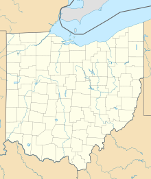
Map of the U.S. state of Ohio showing the location of Lake White State Park | |
| Location | Pike County, Ohio, USA |
| Nearest city | Waverly |
| Coordinates | 39°05′52″N 83°01′11″W / 39.09778°N 83.01972°W |
| Area | Land: 92 acres (37 ha) Water: 337 acres (136 ha) |
| Established | 1949 |
| Governing body | Ohio Department of Natural Resources |
Lake White State Park is a state park located southwest of Waverly in Pike County, Ohio, United States. It contains 92 acres (37 ha) of land and 337 acres (136 ha) of water.

Gallery
-
Lake White State Park sign.
-
Lake White
-
Lake White
-
Lake White
-
Lake White


History
Part of Lake White State Park includes the remains of the old Ohio and Erie Canal channel. The lake was built during the Great Depression by the Works Progress Administration (W.P.A.). Most of the land surrounding the lake is privately owned. Lake White was officially dedicated as a state park in 1949 when the Division of Parks and Recreation was created.
In August 2014, the dam showed signs of leaking and required major repairs. The lake was drained to allow for the process to begin.[1] In July 2015, the Ohio Department of Transportation announced the awarding of a contract to fix the dam and the bridge that goes over it.[2] A groundbreaking ceremony is set for Sept. 15, 2015.
References
External links
- Ohio Department of Natural Resources
- 1935 photographs during the development/construction of Lake White


