
Le Sueur, Minnesota
Le Sueur, Minnesota | |
|---|---|
 Location of Le Sueur, Minnesota | |
| Country | United States |
| State | Minnesota |
| Counties | Le Sueur, Sibley |
| Area | |
| • Total | 4.6 sq mi (12.0 km2) |
| • Land | 4.5 sq mi (11.6 km2) |
| • Water | 0.2 sq mi (0.5 km2) |
| Elevation | 774 ft (236 m) |
| Population (2000) | |
| • Total | 3,922 |
| • Density | 879.0/sq mi (339.4/km2) |
| Time zone | UTC-6 (Central (CST)) |
| • Summer (DST) | UTC-5 (CDT) |
| ZIP code | 56058 |
| Area code | 507 |
| FIPS code | 27-36746Template:GR |
| GNIS feature ID | 0654787Template:GR |
Le Sueur is a city in Le Sueur and Sibley counties in the U.S. state of Minnesota, between Mankato and the Twin Cities. It lies along the Minnesota River, just off U.S. Route 169. Le Sueur was named in honor of the French explorer Pierre Charles Le Sueur. The population was 3,922 at the 2000 census.
The community is known locally as the "Valley of the Jolly Green Giant ". A large billboard, with the caption "Welcome to the Valley" and Green Giant logo, remains even after the company and Green Giant label were bought by Pillsbury in 1979. Now the Green Giant label is owned by General Mills and is canned in Montgomery, Minnesota. The old canning processing plant in Le Sueur was used until 1995. The warehouse is still used for storage.
William Worrall Mayo was an early resident who began his practice in Le Sueur. He eventually founded the world-famous Mayo Clinic in Rochester, Minnesota with his sons William and Charles.
Geography
According to the United States Census Bureau, the city has a total area of 4.7 square miles (12.0 km²), of which, 4.5 square miles (11.6 km²) of it is land and 0.2 square miles (0.5 km²) of it (4.09%) is water. A small part of the city extends into Sibley County.
U.S. Route 169 and Minnesota State Highways 93 and 112 are three of the main routes in the community.
Demographics
As of the censusTemplate:GR of 2000, there were 3,922 people, 1,545 households, and 1,025 families residing in the city. The population density was 879.0 people per square mile (339.5/km²). There were 1,589 housing units at an average density of 356.1/sq mi (137.6/km²). The racial makeup of the city was 92.48% White, 0.25% African American, 0.15% Native American, 0.28% Asian, 0.08% Pacific Islander, 5.86% from other races, and 0.89% from two or more races. Hispanic or Latino of any race were 9.64% of the population.
There were 1,545 households out of which 33.3% had children under the age of 18 living with them, 53.3% were married couples living together, 9.4% had a female householder with no husband present, and 33.6% were non-families. 29.3% of all households were made up of individuals and 14.6% had someone living alone who was 65 years of age or older. The average household size was 2.48 and the average family size was 3.07.
In the city the population was spread out with 27.8% under the age of 18, 7.8% from 18 to 24, 26.7% from 25 to 44, 20.5% from 45 to 64, and 17.2% who were 65 years of age or older. The median age was 37 years. For every 100 females there were 93.5 males. For every 100 females age 18 and over, there were 88.2 males.
The median income for a household in the city was $42,372, and the median income for a family was $53,362. Males had a median income of $35,810 versus $24,359 for females. The per capita income for the city was $21,605. About 5.8% of families and 8.8% of the population were below the poverty line, including 12.3% of those under age 18 and 10.7% of those age 65 or over.
References
Further reading
Municipalities and communities of Le Sueur County, Minnesota, United States | ||
|---|---|---|
| Cities | 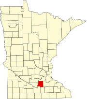 | |
| Townships | ||
| Unincorporated communities | ||
| Footnotes | ‡This populated place also has portions in an adjacent county or counties | |
Municipalities and communities of Sibley County, Minnesota, United States | ||
|---|---|---|
| Cities |  | |
| Townships | ||
| Unincorporated communities | ||
| Footnotes | ‡This populated place also has portions in an adjacent county or counties | |