List of parliamentary constituencies in Bedfordshire
Appearance
The ceremonial county of Bedfordshire (which includes the areas of the Bedford, Central Bedfordshire and Luton unitary authorities) is divided into 6 Parliamentary constituencies - 3 Borough constituencies and 3 County constituencies.
2010 constituencies
(part) signifies that only part of a ward is located in the constituency.
| Name[nb 1] | Electorate[1] | Majority[nb 2] | Member of Parliament | Nearest opposition | Electoral wards[2][3] | Map | ||
|---|---|---|---|---|---|---|---|---|
| Bedford BC | 69,311 | 1,097 | bgcolor=Template:Conservative Party (UK)/meta/color| | Richard Fuller† | bgcolor=Template:Labour Party (UK)/meta/color| | Patrick Hall‡ | Bedford Borough Council: Brickhill, Castle, Cauldwell, De Parys, Goldington, Harpur, Kempston East, Kempston North, Kempston South, Kingsbrook, Newnham, Putnoe, Queen’s Park. |  |
| Luton North BC | 67,329 | 9,504 | bgcolor=Template:Labour Party (UK)/meta/color| | Kelvin Hopkins‡ | bgcolor=Template:Conservative Party (UK)/meta/color| | Dean Russell† | Luton Borough Council: Barnfield, Bramingham, Challney, Icknield, Leagrave, Lewsey, Limbury, Northwell, Saints, Sundon Park. | 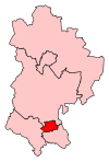 |
| Luton South BC | 67,741 | 5,711 | bgcolor=Template:Labour Party (UK)/meta/color| | Gavin Shuker‡ | bgcolor=Template:Conservative Party (UK)/meta/color| | Katie Redmond† | Luton Borough Council: Biscot, Crawley, Dallow, Farley, High Town, Round Green, South, Stopsley, Wigmore. Central Bedfordshire Council: Caddington, Hyde and Slip End. | 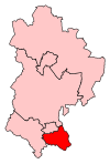 |
| Mid Bedfordshire CC | 78,501 | 23,327 | bgcolor=Template:Conservative Party (UK)/meta/color| | Nadine Dorries† | bgcolor=Template:Labour Party (UK)/meta/color| | Charlynne Pullen‡ | Bedford Borough Council: Turvey, Wilshamstead, Wootton. Central Bedfordshire Council: Ampthill, Aspley Guise, Clifton and Meppershall, Cranfield, Flitton, Greenfield and Pulloxhill, Flitwick East, Flitwick West, Harlington, Houghton, Haynes, Southill and Old Warden, Marston, Maulden and Clophill, Shefford, Campton and Gravenhurst, Shillington, Stondon and Henlow Camp, Streatley, Silsoe, Toddington, Westoning and Tingrith. | 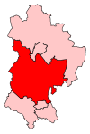 |
| North East Bedfordshire CC | 83,551 | 25,644 | bgcolor=Template:Conservative Party (UK)/meta/color| | Alistair Burt† | bgcolor=Template:Labour Party (UK)/meta/color| | Saqhib Ali‡ | Bedford Borough Council: Bromham, Carlton, Clapham, Eastcotts, Great Barford, Harrold, Oakley, Riseley, Roxton, Sharnbrook. Central Bedfordshire Council: Arlesey, Biggleswade Holme, Biggleswade Ivel, Biggleswade Stratton, Langford and Henlow Village, Northill and Blunham, Potton and Wensley, Sandy Ivel, Sandy Pinnacle, Stotfold. | 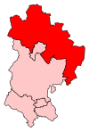 |
| South West Bedfordshire CC | 79,285 | 17,813 | bgcolor=Template:Conservative Party (UK)/meta/color| | Andrew Selous† | bgcolor=Template:Labour Party (UK)/meta/color| | Daniel Scott‡ | Central Bedfordshire Council: All Saints, Chiltern, Dunstable Central, Eaton Bray, Grovebury, Heath and Reach, Houghton Hall, Icknield, Kensworth and Totternhoe, Linslade, Manshead, Northfields, Parkside, Planets, Plantation, Southcott, Stanbridge, Tithe Farm, Watling. | 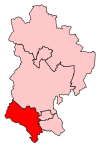 |
Boundaries 1997-2010
The same constituency names were in use during this period, with slightly different boundaries.
| Name | Boundaries 1997 – 2010 | Boundaries 2010 – present |
|---|---|---|
 |
 |
Results
| 2005 | 2010 | 2015 |
|---|---|---|

|

|

|
Total County Results
The total number of aggregate votes cast for each political party which fielded candidates in constituencies which comprise Bedfordshire in the 2015 general election was as follows:
| Party | Votes | Votes % | Seats |
|---|---|---|---|
| Conservative | 140,960 | 47.16 | 4 |
| Labour | 88,294 | 29.54 | 2 |
| UKIP | 40,367 | 13.51 | - |
| Liberal Democrats | 16,697 | 5.59 | - |
| Greens | 10,726 | 3.59 | - |
| Independents | 1,413 | 0.47 | - |
| Monster Raving Loony | 294 | - | |
| Liberty GB | 158 | - | |
| Total | 298,909 | 6 |
Notes
References
- ^ "2015 Electorates".
- ^ "The Parliamentary Constituencies (England) Order 2007, page 4". Office of Public Sector Information. Crown copyright. 13 June 2007. Retrieved 7 November 2009.
- ^ Boundary Commission for England pp. 1004–1007
