Lyttelton Harbour

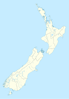
Lyttelton Harbour / Whakaraupō is one of two major inlets in Banks Peninsula, on the coast of Canterbury, New Zealand; the other is Akaroa Harbour.
Approximately 15 kilometres (9.3 mi) in length from its mouth to Teddington, the harbour sits in the erosion caldera of the ancient Lyttelton Volcano,[1] the steep sides of which form the Port Hills on its northern shore.[2]
The harbour's main population centre is Lyttelton, which serves the city of Christchurch, linked with Christchurch by the single-track Lyttelton rail tunnel (opened 1867), a two lane road tunnel (opened 1964) and two roads over the Port Hills. Diamond Harbour lies to the south and the Māori village of Rāpaki to the west. At the head of the harbour is the settlement of Governors Bay. The reserve of Quail Island is near the harbour head and Ripapa Island is just off its south shore at the entrance to Purau Bay.
The harbour provides access to a busy commercial port at Lyttelton which today includes a petroleum storage facility and a modern container and cargo terminal.[3]
Hector's dolphins, a species endemic to New Zealand, and New Zealand fur seals live in the harbour.
Etymology
Māori referred to the harbour as Te Whakaraupō, with this translating as harbour of the raupō reed.[4] The common original European name for the harbour was Port Cooper, after Daniel Cooper). A less common early name was Cook's Harbour, based on the early explorations by James Cook; the equivalent naming convention referred to Akaroa Harbour as Bank's Harbour after the botanist Joseph Banks.[5] The surveyors under Joseph Thomas who surveyed Canterbury in the late 1840s named the harbour Port Victoria after the monarch of the United Kingdom, but the name did not find common acceptance. The name was officially changed to Lyttelton Harbour in 1858, in honour of George William Lyttelton, who was the chairman of the Canterbury Association.[6] The official name of the harbour was amended again to become a dual name by the Ngāi Tahu Claims Settlement Act 1998.[7]
History
Early European settlers used Quail Island as a leper colony in 1918–25.[3] It is now a nature reserve.[3]
Fort Jervois was built on the island of Rīpapa in 1885–95.[3] Rīpapa was used in World War I to intern German nationals as enemy aliens, the most notable being Count Felix von Luckner.
In 1877 the Lyttelton Harbour Board (now Lyttelton Port Company) started building an inner harbour,[3] and in 1895 the Union Steamship Company of New Zealand started a steamship service on the 200-nautical-mile (370 km) route between here and Wellington.[8] From 1907 it was worked with turbine steamships and from 1933 it was named the "Steamer Express".[8]
However, in 1962 New Zealand Railways started the Interislander ferry service on the 55-nautical-mile (102 km) route between Picton and Wellington. This competing service not only offered a shorter crossing but also used diesel ships that had lower running costs than the Union Company's turbine steamers. The wreck of the Steamer Express TEV Wahine in 1968 was a setback for the Lyttelton service but the Union Company introduced a new ship, TEV Rangatira, in 1972.[8] She lost money, survived on a Ministry of Transport subsidy from 1974 and was withdrawn in 1976,[8] leaving the Interislander's Picton route to continue the ferry link between the two islands.
 |
 |
References
- ^ Hampton, S.J.; J.W. Cole (March 2009). "Lyttelton Volcano, Banks Peninsula, New Zealand: Primary volcanic landforms and eruptive centre identification". Geomorphology. 104 (3–4): 284–298. Bibcode:2009Geomo.104..284H. doi:10.1016/j.geomorph.2008.09.005.
- ^ "Geology of the Provinces of Canterbury and Westland, New Zealand" (web). New Zealand Texts Collection. NZETC. 1879. Retrieved 23 July 2010.
- ^ a b c d e "Page 12 – Lyttelton Harbour". Story: Canterbury places. Te Ara Encyclopedia of New Zealand. 13 July 2012.
- ^ "Te Whakaraupō – Lyttelton Harbour". Christchurch City Libraries. Retrieved 29 September 2015.
- ^ Hight, James; Straubel, C. R. (1957). A History of Canterbury : to 1854. Vol. I. Christchurch: Whitcombe and Tombs Ltd. p. 35.
- ^ McLintock, A. H., ed. (23 April 2009) [First published in 1966]. "Lyttelton". An Encyclopaedia of New Zealand. Ministry for Culture and Heritage / Te Manatū Taonga. Retrieved 27 September 2015.
- ^ "Ngai Tahu Claims Settlement Act 1998".
- ^ a b c d "Steamer Express". New Zealand Coastal Shipping. 2003–2009. Retrieved 29 May 2013.

