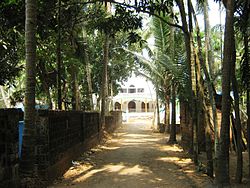
Manjeshwaram taluk
Appearance
Manjeshwaram Taluk | |
|---|---|
taluk | |
 Olayam Masjidh in Shiriya | |
| Coordinates: 12°40′59″N 74°54′00″E / 12.683°N 74.9°E | |
| Country | |
| State | Kerala |
| District | Kasaragod |
| Headquarters | Uppala |
| Area | |
| • Total | 545.3 km2 (210.5 sq mi) |
| Languages | |
| • Official | Malayalam, Tulu |
| Time zone | UTC+5:30 (IST) |
Manjeshwaram taluk is a taluk in Kasaragod district, Kerala. It is carved out from Kasaragod taluk.
