Marine Corps Auxiliary Airfield Corvallis
Appearance
Marine Corps Air Facility Corvallis | |||||||||||||||
|---|---|---|---|---|---|---|---|---|---|---|---|---|---|---|---|
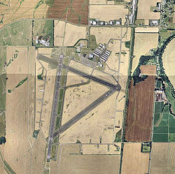
 USGS 2006 orthophoto | |||||||||||||||
| Summary | |||||||||||||||
| Airport type | Military | ||||||||||||||
| Owner | United States Marine Corps | ||||||||||||||
| Serves | Corvallis, Oregon | ||||||||||||||
| Elevation AMSL | 250 ft / 76 m | ||||||||||||||
| Coordinates | 44°29′50″N 123°17′22″W / 44.49722°N 123.28944°W | ||||||||||||||
| Map | |||||||||||||||
 | |||||||||||||||
| Runways | |||||||||||||||
| |||||||||||||||
Marine Corps Air Facility Corvallis is a former United States Marine Corps facility located four nautical miles (5 mi, 7 km) southwest of the central business district of Corvallis, a city in Benton County, Oregon, United States.[1]
History

The site was built during World War II by the United States Army Air Forces for bomber training. The original hangar is still being used today. After its closure, it was turned over to the city and reopened as Corvallis Municipal Airport.
See also
References
- ^ a b FAA Airport Form 5010 for CVO PDF. Federal Aviation Administration. Effective May 31, 2012.


