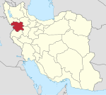
Marivan
Appearance
Marivan
مریوان Merîwan مەریوان Merîwan | |
|---|---|
City | |
| Coordinates: 35°31′37″N 46°10′35″E / 35.52694°N 46.17639°E | |
| Country | |
| Province | |
| County | Marivan |
| Bakhsh | Central |
| Founded | 1950s |
| Elevation | 1,310 m (4,300 ft) |
| Population (2016 Census) | |
| • Total | 136,654 [1] |
| Time zone | UTC+3:30 (IRST) |
| • Summer (DST) | UTC+4:30 (IRDT) |
| Area code | (+98)875 |
| Website | www |
Mariwan (Persian: مريوان, ; Kurdish: مەریوان, Merîwan; also Romanized as Persian pronunciation Marīvān) also known as Qal‘eh-ye Marīvān - "Fort Marivan"; formerly, Dezhe Shahpur (Persian: دِژ شاهپور), also Romanized as Dezhe Shāhpūr and Dezhe Shapoor)[2] is a Kurdish city in – and the capital of – Marivan County, Kurdistan Province, of Iran. At the 2006 census, its population was 91,664, in 22,440 families.[3] Before the foundation of the city in 1950s, Marîwan was the name of the region.[citation needed]
The spoken language in the city is Kurdish, but the language which is used in schools and offices is Persian, as the official language of Iran in which almost everyone in the city is fluent.
References
- ^ http://www.amar.org.ir/english
- ^ Marivan can be found at GEOnet Names Server, at this link, by opening the Advanced Search box, entering "-3074138" in the "Unique Feature Id" form, and clicking on "Search Database".
- ^ "Census of the Islamic Republic of Iran, 1385 (2006)" (Excel). Statistical Center of Iran. Archived from the original on 2011-09-20.


