De Meinweg National Park
Appearance
You can help expand this article with text translated from the corresponding article in Dutch. (August 2011) Click [show] for important translation instructions.
|
| Meinweg National Park | |
|---|---|
| Nationaal Park De Meinweg | |
 Autumn in the national park De Meinweg, Netherlands | |
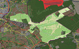
 Map of the National Park | |
| Location | Roerdalen, Limburg, Netherlands |
| Coordinates | 51°10′N 6°07′E / 51.16°N 6.12°E |
| Area | 1,800 ha (6.9 sq mi) |
| Established | 1995 |
| Governing body | Staatsbosbeheer |
Meinweg National Park (Nationaal Park De Meinweg) is a national park in Limburg, Netherlands. It is about 1800 hectares in size and was established in 1995.
In 2002 it became part of the Maas-Swalm-Nette park, a transboundary protected area on the German/Dutch border, covering 10,000 hectares.[1]
See also
References
External links
 Media related to Meinweg National Park at Wikimedia Commons
- Official website Template:En icon
