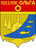
Olga, Russia
43°44′40″N 135°17′5″E / 43.74444°N 135.28472°E


Olga (Russian: О́льга) is an urban locality (an urban-type settlement) and the administrative center of Olginsky District of Primorsky Krai, Russia, located on the Olga Bay of the Sea of Japan, 240 kilometers (150 mi) northeast of Nakhodka. Population: 4,026 (2010 Census);[1] 4,453 (2002 Census);[2] 4,802 (1989 Soviet census).[3]
History
[edit]During the Balhae Kingdom period, a town called Anju was founded near the present-day Olga, on the shores of the Olga Bay.
The military post of Olga was established by the Russians in 1858,[4] several months after the region passed to Russia under the terms of the Treaty of Aigun. It was named for St. Olga. In the 19th century, it had a significant Chinese minority. This town has a similar name to the eldest daughter of Nicholas II.
Notable residents
[edit]- Valentin Parinov (born 1959), swimmer
- Ivan Stolbovoy (born 1986), football player
References
[edit]- ^ Russian Federal State Statistics Service (2011). Всероссийская перепись населения 2010 года. Том 1 [2010 All-Russian Population Census, vol. 1]. Всероссийская перепись населения 2010 года [2010 All-Russia Population Census] (in Russian). Federal State Statistics Service.
- ^ Federal State Statistics Service (May 21, 2004). Численность населения России, субъектов Российской Федерации в составе федеральных округов, районов, городских поселений, сельских населённых пунктов – районных центров и сельских населённых пунктов с населением 3 тысячи и более человек [Population of Russia, Its Federal Districts, Federal Subjects, Districts, Urban Localities, Rural Localities—Administrative Centers, and Rural Localities with Population of Over 3,000] (XLS). Всероссийская перепись населения 2002 года [All-Russia Population Census of 2002] (in Russian).
- ^ Всесоюзная перепись населения 1989 г. Численность наличного населения союзных и автономных республик, автономных областей и округов, краёв, областей, районов, городских поселений и сёл-райцентров [All Union Population Census of 1989: Present Population of Union and Autonomous Republics, Autonomous Oblasts and Okrugs, Krais, Oblasts, Districts, Urban Settlements, and Villages Serving as District Administrative Centers]. Всесоюзная перепись населения 1989 года [All-Union Population Census of 1989] (in Russian). Институт демографии Национального исследовательского университета: Высшая школа экономики [Institute of Demography at the National Research University: Higher School of Economics]. 1989 – via Demoscope Weekly.
- ^ История. Preobrprim.ru (in Russian). Preobrazhenskoye Urban Settlement Administration. Retrieved December 1, 2017.
External links
[edit]- (in Chinese) The capitals and the prefectures of Bohai Kingdom
