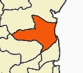
Pettai, Cuddalore
Appearance
Pettai | |
|---|---|
village | |
| Coordinates: 11°26′06″N 79°44′03″E / 11.43500°N 79.73417°E | |
| Country | |
| State | Tamil Nadu |
| District | Cuddalore |
| Taluka | Chidambaram |
| Revenue block | Komaratchi |
| Population (2011) | |
• Total | 469 |
| Time zone | UTC+5:30 (IST) |
Pettai is a village in the southern state of Tamil Nadu, India.[1][2] Administratively, Parangipettai is under the Chidambaram Taluk of Cuddalore District, Tamil Nadu.[3] In the 2011 census 469 people were reported as living in Parangipettai.[3]
The village of Parangipettai is .5 km west of the panchayat village of Varagur, and 1.5 km southeast of Annamalai University.[citation needed]
Notes
[edit]- ^ 2001 Census Village code = 1005400, "2001 Census of India: List of Villages by Tehsil: Tamil Nadu" (PDF). Registrar General & Census Commissioner, India. p. 180. Archived (PDF) from the original on 13 November 2011.
- ^ 2011 Census Village code = 638613, "Reports of National Panchayat Directory: List of Census Villages mapped for: Varagoor Gram Panchayat, Komaratchi, Cuddalore, Tamil Nadu". Registrar General & Census Commissioner, India. Archived from the original on 25 April 2013.
- ^ a b "NPR Report: Tamil Nadu: Cuddalore: Chidambaram". National Population Register, Ministry of Home Affairs, Government of India. Archived from the original on 25 April 2013.


