Portal:Europe/Featured location
Featured locations
Usage
The layout design for these subpages is at Portal:Europe/Featured location/Layout.
- Add a new Selected article to the next available subpage.
- Update "max=" to new total for its {{Random portal component}} on the main page.
Selected articles list
Portal:Europe/Featured location/1
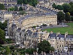
Bath is a city in the ceremonial county of Somerset, England, known for its Roman-built baths. In 2011, the population was 88,859. Bath is in the valley of the River Avon, 97 miles (156 km) west of London and 11 miles (18 km) south-east of Bristol. The city became a World Heritage Site in 1987.The city became a spa with the Latin name Aquæ Sulis ("the waters of Sulis") c. AD 60 when the Romans built baths and a temple in the valley of the River Avon, although hot springs were known even before then. Bath Abbey was founded in the 7th century and became a religious centre; the building was rebuilt in the 12th and 16th centuries. In the 17th century, claims were made for the curative properties of water from the springs, and Bath became popular as a spa town in the Georgian era. Georgian architecture, crafted from Bath stone, includes the Royal Crescent, Circus, Pump Room and Assembly Rooms where Beau Nash presided over the city's social life from 1705 until his death in 1761. Many of the streets and squares were laid out by John Wood, the Elder, and in the 18th century the city became fashionable and the population grew. Jane Austen lived in Bath in the early 19th century. Further building was undertaken in the 19th century and following the Bath Blitz in World War II.
Portal:Europe/Featured location/2
Belarus is a landlocked country in Eastern Europe bordered by Russia to the northeast, Ukraine to the south, Poland to the west, and Lithuania and Latvia to the northwest. Its capital and most populous city is Minsk. Over 40% of its 207,600 square kilometres (80,200 sq mi) is forested. Its strongest economic sectors are service industries and manufacturing. Until the 20th century, different states at various times controlled the lands of modern-day Belarus, including the Principality of Polotsk (11th to 14th centuries), the Grand Duchy of Lithuania, the Polish–Lithuanian Commonwealth, and the Russian Empire.In the aftermath of the 1917 Russian Revolution, Belarus declared independence as the Belarusian People's Republic, which was conquered by Soviet Russia as the Socialist Soviet Republic of Byelorussia, which became a founding constituent republic of the Soviet Union in 1922 and was renamed as the Byelorussian Soviet Socialist Republic (Byelorussian SSR). Belarus lost almost half of its territory to Poland after the Polish–Soviet War of 1919-1921. Much of the borders of Belarus took their modern shape in 1939, when some lands of the Second Polish Republic were reintegrated into it after the Soviet invasion of Poland, and were finalized after World War II.
Portal:Europe/Featured location/3
Belgrade is the capital and largest city of Serbia. It is located at the confluence of the Sava and Danube rivers, where the Pannonian Plain meets the Balkans. Its name translates to "White city". The urban area of the City of Belgrade has a population of 1.34 million, while over 1.65 million people live within its administrative limits. One of the most important prehistoric cultures of Europe, the Vinča culture, evolved within the Belgrade area in the 6th millennium BC. In antiquity, Thraco-Dacians inhabited the region, and after 279 BC Celts conquered the city, naming it Singidūn.It was conquered by the Romans during the reign of Augustus, and awarded city rights in the mid-2nd century. It was settled by the Slavs in the 520s, and changed hands several times between the Byzantine Empire, Frankish Empire, Bulgarian Empire and Kingdom of Hungary before it became the capital of Serbian king Stephen Dragutin (1282–1316). In 1521, Belgrade was conquered by the Ottoman Empire and became the seat of the Sanjak of Smederevo.It frequently passed from Ottoman to Habsburg rule, which saw the destruction of most of the city during the Austro-Ottoman wars. Belgrade was again named the capital of Serbia in 1841. Northern Belgrade remained the southernmost Habsburg post until 1918, when the city was reunited. As a strategic location, the city was battled over in 115 wars and razed to the ground 44 times.
Portal:Europe/Featured location/4
Shapinsay is one of the Orkney Islands off the north coast of mainland Scotland. There is one village on the island, Balfour, from which roll-on/roll-off car ferries sail to Kirkwall on the Orkney Mainland. Balfour Castle, built in the Scottish Baronial style, is one of the island's most prominent features, a reminder of the Balfour family's domination of Shapinsay during the 18th and 19th centuries; the Balfours transformed life on the island by introducing new agricultural techniques. Other landmarks include a standing stone, an Iron Age broch, a souterrain and a salt-water shower.With an area of 29.5 square kilometres (11.4 sq mi), Shapinsay is the eighth largest island in the Orkney archipelago. It is low-lying and fertile, consequently most of the area is given over to farming. Shapinsay has two nature reserves and is notable for its bird life. At the 2011 census, Shapinsay had a population of 307.The economy of the island is primarily based on agriculture with the exception of a few small businesses that are largely tourism-related. Plans for the construction of a wind turbine are under consideration.
Portal:Europe/Featured location/5
Surtsey is a volcanic island located in the Vestmannaeyjar archipelago off the southern coast of Iceland. At 63°18′11″N 20°36′18″W / 63.303°N 20.605°W, Surtsey is the southernmost point of Iceland. It was formed in a volcanic eruption which began 130 metres (426 ft) below sea level, and reached the surface on 14 November 1963. The eruption lasted until 5 June 1967, when the island reached its maximum size of 2.7 km2 (1.0 sq mi). Since then, wave erosion has caused the island to steadily diminish in size: as of 2012[update], its surface area was 1.3 km2 (0.50 sq mi).The new island was named after Surtr, a fire jötunn or giant from Norse mythology. It was intensively studied by volcanologists during its eruption, and afterwards by botanists and other biologists as life forms gradually colonised the originally barren island. The undersea vents that produced Surtsey are part of the Vestmannaeyjar submarine volcanic system, part of the fissure of the sea floor called the Mid-Atlantic Ridge. Vestmannaeyjar also produced the famous eruption of Eldfell on the island of Heimaey in 1973. The eruption that created Surtsey also created a few other small islands along this volcanic chain, such as Jólnir and unnamed other peaks. Most of these eroded away fairly quickly.
Portal:Europe/Featured location/6
Manchester is a major city and metropolitan borough in Greater Manchester, England, with a population of 514,414 as of 2013[update]. It lies within the United Kingdom's second-most populous urban area, with a population of 2.55 million. Manchester is fringed by the Cheshire Plain to the south, the Pennines to the north and east and an arc of towns with which it forms a continuous conurbation. The local authority is Manchester City Council.The recorded history of Manchester began with the civilian settlement associated with the Roman fort of Mamucium or Mancunium, which was established in about 79 AD on a sandstone bluff near the confluence of the rivers Medlock and Irwell. It was historically a part of Lancashire, although areas of Cheshire south of the River Mersey were incorporated during the 20th century. Throughout the Middle Ages Manchester remained a manorial township but began to expand "at an astonishing rate" around the turn of the 19th century. Manchester's unplanned urbanisation was brought on by a boom in textile manufacture during the Industrial Revolution, and resulted in it becoming the world's first industrialised city.
Portal:Europe/Featured location/7
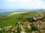
The Mendip Hills is a range of limestone hills to the south of Bristol and Bath in Somerset, England. Running east to west between Weston-super-Mare and Frome, the hills overlook the Somerset Levels to the south and the Chew Valley and other tributaries of the Avon to the north. The hills give their name to the local government district of Mendip, which administers most of the area. The higher, western part of the hills, covering 198 km2 (76 sq mi) has been designated an Area of Outstanding Natural Beauty (AONB), which gives it a level of protection comparable to a national park.The hills are largely formed from Carboniferous Limestone, which is quarried at several sites. Three nationally important semi-natural habitats are characteristic of the area: ash–maple woodland, calcareous grassland and mesotrophic grassland. With their temperate climate these support a range of flora and fauna including birds, butterflies and small mammals. The dry stone walls that divide the pasture into fields are of botanical importance as they support important populations of the nationally scarce wall whitlowgrass (Draba muralis).
Portal:Europe/Featured location/8
Germany is a federal parliamentary republic in central-western Europe. It includes 16 constituent states, covers an area of 357,021 square kilometres (137,847 sq mi), and has a largely temperate seasonal climate. With about 82 million inhabitants, Germany is the most populous member state of the European Union. After the United States, it is the second most popular immigration destination in the world. Germany's capital and largest metropolis is Berlin. Major urban areas include Ruhr, Hamburg, Munich, Cologne, Frankfurt, Stuttgart and Düsseldorf.Various Germanic tribes have occupied the northern parts of modern Germany since classical antiquity. A region named Germania was documented before 100 AD. During the Migration Period the Germanic tribes expanded southward. Beginning in the 10th century, German territories formed a central part of the Holy Roman Empire. During the 16th century, northern German regions became the centre of the Protestant Reformation.
Portal:Europe/Featured location/9
Dorset is a county in South West England on the English Channel coast. The ceremonial county comprises the non-metropolitan county, which is governed by Dorset County Council, and the unitary authority areas of Poole and Bournemouth. Covering an area of 2,653 square kilometres (1,024 sq mi), Dorset borders Devon to the west, Somerset to the north-west, Wiltshire to the north-east, and Hampshire to the east. The county town is Dorchester which is in the south. After the reorganisation of local government in 1974 the county's border was extended eastward to incorporate the Hampshire towns of Bournemouth and Christchurch. Around half of the population lives in the South East Dorset conurbation, while the rest of the county is largely rural with a low population density.The county has a long history of human settlement stretching back to the Neolithic era. The Romans conquered Dorset's indigenous Celtic tribe, and during the early Middle Ages, the Saxons settled the area and made Dorset a shire in the 7th century.
Portal:Europe/Featured location/10
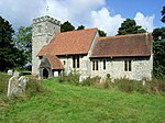
Wormshill is a small village and civil parish within the Borough of Maidstone, Kent, England. The parish is approximately 7 miles (11 km) south of the Swale and 8 miles (13 km) east of Maidstone. The village of Frinsted lies 0.6 miles (1 km) to the east and Bicknor 1+1⁄2 miles (2.4 km) to the north-west; while Hollingbourne is 3 miles (5 km) to the south-west. The village lies on an exposed high point of the North Downs, within the Kent Downs Area of Outstanding Natural Beauty.Archaeological and toponymic evidence of Wormshill's existence predates its appearance in the Domesday survey of 1086. The village contains a number of heritage-listed buildings, which include a Norman church, a public house and one of the oldest surviving post office buildings in the United Kingdom. The fields and woodland surrounding Wormshill have changed little in the past 500 years, and the village itself remains rural with a low population density compared to the national average. The population of 200 is a mixture of agricultural workers employed by local farms and professional residents who commute to nearby towns.
Nominations
Feel free to add Europe related articles Featured articles to the above list.


