Pukete
This article needs additional citations for verification. (October 2016) |
Pukete | |
|---|---|
 Pukete, Hamilton | |
| Country | New Zealand |
| City | Hamilton, New Zealand |
| Electoral ward | Hamilton West |
| Population (2006 Census) | |
| • Total | 4,500 |
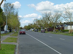
Pukete is a leafy river side suburb in northwestern Hamilton in New Zealand.[1] Pukete has two primary schools: Pukete Primary school (years 1-6) and Te Rapa Primary school (years 1-8). Pukete Pa is located in the north of the suburb on a cliff on the Waikato River bank. The Pa was in use until the arrival of military settlers in 1863. The Pa is located at the northern end of the riverside Braithwate Park. The cobblestoned walk in the park has a grass dog exercise area. The riverside walkway, which includes many pedestrian bridges, can be used by walkers or cyclists, but the lower sections are subject to flooding in winter. A pedestrian bridge links Braithwaite Park to Flagstaff on the eastern side of the Waikato River. There is a small beach on the west side of the river at Braithwaite park often used in summer by water skiers and picnickers.
To the north of the residential area is the Pukete Mountain Bike track, an Equestrian centre, and a two-lane launching ramp into the Waikato River, all on the Pukete Farm Park. A concreted riverside track, for bikes and pedestrians, runs north from Mountain View Lane starting by the southeast side of the Fonterra Te Rapa Milk powder factory.
The eastern part of Pukete and St Andrews is built on an old river terrace. This rises to the flat alluvial fan that covers most of Hamilton. The land rises to one of Hamilton's many small hills at Ngaio Place giving views over most of Hamilton.
Four-laning of the Pukete Bridge was completed in Easter 2013, well ahead of schedule due to the long dry summer.
References
- ^ "Hamilton Map". Hamilton City Council. Archived from the original on 23 September 2010. Retrieved 18 September 2010.
{{cite web}}: Unknown parameter|deadurl=ignored (|url-status=suggested) (help)
See also
37°44′37.65″S 175°14′22.92″E / 37.7437917°S 175.2397000°E
