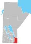
Shoal Lake 40
Appearance
Shoal Lake 40 | |
|---|---|
| Shoal Lake Indian Reserve No. 40 | |
| Coordinates: 49°37′N 95°09′W / 49.617°N 95.150°W | |
| Country | |
| Provinces | |
| District / Division | Kenora / Division 1 |
| First Nation | Shoal Lake 40 |
| Area | |
| • Land | 26.21 km2 (10.12 sq mi) |
| Population | |
| • Total | 101 |
| • Density | 3.9/km2 (10/sq mi) |
| Website | www.sl40.ca |
Shoal Lake 40 is a First Nations reserve straddling the border of Manitoba and Ontario on the shores of Shoal Lake. It is one the reserves of the Shoal Lake 40 First Nation.
References
- ^ a b "Shoal Lake (part) 40 census profile". 2011 Census of Population. Statistics Canada. Retrieved 22 June 2015.
- ^ a b "Shoal Lake (part) 40 census profile". 2011 Census of Population. Statistics Canada. Retrieved 22 June 2015.


