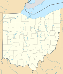
Tinkers Creek State Park
Appearance
| Tinkers Creek State Park | |
|---|---|
| Location | Portage County, Ohio, USA |
| Nearest city | Streetsboro |
| Coordinates | 41°16′25″N 81°22′32″W / 41.27361°N 81.37556°W[1] |
| Area | Land: 355 acres (1.44 km2) Water: 15 acres (61,000 m2) |
| Elevation | 1007 [1] |
| Established | 1973 |
| Governing body | Ohio Department of Natural Resources |
Tinkers Creek State Park is a state park located in Streetsboro, Portage County, Ohio, United States. Its many small lakes and marshes provide food and habitat for beavers and thousands of waterfowl.[2]
History
Before the state park opened, a private park called Colonial Spring Gardens existed on the land. The State of Ohio acquired the land in 1966 and officially opened the state park in 1973.[3]
Activities and amenities
The park offers a spring-fed fishing lake, hiking trails, and picnicking areas.[4]
References
- ^ a b "Tinkers Creek State Park". Geographic Names Information System. United States Geological Survey, United States Department of the Interior.
- ^ "Tinkers Creek State Park". Ohio Department of Natural Resources. Retrieved November 19, 2017.
- ^ "Tinkers Creek State Park: History". Ohio Department of Natural Resources. Retrieved November 19, 2017.
- ^ "Tinkers Creek State Park: Activities". Ohio Department of Natural Resources. Retrieved November 19, 2017.
External links
- Tinkers Creek State Park Ohio Department of Natural Resources
- Tinkers Creek State Park Map Ohio Department of Natural Resources
- Tinkers Creek State Park Trail Map Ohio Department of Natural Resources

