User:Jarda2020/2021–22 South-West Indian Ocean cyclone season
| 2021–22 South-West Indian Ocean cyclone season | |
|---|---|
 Season summary map | |
| Seasonal boundaries | |
| First system formed | 3 February 2022 (Record latest start) |
| Last system dissipated | Season ongoing |
| Strongest storm | |
| Name | Batsirai |
| • Maximum winds | 270 km/h (165 mph) (10-minute sustained) |
| • Lowest pressure | 898 hPa (mbar) |
| Seasonal statistics | |
| Total disturbances | 3 |
| Total depressions | 3 |
| Total storms | 3 |
| Tropical cyclones | 2 |
| Intense tropical cyclones | 1 |
| Very intense tropical cyclones | 1 |
| Total fatalities | 568 total |
| Total damage | > $2.6 billion (2022 USD) |
| Related articles | |
The 2021–22 South-West Indian Ocean cyclone season is a ongoing event of the annual cycle of tropical cyclone and subtropical cyclone formation. It began on 15 November 2021, and it will end on 30 April 2022, with the exception for Mauritius and the Seychelles, for which it will end on 15 May 2022. These dates conventionally delimit the period of each year when most tropical and subtropical cyclones form in the basin, which is west of 90°E and south of the Equator. However, tropical cyclones that form at any time between 1 July 2021 and 30 June 2022 will count towards the season total. Tropical and subtropical cyclones in this basin are monitored by the Regional Specialised Meteorological Centre in Réunion
Seasonal summary[edit]

Systems[edit]
Tropical Cyclone Ana[edit]
| Tropical cyclone (MFR) | |
| Category 1 tropical cyclone (SSHWS) | |
| Duration | 3 February – 12 February |
|---|---|
| Peak intensity | 140 km/h (85 mph) (10-min); 968 hPa (mbar) |
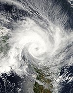
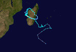
At 07:30 UTC on 3 February, the Joint Typhoon Warning Center began monitoring an area of convection, which they designated as Invest 99S, approximately 1,202 nmi (2,226 km; 1,383 mi) from Mauritius, with the agency giving a medium chance for potential cyclogenesis within the next 24 hours. At midday, the MFR observed a closed circulation north-northwest of Saint-Brandon, with a rather ill-defined center. Early the next day, at 02:00 UTC, the JTWC issued a Tropical Cyclone Formation Alert (TCFA) for Invest 99S, as the agency noted its consolidation of a well-defined low-level center. On 4 February , after stable strengthening, it was designated a Moderate Tropical Storm Ana. On 5 February at 06:00 UTC, Ana strengthened into a severe tropical storm. Ana generally moved rapidly in a southwesterly direction due to the steering flow of a mid-level subtropical ridge to the storm's southeast. The severe tropical storm intensified into Tropical Cyclone Ana at 12:00 UTC on 7 February, after very deep convection developed near its center. On that same day while moving to the southwest, Ana made powerful landfall on the island of Madagascar. Here, Ana caused historic floodings in many towns and cities. After the landfall Ana moved towards shores of Mozambique, but it didn't make landfall, though it was still very badly affected by the rainbands. On 8 February, Ana weakened to a severe tropical storm, and shortly after, it degenerated to a moderate tropical storm. On 9 February while loosing its strong convection, it degenerated to a weak tropical depression, and it stayed at that status, untill the last advisory from JTWC, on 12:00 UTC, 12 February. After that, Ana turned to a powerful extratropical cyclone. Cyclone Ana killed at least 386 casualties, and caused damages of about 1.8 million USD.
Very Intense Tropical Cyclone Batsirai[edit]
| |||
|---|---|---|---|
| |||
| As of: | 12:00 UTC, 14 February | ||
| Location: | 22°54′S 41°36′E / 22.9°S 41.6°E ± 20 nmi About 187 nmi (346 km; 215 mi) NE of Maputo | ||
| Sustained winds: | 60 knots (110 km/h; 70 mph) (10-min mean) gusting to 80 knots (150 km/h; 90 mph) 55 knots (100 km/h; 65 mph) (1-min mean) | ||
| Pressure: | 989 hPa (29.21 inHg) | ||
| Movement: | S at 10 knots (19 km/h; 12 mph) | ||
| See more detailed information. | |||
Current storm information[edit]
As of 12:00 UTC 14 February, Severe Tropical Storm Batsirai is located within 20 nautical miles of 22°54′S 41°36′E / 22.9°S 41.6°E, approximately 187 nmi (346 km; 215 mi) east of Maputo. Maximum 10-minute sustained winds are at 60 knots (110 km/h; 70 mph), with gusts up to 80 knots (150 km/h; 90 mph), while maximum 1-minute sustained winds are at 55 knots (100 km/h; 65 mph). The minimum central barometric pressure is 989 hPa (29.21 inHg) and the system moving south at 10 knots (19 km/h; 12 mph).
For the latest official information see:
- MFR's Cyclonic Analysis and Forecast Bulletins on Severe Tropical Storm Batsirai (07S)
- JTWC's Tropical Cyclone Warning on Severe Tropical Storm Batsirai (07S)
Severe Tropical Storm Cliff[edit]
| |||
|---|---|---|---|
Current storm status Category 1 tropical cyclone (1-min mean) | |||
| |||
| As of: | 12:00 UTC, 14 February | ||
| Location: | 20°06′S 61°06′E / 20.1°S 61.1°E ± 20 nmi About 87 nmi (161 km; 100 mi) E of Port Louis | ||
| Sustained winds: | 60 knots (110 km/h; 70 mph) (10-min mean) gusting to 85 knots (155 km/h; 100 mph) 65 knots (120 km/h; 75 mph) (1-min mean) | ||
| Pressure: | 983 hPa (29.03 inHg) | ||
| Movement: | W at 8 knots (15 km/h; 9.2 mph) | ||
| See more detailed information. | |||
Current storm information[edit]
As of 12:00 UTC 14 February, Severe Tropical Storm Cliff is located within 20 nautical miles of 20°06′S 61°06′E / 20.1°S 61.1°E, approximately 87 nmi (161 km; 100 mi) east of Port Louis. Maximum 10-minute sustained winds are at 60 knots (110 km/h; 70 mph), with gusts up to 85 knots (155 km/h; 100 mph), while maximum 1-minute sustained winds are at 65 knots (120 km/h; 75 mph). The minimum central barometric pressure is 983 hPa (29.03 inHg) and the system moving west at 8 knots (15 km/h; 9.2 mph).
For the latest official information see:
- MFR's Cyclonic Analysis and Forecast Bulletins on Severe Tropical Storm Cliff (12S)
- JTWC's Tropical Cyclone Warning on Severe Tropical Storm Cliff (12S)
Storm names[edit]
Within the South-West Indian Ocean, tropical depressions and subtropical depressions that are judged to have 10-minute sustained windspeeds of 65 km/h (40 mph) by the Regional Specialized Meteorological Center on La Réunion Island, France (RSMC La Réunion) are usually assigned a name. However, it is the Sub-Regional Tropical Cyclone Advisory Centers in Mauritius and Madagascar who name the systems. The Sub-Regional Tropical Cyclone Advisory Center in Mauritius names a storm should it intensify into a moderate tropical storm between 55°E and 90°E. If instead a cyclone intensifies into a moderate tropical storm between 30°E and 55°E then the Sub-Regional Tropical Cyclone Advisory Center in Madagascar assigns the appropriate name to the storm. Beginning from the 2016–17 season, name lists within the South-West Indian Ocean will be rotated on a triennial basis. Storm names are only used once, so any storm name used this year will be removed from rotation and replaced with a new name for the 2024–25 season. The unused names are expected to be reused in the list for the 2024–25 season.[1] All of the names are the same with the exception of Ana, Batsirai, Cliff, Damako, Emnati, Fezile, Gomba, Halima, Issa, Jasmine, Karim, and Letlama which replaced Alcide, Bouchra, Cilida, Desmond, Eketsang, Funani, Gelena, Haleh, Idai, Joaninha, Kenneth, and Lorna from the 2018–19 season.
|
|
|
Season effects[edit]
This table lists all of the tropical cyclones and subtropical cyclones that were monitored during the 2021–2022 South-West Indian Ocean cyclone season. Information on their intensity, duration, name, areas affected, primarily comes from RSMC La Réunion. Death and damage reports come from either press reports or the relevant national disaster management agency while the damage totals are given in 2021 or 2022 USD.
| Name | Dates | Peak intensity | Areas affected | Damage (USD) |
Deaths | Refs | ||
|---|---|---|---|---|---|---|---|---|
| Category | Wind speed | Pressure | ||||||
| Ana | 3 – 12 February | Tropical cyclone | 140 km/h (85 mph) | 968 hPa (28.59 inHg) | Mauritius, Réunion, Madagascar | > $1.8 billion | 386 | |
| Batsirai | 5 February – Present | Very Intense Tropical Cyclone | 270 km/h (165 mph) | 898 hPa (26.52 inHg) | Mauritius, Réunion, Madagascar, Comoros | > $800 million | 182 | |
| Cliff | 8 February – Present | Severe tropical storm | 110 km/h (70 mph) | 982 hPa (29.00 inHg) | None | None | None | |
| Season aggregates | ||||||||
| 3 systems | 3 February – Season ongoing | 270 km/h (165 mph) | 898 hPa (26.52 inHg) | > $2.6 billion | 568 | |||
See also[edit]
- Weather of 2021 and 2022
- List of Southern Hemisphere cyclone seasons
- Tropical cyclones in 2021 and 2022
- Atlantic hurricane seasons: 2021, 2022
- Pacific hurricane seasons: 2021, 2022
- Pacific typhoon seasons: 2021, 2022
- North Indian Ocean cyclone seasons: 2021, 2022
- 2021–22 Australian region cyclone season
- 2021–22 South Pacific cyclone season
References[edit]
- ^ Regional Association I Tropical Cyclone Committee (2016). "Tropical Cyclone Operational Plan for the South-West Indian Ocean" (PDF). World Meteorological Organization. Retrieved 5 October 2016.


