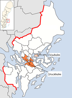
Vaxholm Municipality
Vaxholms kommun | |
|---|---|
 | |
| Country | Sweden |
| County | Stockholm County |
| Seat | Vaxholm |
| Area | |
| • Total | 107.07 km2 (41.34 sq mi) |
| • Land | 57.88 km2 (22.35 sq mi) |
| • Water | 49.19 km2 (18.99 sq mi) |
| Area as of 1 January 2014. | |
| Population (31 December 2023)[2] | |
| • Total | 11,817 |
| • Density | 110/km2 (290/sq mi) |
| Time zone | UTC+1 (CET) |
| • Summer (DST) | UTC+2 (CEST) |
| ISO 3166 code | SE |
| Province | Uppland |
| Municipal code | 0187 |
| Website | www.vaxholm.se |
| Density is calculated using land area only. | |
Vaxholm Municipality (Vaxholms kommun or Vaxholms stad) is a municipality within Stockholm archipelago in Stockholm County in east central Sweden. The municipal slogan is "Vaxholm – the capital of the archipelago", due to its central location in the archipelago. Its seat is located in the city of Vaxholm.
From 1974 to 1984 Vaxholm was united with Österåker Municipality, making up a municipality called Vaxholm, but with the seat in Åkersberga. After the "divorce" the new Vaxholm Municipality came out larger than it had been before the amalgamation. The municipality prefers to style itself City of Vaxholm.
64 islets are in the municipality, and also the peninsula Bogesundslandet.
Localities
- Kullö, 201 inhabitants (2000)
- Oskar-Fredriksborg, 692 inhabitants (2000)
- Resarö, 2,079 inhabitants (2000)
- Vaxholm, 4,887 inhabitants (2000)
- Ytterby (mine), a renowned village

Industry
The municipality has a significant amount of tourism. Ships transporting passengers between the islands began running on a daily basis in the 1850s. Today, many of islands (among them the main island Vaxholm) can also be reached by bridges from the mainland. The tourist boats depart from Stockholm's Slussen.
References
- ^ "Statistiska centralbyrån, Kommunarealer den 1 januari 2014" (in Swedish). Statistics Sweden. 2014-01-01. Archived from the original (Microsoft Excel) on 2016-09-27. Retrieved 2014-04-18.
- ^ "Folkmängd och befolkningsförändringar - Kvartal 4, 2023" (in Swedish). Statistics Sweden. February 22, 2024. Retrieved February 22, 2024.
External links
- Vaxholm Municipality - Official site

