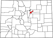
Washington Virginia Vale, Denver
Washington Virginia Vale is a neighborhood in southeastern Denver, Colorado. The neighborhood is roughly bound by Alameda Avenue, South Cherry Creek Drive, and South Quebec Street.[1] The western border of the neighborhood merges into the city of Glendale, Colorado, an enclave of Denver.
Washington Virginia Vale is home to George Washington High School, McMeen Elementary School, Garland Park, and two other small city parks. The Consulates General of México, Peru, and Guatemala are all located in the neighborhood.[2][3][4] At the heart of the Washington Virginia Vale neighborhood sits Four Mile Historic Park and the Four Mile House, a Denver landmark that "served as a stage stop, wayside inn and tavern to travelers on the Cherokee Trail."[5]

