Wau Airport
Wau Airport | |||||||||||
|---|---|---|---|---|---|---|---|---|---|---|---|
| Summary | |||||||||||
| Airport type | Public, Civilian | ||||||||||
| Owner | Civil Aviation Authority of South Sudan | ||||||||||
| Serves | Wau, South Sudan | ||||||||||
| Location | Wau, South Sudan | ||||||||||
| Elevation AMSL | 433 m / 1,421 ft | ||||||||||
| Coordinates | 07°43′30″N 027°58′48″E / 7.72500°N 27.98000°E | ||||||||||
| Map | |||||||||||
 | |||||||||||
| Runways | |||||||||||
| |||||||||||
Wau Airport is a civilian airport that serves the city of Wau and surrounding communities. Feeder Airlines has three return flights a week between Khartoum-Wau-Juba.[1][2][3] Southern Star Airlines provides service on Wednesdays and Sundays to Juba, this service has since been suspended in 2011 when the airline ceased flying.[4]
Location
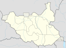
Wau Airport (IATA: WUU, ICAO: HSWW) is located in Wau County, Wau State, in the city of Wau. The airport is located to the northeast of the central business district of the city.
This location lies approximately 511 kilometres (318 mi), by air, northwest of Juba International Airport, the largest airport in South Sudan.[5] The geographic coordinates of Wau Airport are: 7° 43' 30.00"N, 27° 58' 48.00"E (Latitude: 7.7250; Longitude: 27.9800). This airport sits at an elevation of 433 metres (1,421 ft) above sea level. In December 2012 a new paved runway measuring 2,500 metres (8,200 ft) in length was opened.
Airlines and destinations
Service to Juba, South Sudan was provided by Southern Star Airlines until the airline's failure in late 2011.
| Airlines | Destinations |
|---|---|
| Sudan Airways | Khartoum |

