
Waxxari
Waxxari
瓦石峡镇 (Chinese) Washixia, Wa-shih-hsia | |
|---|---|
 Waxxari Location in Xinjiang | |
| Coordinates: 38°40′59″N 087°19′47″E / 38.68306°N 87.32972°E | |
| Country | China |
| Autonomous Region | Xinjiang |
| Prefecture | Bayingolin |
| County | Ruoqiang / Qakilik |
| Population (2010)[1] | |
| • Total | 5,886 |
| Ethnic groups | |
| • Major ethnic groups | Uyghur, Han Chinese[2][3] |
| Time zone | UTC+8 (China Standard) |
Waxxari[4][5][6]: 145 [7] (Chinese: 瓦石峡镇) is a town in Ruoqiang / Qakilik County, Bayingolin Mongol Autonomous Prefecture, Xinjiang, China.
Name[edit]
'Waxxari' means 'noisy city' in Uyghur. The Mandarin Chinese pinyin-derived name Washixia (Wade-Giles: Wa-shih-hsia) is derived from the sound of the Uyghur name, an abbreviation of Washixiehai'er (瓦石协海尔).[6]: 145 [8]
History[edit]
In 1953, Waxxari Township (瓦石峡乡) was established.[3]
In 1960, Waxxari Township became Waxxari Commune (瓦石峡公社).[3]
In 1984, Waxxari Commune became Waxxari Township.[3]
In 2012, Waxxari Township became Waxxari Town (瓦石峡镇).[1]
Geography[edit]
Waxxari is located 80 km (50 mi) southwest of the county seat, Ruoqiang Town.[6]: 145 [9] Waxxari is located on the Waxxari River (Waxxari He, Wa-shih-hsia Ho).
Administrative divisions[edit]
Waxxari includes one residential community and five villages:[10]
Residential community:
Villages:
- Wudulewusitang (乌都勒吾斯塘村), Wutamu (Wutamucun;[11] 吾塔木村) 38°41′12″N 087°21′41″E / 38.68667°N 87.36139°E, Xinjian (新建村), Muye (牧业村), Tashisayi (塔什萨依村)
Demographics[edit]
| Year | Pop. | ±% p.a. |
|---|---|---|
| 2000 | 4,691 | — |
| 2010 | 5,886 | +2.30% |
| [1] | ||
As of 1997[update], the population of Waxxari was 43.9% Uyghur and 43.2% Han Chinese.[2]
Transportation[edit]
Historical maps[edit]
-
 Map of Waxxari (labeled as Wa-shih-hsia) and surrounding area (DMA, 1975)
 -
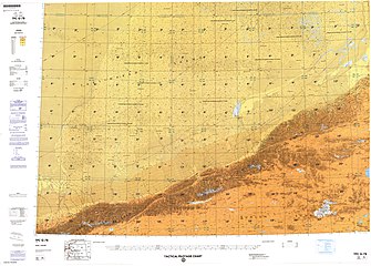
![Map including Waxxari (Wa-shih-hsia) (DMA, 1980)[a]](//upload.wikimedia.org/wikipedia/commons/thumb/f/fb/Operational_Navigation_Chart_G-7%2C_6th_edition.jpg/331px-Operational_Navigation_Chart_G-7%2C_6th_edition.jpg)
-
 Map including Waxxari (DMA, 1990)

![Map including Waxxari (Wa-shih-hsia) (DMA, 1980)[a]](/wiki/File:Operational_Navigation_Chart_G-7,_6th_edition.jpg)

See also[edit]
Notes[edit]
- ^ From map: "The representation of international boundaries is not necessarily authoritative."
References[edit]
- ^ a b c 若羌县历史沿革 [Ruoqiang / Qakilik County Historical Development] (in Simplified Chinese). XZQH.org. 30 January 2015. Retrieved 4 December 2019.
2000年第五次人口普查,若羌县常住总人口28636人,其中:{...}瓦石峡乡4691人、{...}2010年第六次人口普查,若羌县常住总人口35580人,其中:{...}瓦石峡乡5886人,{...}2012年,自治区政府(新政函[2012]131号)批复同意撤销瓦石峡乡,设立瓦石峡镇。
- ^ a b 1997年若羌县行政区划 [1997 Ruoqiang / Qakilik County Administrative Divisions] (in Simplified Chinese). XZQH.org. 13 December 2010. Retrieved 31 July 2020.
瓦石峡乡 1950年建区公所,1953年后改为瓦石峡乡,1960年成立瓦石峡公社,1984年重设瓦石峡乡。位于县城西北80千米处。315国道从乡境中部穿过。面积2.4万平方千米,人口0.4万,其中维吾尔族占43.9%,汉族占43.2%,辖乌都勒吾斯塘、吾塔木、新建、瓦石峡牧业4个行政村。是若羌唯一水稻产区。境内有瓦石峡古城遗址。 (本页根据《中国政区大典》整理,1997年左右资料)
- ^ a b c d 瓦石峡乡 [Waxxari Township] (in Simplified Chinese). XZQH.org. 13 December 2010. Retrieved 31 July 2020.
- ^ Zihua Tang; Dongmei Chen; Xinhua Wu; Guijin Mu (2 October 2013). "Redistribution of prehistoric Tarim people in response to climate change". Quaternary International. 308–9: 36–41. Bibcode:2013QuInt.308...36T. doi:10.1016/j.quaint.2013.01.021. Retrieved 31 July 2020 – via ScienceDirect.
Waxxari
- ^ Complete Atlas Of The World (3 ed.). Penguin Random House. 2016. p. 238 – via Internet Archive.
Waxxari
- ^ a b c d Xie Yuzhong 解玉忠 (2003). 地名中的新疆 (in Simplified Chinese). Ürümqi: 新疆人民出版社. ISBN 7-228-08004-1.
- ^ Waxxari (Approved - N) at GEOnet Names Server, United States National Geospatial-Intelligence Agency
- ^ Wen Hao 文昊, ed. (January 2007). 新疆地名与传说故事. 走进新疆丛书 (in Simplified Chinese). Ürümqi: 新疆美术摄影出版社, 新疆电子音像出版社. p. 33. ISBN 978-7-80744-012-3.
- ^ Zhong Xingqi 钟兴麒, ed. (July 2008). 西域地名考录 (in Simplified Chinese). Beijing: 国家图书馆出版社. p. 957. ISBN 978-7-5013-3628-9.
- ^ 2019年统计用区划代码和城乡划分代码:瓦石峡镇 [2019 Statistical Area Numbers and Rural-Urban Area Numbers: Waxxari Town] (in Simplified Chinese). National Bureau of Statistics of the People's Republic of China. 2019. Retrieved 31 July 2020.
统计用区划代码 城乡分类代码 名称 652824103001 121 瓦石峡社区居民委员会 652824103200 220 乌都勒吾斯塘村民委员会 652824103201 220 吾塔木村民委员会 652824103202 220 新建村民委员会 652824103203 220 牧业村民委员会 652824103204 220 塔什萨依村民委员会
- ^ Wutamucun (Approved - N) at GEOnet Names Server, United States National Geospatial-Intelligence Agency
This Xinjiang location article is a stub. You can help Wikipedia by expanding it. |