
Webster Hojack Trail
43°13′23″N 77°26′57″W / 43.2231°N 77.4492°W The Webster Hojack Trail is one of two Hojack trails in New York, the other being the Cayuga Hojack Trail. Both are built on remnants of the Hojack, a common name for the Rome, Watertown and Ogdensburg Railroad. The Friends of Webster Trails maintains this 3.5-mile (5.6 km) long trail, fully within the Town of Webster. It begins at Phillips Road near Route 104 east of the village and runs along the right of way, now owned by Rochester Gas & Electric, to Lake Road.
External links
- Hojack Trail - Friends of Webster Trails
- Route of the trail
| Albany | 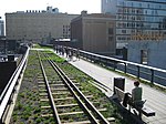   | |
|---|---|---|
| Allegany | ||
| Cattaraugus | ||
| Cayuga | ||
| Columbia | ||
| Delaware | ||
| Dutchess | ||
| Franklin | ||
| Livingston | ||
| Monroe | ||
| New York | ||
| Ontario | ||
| Orange | ||
| Oswego | ||
| Putnam | ||
| Rockland | ||
| St. Lawrence | ||
| Schenectady | ||
| Suffolk | ||
| Ulster | ||
| Westchester | ||
| Wyoming | ||
This article about a location in Cayuga County, New York is a stub. You can help Wikipedia by expanding it. |
This United States trail or long-distance path–related article is a stub. You can help Wikipedia by expanding it. |