Almassora
Appearance
You can help expand this article with text translated from the corresponding articles in Catalan and Spanish. (May 2024) Click [show] for important translation instructions.
|
Almassora
Almazora | |
|---|---|
 | |
| Coordinates: 39°56′25″N 0°3′45″W / 39.94028°N 0.06250°W | |
| Country | |
| Autonomous community | |
| Province | Castellón |
| Comarca | Plana Alta |
| Judicial district | Villarreal |
| Government | |
| • Alcalde | María Tormo (2023-) (PP) |
| Area | |
| • Total | 33 km2 (13 sq mi) |
| Elevation | 31 m (102 ft) |
| Population (2018)[1] | |
| • Total | 25,831 |
| • Density | 780/km2 (2,000/sq mi) |
| Demonyms | Almassorí, almassorina |
| Time zone | UTC+1 (CET) |
| • Summer (DST) | UTC+2 (CEST) |
| Postal code | 12550 |
| Dialing code | 964 |
| Official language(s) | Valencian |
| Website | Official website |
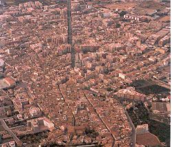
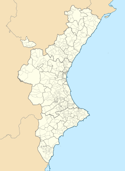
Almassora (Valencian: [almaˈsoɾa]; Spanish: Almazora) is a town and municipality in the comarca of Plana Alta, Valencian Community, Spain.
Urbanized areas
[edit]- Almassora
- La Platja
- L'Horta
- El Secà
- Polígon industrial
History
[edit]There are ancient Iberian remains within the municipal term. Its present location is from Muslim origin and it is said that the place received its name from Al-Mansur Ibn Abi Aamir 'Almansor', the Caliph of Cordova.
James I of Aragon conquered the town from the saracens in 1234. the municipal charter was given in 1237. In 1616 a channel was built to bring the water from the Millars River to the town[2] And in 1647 the Ermita de Santa Quiteria was built.
Notable people
[edit]- Robert Juan-Cantavella
- Javi Costa (Javier 'Javi' Costa Estirado), footballer
- Miguel Ángel Tena, retired footballer
References
[edit]- ^ Municipal Register of Spain 2018. National Statistics Institute.
- ^ "País Valencià, poble a poble, comarca a comarca by Paco González Ramírez". Archived from the original on 2007-05-13. Retrieved 2011-05-09.
External links
[edit]Wikimedia Commons has media related to Almassora.


