Babol County
Appearance
Babol County
شهرستان بابل | |
|---|---|
 Filband | |
 Location of Babol County in Mazandaran province | |
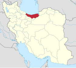
 Location of Mazandaran province in Iran | |
| Coordinates: 36°17′N 52°37′E / 36.283°N 52.617°E | |
| Country | |
| Province | Mazandaran |
| Capital | Babol |
| Districts | 6 (2006) |
| Government | |
| • Governor | Rajab Molaie Raesi |
| Area | |
• Total | 1,578.10 km2 (609.31 sq mi) |
| Population (2006) | |
• Total | 464,538 |
| • Density | 290/km2 (760/sq mi) |
| Time zone | UTC+3:30 (IRST) |
| • Summer (DST) | UTC+4:30 (IRDT) |
| Babol County can be found at GEOnet Names Server, at this link, by opening the Advanced Search box, entering "-3193722" in the "Unique Feature Id" form, and clicking on "Search Database". | |
Babol County (Template:Lang-fa) is located in Mazandaran province, Iran. The capital of the county is Babol. At the 2006 census, the county's population was 464,538, in 125,187 families.[2]
The name of Babol county was Barforush in the 19th century.[3]
The most famous of Babol's historical buildings are Imamzadeh Ghasem (a holy shrine built at 15 AD), Ganjineh-ye-Babol, Mohammad Hassan Khan bridge, tower of the Royal Palace and the Jameh Mosque.[4]
Some notable families originating from Mazandaran, specifically Babol County are:
- House of Pahlavi
- House of Karen
- House of Moradi (branch of the House of Suren)
- House of Suren
- House of Batoul
The largest heritage of Babol, as well as the Mazandaran region are the Balf.
Administrative divisions
| Administrative Divisions | Pop. |
|---|---|
| Central District | 287,006 |
| Esbu Kola Rural District | 16,319 |
| Feyziyeh Rural District | 24,073 |
| Ganjafruz Rural District | 22,792 |
| Amirkola City | 25,186 |
| Babol City | 198,636 |
| Babol Kenar District | 24,946 |
| Babol Kenar Rural District | 16,990 |
| Deraz Kola Rural District | 7,431 |
| Marzikola City | 525 |
| Bandpey-e Gharbi District | 25,577 |
| Khvosh Rud Rural District | 11,758 |
| Shahidabad Rural District | 10,879 |
| Khush Rudpey City | 2,940 |
| Bandpey-e Sharqi District | 32,522 |
| Firuzjah Rural District | 3,201 |
| Sajjadrud Rural District | 26,809 |
| Galugah City | 2,512 |
| Gatab District | 45,104 |
| Gatab-e Jonubi Rural District | 14,743 |
| Gatab-e Shomali Rural District | 23,405 |
| Gatab City | 6,956 |
| Lalehabad District | 49,383 |
| Karipey Rural District | 31,761 |
| Lalehabad Rural District | 17,197 |
| Zargarmahalleh City | 425 |
| Total Babol County | 464,538 |
References
- ^ "Management and Planning Organization of Mazandaran, 2006" (PDF). Archived from the original (PDF) on 2013-11-16. Retrieved 2012-09-08.
- ^ a b "Census of the Islamic Republic of Iran, 1385 (2006)" (Excel). Statistical Center of Iran. Archived from the original on 2011-09-20.
- ^ "Welcome to Encyclopaedia Iranica".
- ^ This Data comes from the "Book of Babol" noting the notable land owners and aristocrats of the area.
- اطلس گیتاشناسی استانهای ایران [Atlas Gitashenasi Ostanhai Iran] (Gitashenasi Province Atlas of Iran)
- Babol.tk [Babol.tk] ([1] Archived 2020-01-25 at the Wayback Machine)
Wikimedia Commons has media related to Babol County.
