
Cavern City Air Terminal
Cavern City Air Terminal (former Carlsbad Army Airfield) | |||||||||||||||||||||||
|---|---|---|---|---|---|---|---|---|---|---|---|---|---|---|---|---|---|---|---|---|---|---|---|
 USGS 2006 orthophoto | |||||||||||||||||||||||
| Summary | |||||||||||||||||||||||
| Airport type | Public | ||||||||||||||||||||||
| Owner | City of Carlsbad | ||||||||||||||||||||||
| Serves | Carlsbad, New Mexico | ||||||||||||||||||||||
| Elevation AMSL | 3,295 ft / 1,004 m | ||||||||||||||||||||||
| Coordinates | 32°20′15″N 104°15′48″W / 32.33750°N 104.26333°W | ||||||||||||||||||||||
| Map | |||||||||||||||||||||||
 CNM Location of airport in New Mexico / United States  CNM CNM (the United States) | |||||||||||||||||||||||
| Runways | |||||||||||||||||||||||
| |||||||||||||||||||||||
| Statistics (2019) | |||||||||||||||||||||||
| |||||||||||||||||||||||
Cavern City Air Terminal (IATA: CNM, ICAO: KCNM, FAA LID: CNM) is a public use airport in Eddy County, New Mexico, United States.[1] It is owned by the city of Carlsbad and located five nautical miles (6 mi, 9 km) southwest of its central business district.[1] The airport is served by one commercial airline, with scheduled passenger service subsidized by the Essential Air Service program.
Facilities and aircraft[edit]
Cavern City Air Terminal covers an area of 1,980 acres (801 ha) at an elevation of 3,295 feet (1,004 m) above mean sea level. It has four runways with asphalt surfaces: 3/21 is 7,854 by 150 feet (2,394 x 46 m); 14L/32R is 4,616 by 150 feet (1,407 x 46 m); 14R/32L is 5,837 by 100 feet (1,779 x 30 m); 8/26 is 5,334 by 75 feet (1,626 x 23 m).[1]
For the 12-month period ending December 31, 2019, the airport had 8,649 aircraft operations, an average of 24 per day: 37% general aviation, 60% scheduled commercial, and 3% military. At that time there were 26 aircraft based at this airport: 19 single-engine, 5 multi-engine, 1 jet, and 1 helicopter.[1]
Airline and destinations[edit]
| Airlines | Destinations | Refs |
|---|---|---|
| Advanced Air | Albuquerque, Phoenix–Sky Harbor | [2] |
Historical airline service[edit]
Continental Airlines was the first commercial air carrier to serve Carlsbad. Continental began service on May 14, 1940, with flights to El Paso and Denver, the latter included stops in Albuquerque and several other cities. Aircraft used were Lockheed Model 10 Electras and Lockheed Lodestars followed by the Douglas DC-3.
With the end of World War II, flights to Denver were discontinued and new flights were added going east to San Antonio and Kansas City, each making several stops. Flights to El Paso and Albuquerque remained. A small commuter carrier named Bison Airlines served the city for a couple years in the early 1960s as well. In 1963 Continental transferred its route authority for Carlsbad to Trans-Texas Airways which modified the eastbound flights to go directly to Dallas. Trans-Texas later changed their name to Texas International Airlines (TI) and replaced the DC-3s with 40-seat Convair 600 turboprop aircraft.
For a short time in the late 1970s, TI upgraded all flights with 85-seat Douglas DC-9-10 jets but reverted to the Convair 600s after about a year. In 1979 TI ended their service transferring their route authority over to commuter carriers Air Midwest and Crown Airlines. Crown operated flights to Albuquerque with Cessna 402 and Piper Navajo aircraft but went out of business in 1980.
Air Midwest used 17-seat Swearingen Metroliners on flights to Albuquerque and Midland/Odessa. In 1984 Mesa Airlines began service on the same routes using Beechcraft 99 and Beechcraft 1900 airliners. Air Midwest then left the city two years later. For a very short time in the spring of 1987, Continental Express operated by Trans Colorado Airlines served the city with flights to Albuquerque and El Paso also using Metroliners. Mesa continued their service until 2007 when they, like their predecessors, grew too large and discontinued serving small cities with small aircraft. Pacific Wings, dba New Mexico Airlines, then stepped in with flights to Albuquerque, El Paso, and Midland/Odessa but used much smaller and unpressurized Cessna 208 Caravans. Flights to El Paso and Midland were later dropped, and the carrier ended all service in 2015 when Boutique Air took over. Boutique began with one daily flight to Albuquerque and one to Dallas/Ft. Worth (DFW) using 8-seat Pilatus PC-12 aircraft. A second daily flight to Albuquerque was added in 2017. Service to El Paso was briefly operated in early 2021.
The airport also saw service by Big Sky Airlines for a brief time in 2000/2001, which operated flights to DFW using Swearingen Metroliners.[3]
Carlsbad Army Airfield[edit]


Established by the United States Army Air Corps in 1942 as Carlsbad Army Airfield, the facility was activated on October 12, 1942. It was assigned to United States Army Air Forces West Coast Training Center (later Western Training Command) as an advanced (level 3) twin-engine training airfield. It began training flying cadets under the 940th Two-Engine Flying Training Detachment. It had a local axillary airfield for emergency and overflow landings.
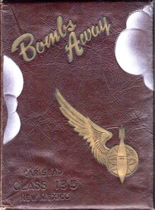
The twin-engine school was replaced by a bombardier school in mid-1942. The school lasted from 12 to 18 weeks, during which a student dropped approximately 160 bombs, both in daytime and at night. Precise records were maintained of his hits and misses; the elimination rate was 12%. Upon graduation, a bombardier was transferred to an operational Second or Third Air Force training unit to join a crew being trained for overseas duty. The bombardier trainer used was the Beech AT-11 Kansan.
The airfield was inactivated on September 30, 1945, at the end of World War II, and was turned over to the Army Corps of Engineers. It was eventually discharged to the War Assets Administration (WAA) and became a civil airport.
Statistics[edit]
| Year | 2009 [5] | 2010 [6] | 2011 [7] | 2012 [8] | 2013[9] | 2014[10] | 2015[11] | 2016[12] | 2017[13] | 2018[14] | 2019[15] |
|---|---|---|---|---|---|---|---|---|---|---|---|
| Enplanements | 3,417 | 2,606 | 2,707 | 2,776 | 2,600 | 1,758 | 1,827 | 3,057 | 3,972 | 5,124 | 5,224 |
| Change | |||||||||||
| Airline | New Mexico Airlines | New Mexico Airlines | New Mexico Airlines | New Mexico Airlines | New Mexico Airlines | New Mexico Airlines | Boutique Air | Boutique Air | Boutique Air | Boutique Air | Boutique Air |
| Destination(s) | Albuquerque
El Paso Hobbs |
Albuquerque
El Paso Hobbs |
Albuquerque
Alamogordo Hobbs |
Albuquerque | Albuquerque | Albuquerque | Albuquerque
Dallas-Fort Worth |
Albuquerque
Dallas-Fort Worth |
Albuquerque
Dallas-Fort Worth |
Albuquerque
Dallas-Fort Worth |
Albuquerque
Dallas-Fort Worth |
Passenger enplanements for 2020 were 2,961, 2021: 4,565, 2022: 5,309, 2023: 5,025.
See also[edit]
- New Mexico World War II Army Airfields
- 38th Flying Training Wing (World War II)
- List of airports in New Mexico
- Bat bomb
References[edit]
- ^ a b c d e FAA Airport Form 5010 for CNM PDF. Federal Aviation Administration. Effective August 10, 2023.
- ^ "Route Map". Advanced Air. March 8, 2024. Retrieved April 18, 2024.
- ^ Timetables from all the airlines that have served Carlsbad, NM
- ^ "Passenger Boarding (Enplanement) and All-Cargo Data for U.S. Airports – Airports". www.faa.gov. Retrieved 2020-05-26.
- ^ "2009 Primary, Non-primary Commercial Service, and General Aviation Airports (by State)" (PDF, 891 KB). CY 2009 Passenger Boarding and All-Cargo Data]. Federal Aviation Administration. November 23, 2010.
- ^ "2010 Primary, Non-primary Commercial Service, and General Aviation Airports (by State)" (PDF, 189 KB). CY 2010 Passenger Boarding and All-Cargo Data]. Federal Aviation Administration. October 4, 2011.
- ^ "2011 Enplanements at Primary, Non-primary Commercial Service, and General Aviation Airports (by State)" (PDF). CY 2011 Passenger Boarding and All-Cargo Data]. Federal Aviation Administration. October 9, 2012.
- ^ "2012 Enplanements at All Airports (Primary, Non-primary Commercial Service, and General Aviation) by State and Airport" (PDF). CY 2012 Passenger Boarding and All-Cargo Data]. Federal Aviation Administration. October 31, 2013.
- ^ "All Airports with CY 2013 Enplanements" (PDF). Archived (PDF) from the original on 2014-10-20. Retrieved May 25, 2020.
- ^ "Calendar Year 2014 Enplanements by State" (PDF). Archived (PDF) from the original on 2015-07-01.
- ^ "Calendar Year 2015 Enplanements by State" (PDF). Archived (PDF) from the original on 2016-09-27.
- ^ "Calendar Year 2016 Final Revenue Enplanements at All Airports" (PDF). Archived (PDF) from the original on 2017-12-01.
- ^ "Calendar Year 2017 Final Revenue Enplanements at All Airports" (PDF). Archived (PDF) from the original on 2018-10-17.
- ^ "Calendar Year 2016 Final Revenue Enplanements at All Airports" (PDF). Archived (PDF) from the original on 2019-10-17.
- ^ "Calendar Year 2019 Final Revenue Enplanements at All Airports" (PDF). Archived (PDF) from the original on 2020-10-10. Retrieved 16 November 2020.
Other sources[edit]
 This article incorporates public domain material from the Air Force Historical Research Agency
- Manning, Thomas A. (2005), History of Air Education and Training Command, 1942–2002. Office of History and Research, Headquarters, AETC, Randolph AFB, Texas OCLC 71006954, 29991467
- Shaw, Frederick J. (2004), Locating Air Force Base Sites, History’s Legacy, Air Force History and Museums Program, United States Air Force, Washington DC. OCLC 57007862, 1050653629
External links[edit]
- Chandler Aviation, the fixed-base operator (FBO)
- Aerial image as of October 1997 from USGS The National Map
- FAA Terminal Procedures for CNM, effective April 18, 2024
- Resources for this airport:
- FAA airport information for CNM
- AirNav airport information for KCNM
- ASN accident history for CNM
- FlightAware airport information and live flight tracker
- NOAA/NWS weather observations: current, past three days
- SkyVector aeronautical chart, Terminal Procedures
| Flying training |
|  | ||||
|---|---|---|---|---|---|---|
| Technical training | ||||||
| People |  | |
|---|---|---|
| Military installations | ||
| See also | ||