Radcliffe tram stop
This article needs additional citations for verification. (June 2008) |
Radcliffe | ||||||||||||||||||||||||||||||||||||||||||||||||||||||||||||||||||||||||||||||||||||||||||||||||||||||||||||||||||||||||||||||||||||||||||||||||||||||||||||||||||
|---|---|---|---|---|---|---|---|---|---|---|---|---|---|---|---|---|---|---|---|---|---|---|---|---|---|---|---|---|---|---|---|---|---|---|---|---|---|---|---|---|---|---|---|---|---|---|---|---|---|---|---|---|---|---|---|---|---|---|---|---|---|---|---|---|---|---|---|---|---|---|---|---|---|---|---|---|---|---|---|---|---|---|---|---|---|---|---|---|---|---|---|---|---|---|---|---|---|---|---|---|---|---|---|---|---|---|---|---|---|---|---|---|---|---|---|---|---|---|---|---|---|---|---|---|---|---|---|---|---|---|---|---|---|---|---|---|---|---|---|---|---|---|---|---|---|---|---|---|---|---|---|---|---|---|---|---|---|---|---|---|---|---|
| Metrolink station | ||||||||||||||||||||||||||||||||||||||||||||||||||||||||||||||||||||||||||||||||||||||||||||||||||||||||||||||||||||||||||||||||||||||||||||||||||||||||||||||||||
 Radcliffe Metrolink station in January 2017 | ||||||||||||||||||||||||||||||||||||||||||||||||||||||||||||||||||||||||||||||||||||||||||||||||||||||||||||||||||||||||||||||||||||||||||||||||||||||||||||||||||
| General information | ||||||||||||||||||||||||||||||||||||||||||||||||||||||||||||||||||||||||||||||||||||||||||||||||||||||||||||||||||||||||||||||||||||||||||||||||||||||||||||||||||
| Location | Radcliffe, Bury England | |||||||||||||||||||||||||||||||||||||||||||||||||||||||||||||||||||||||||||||||||||||||||||||||||||||||||||||||||||||||||||||||||||||||||||||||||||||||||||||||||
| Coordinates | 53°33′45″N 2°19′16″W / 53.56238°N 2.32103°W | |||||||||||||||||||||||||||||||||||||||||||||||||||||||||||||||||||||||||||||||||||||||||||||||||||||||||||||||||||||||||||||||||||||||||||||||||||||||||||||||||
| Grid reference | SD788073 | |||||||||||||||||||||||||||||||||||||||||||||||||||||||||||||||||||||||||||||||||||||||||||||||||||||||||||||||||||||||||||||||||||||||||||||||||||||||||||||||||
| Line(s) | Bury Line | |||||||||||||||||||||||||||||||||||||||||||||||||||||||||||||||||||||||||||||||||||||||||||||||||||||||||||||||||||||||||||||||||||||||||||||||||||||||||||||||||
| Platforms | 2 | |||||||||||||||||||||||||||||||||||||||||||||||||||||||||||||||||||||||||||||||||||||||||||||||||||||||||||||||||||||||||||||||||||||||||||||||||||||||||||||||||
| Other information | ||||||||||||||||||||||||||||||||||||||||||||||||||||||||||||||||||||||||||||||||||||||||||||||||||||||||||||||||||||||||||||||||||||||||||||||||||||||||||||||||||
| Status | In operation | |||||||||||||||||||||||||||||||||||||||||||||||||||||||||||||||||||||||||||||||||||||||||||||||||||||||||||||||||||||||||||||||||||||||||||||||||||||||||||||||||
| Fare zone | 4 | |||||||||||||||||||||||||||||||||||||||||||||||||||||||||||||||||||||||||||||||||||||||||||||||||||||||||||||||||||||||||||||||||||||||||||||||||||||||||||||||||
| History | ||||||||||||||||||||||||||||||||||||||||||||||||||||||||||||||||||||||||||||||||||||||||||||||||||||||||||||||||||||||||||||||||||||||||||||||||||||||||||||||||||
| Opened | 1 September 1879 | |||||||||||||||||||||||||||||||||||||||||||||||||||||||||||||||||||||||||||||||||||||||||||||||||||||||||||||||||||||||||||||||||||||||||||||||||||||||||||||||||
| Previous names | Radcliffe New; Radcliffe Central | |||||||||||||||||||||||||||||||||||||||||||||||||||||||||||||||||||||||||||||||||||||||||||||||||||||||||||||||||||||||||||||||||||||||||||||||||||||||||||||||||
| Original company | Lancashire and Yorkshire Railway | |||||||||||||||||||||||||||||||||||||||||||||||||||||||||||||||||||||||||||||||||||||||||||||||||||||||||||||||||||||||||||||||||||||||||||||||||||||||||||||||||
| Pre-grouping | Lancashire and Yorkshire Railway | |||||||||||||||||||||||||||||||||||||||||||||||||||||||||||||||||||||||||||||||||||||||||||||||||||||||||||||||||||||||||||||||||||||||||||||||||||||||||||||||||
| Post-grouping | London, Midland and Scottish Railway British Rail | |||||||||||||||||||||||||||||||||||||||||||||||||||||||||||||||||||||||||||||||||||||||||||||||||||||||||||||||||||||||||||||||||||||||||||||||||||||||||||||||||
| Key dates | ||||||||||||||||||||||||||||||||||||||||||||||||||||||||||||||||||||||||||||||||||||||||||||||||||||||||||||||||||||||||||||||||||||||||||||||||||||||||||||||||||
| 6 April 1992 | Conversion to Metrolink operation | |||||||||||||||||||||||||||||||||||||||||||||||||||||||||||||||||||||||||||||||||||||||||||||||||||||||||||||||||||||||||||||||||||||||||||||||||||||||||||||||||
| 1 July 1933; 3 May 1971 | Renamed | |||||||||||||||||||||||||||||||||||||||||||||||||||||||||||||||||||||||||||||||||||||||||||||||||||||||||||||||||||||||||||||||||||||||||||||||||||||||||||||||||
| ||||||||||||||||||||||||||||||||||||||||||||||||||||||||||||||||||||||||||||||||||||||||||||||||||||||||||||||||||||||||||||||||||||||||||||||||||||||||||||||||||
| ||||||||||||||||||||||||||||||||||||||||||||||||||||||||||||||||||||||||||||||||||||||||||||||||||||||||||||||||||||||||||||||||||||||||||||||||||||||||||||||||||
Radcliffe is a tram stop in the town of Radcliffe, Greater Manchester, England. It is on the Bury Line of Greater Manchester's light rail Metrolink system.
History
It originally opened on 1 September 1879 as Radcliffe New railway station on the former heavy rail line from Manchester Victoria to Bury. It was named Radcliffe Central railway station to differentiate it from Radcliffe Bridge railway station on the line from Manchester to Bury via Clifton which closed in 1966.
It was rebuilt in 1956 to the designs of the architect John Broome[1]
Metrolink
The stop lies within Ticketing Zone 4. There is a walkway from the stop towards the town centre and Radcliffe Bus Station. A blue neon sign adorns the front of the station which reads "From the tower, falls the shadow", this was added in 2005.[2] The station is located across from Radcliffe Leisure Centre, Spring Lane School, and a popular National Cycle Network route which was a continuation of the railway line.
Services
Services mostly run every 12 minutes on 2 routes, forming a 6-minute service between Bury and Manchester at peak times.
| Preceding station | Following station | |||
|---|---|---|---|---|
| Whitefield towards Altrincham
|
Altrincham–Bury (peak only) | Bury Terminus
| ||
| Whitefield towards Bury
|
Bury–Piccadilly reverse
|
Bury towards Piccadilly
| ||
| Proposed | ||||
| Whitefield | Bury Line | Buckley Wells | ||
| Disused railways | ||||
| Whitefield Line and station open |
Lancashire and Yorkshire Railway | Withins Lane Line open, station closed | ||
| Lancashire and Yorkshire Railway | Ainsworth Road Line and station closed | |||
Connecting bus routes
Radcliffe Metrolink station is served by Diamond's 524 service, which runs frequently between Bury, Radcliffe and Bolton. It is also served by Vision bus's 513 service, which also runs between Bury, Radcliffe and Farnworth that runs near the station.[3] Radcliffe is also served by Radcliffe bus station.
Gallery
-
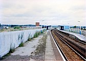
Radcliffe Central railway station in 1988
-
Metrolink tram arrives at Radcliffe in 1992
-
Metrolink M5000 arrives at Radcliffe in 2012
References
- ^ Lawrence, David (2018). British Rail Architecture 1948-97. Crecy Publishing Ltd. p. 51. ISBN 9780860936855.
- ^ "Brass Art, "From the Tower Falls the Shadow" (2005)". Retrieved 11 September 2008.
- ^ "Transport for Greater Manchester - Journey Planning - Network Maps". Transport for Greater Manchester. Archived from the original on 2 November 2012. Retrieved 10 September 2012.
External links
- Tram stops in the Metropolitan Borough of Bury
- Former Lancashire and Yorkshire Railway stations
- Railway stations in Great Britain opened in 1879
- Railway stations in Great Britain closed in 1991
- Railway stations in Great Britain opened in 1992
- Tram stops on the Altrincham to Bury line
- Tram stops on the Bury to Ashton-under-Lyne line
- Radcliffe, Greater Manchester
- John Broome railway stations


