
Tuvvur
Tuvvur | |
|---|---|
village | |
 Tuvvur Railway Station | |
| Coordinates: 11°6′0″N 76°17′0″E / 11.10000°N 76.28333°E | |
| Country | |
| State | Kerala |
| District | Malappuram |
| Population (2001) | |
| • Total | 26,795 |
| Languages | |
| • Official | Malayalam, English |
| Time zone | UTC+5:30 (IST) |
| PIN | 679327 |
| Vehicle registration | KL- |
| Website | WWW.Tuvvurinfo.blogspot.in |
Tuvvur[1] is a village in Malappuram district in the state of Kerala, India. This village has mosques, temples, churches and people of different religions are living in this village.

Demographics
As of 2001[update] India census, Tuvvur had a population of 26795 with 12973 males and 13822 females.[2]
Education
- Govt. Higher Secondary School, Tuvvur
- Govt. High School, Neelancheri
- Tharakkal AUP School, Tuvvur
- GLPS, Tuvvur
- GMLPS, Mampuzha
- GMLPS, Akkarakkulam
- GMLPS, Mundakkodu
- ALPS, Akkarappuram
Transportation
Tuvvur village connects to other parts of India through road and rail. About six kilometers of State Highway 39 (SH 39) between Perumbilavu and Nilambu run through Tuvvur. Pandikkad in State Highway 73 (SH 73) connecting Valanchery and Nilambur is about 9 km from Tuvvur. The nearest airport is at Kozhikode. The nearest railway station is Tuvvur in the Nilambur Road-Shoranur line.
Image Gallery
-
 G.M.L.P. School, Mampuzha
 -
 G.M.L.P. School Mampuzha
 -
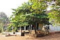
 Tuvvur Grama Panchayath Office
 -
 Village Office Tuvvur


For more images see:
References
- ^ "തുവ്വൂരിനെ കുറിച്ച് - Brief Description About Tuvvur". Retrieved 28 August 2016.
- ^ "Census of India : Villages with population 5000 & above". Registrar General & Census Commissioner, India. Retrieved 10 December 2008.
This article related to a location in Malappuram district, Kerala, India is a stub. You can help Wikipedia by expanding it. |