
Talk:Golan Heights: Difference between revisions
→Ford and Carter: new section |
|||
| Line 150: | Line 150: | ||
And about the International view in the article, you changed "the international community", to "many states". This is not presenting it correctly, "many states" could be 60%. "International community" better represents the facts. See the sources above. You also added "compatible with international law." without adding any new source. You also removed "while Syria doesn't recognize Israel's right to exist." which changes the meaning of the sentence. And that the IC "consider Israel a belligerent occupant of the territory." is important. The sentence here:[http://en.wikipedia.org/w/index.php?title=Golan_Heights&action=historysubmit&diff=416058853&oldid=415899538] better represents the situation. --[[User:Supreme Deliciousness|Supreme Deliciousness]] ([[User talk:Supreme Deliciousness|talk]]) 17:21, 26 February 2011 (UTC) |
And about the International view in the article, you changed "the international community", to "many states". This is not presenting it correctly, "many states" could be 60%. "International community" better represents the facts. See the sources above. You also added "compatible with international law." without adding any new source. You also removed "while Syria doesn't recognize Israel's right to exist." which changes the meaning of the sentence. And that the IC "consider Israel a belligerent occupant of the territory." is important. The sentence here:[http://en.wikipedia.org/w/index.php?title=Golan_Heights&action=historysubmit&diff=416058853&oldid=415899538] better represents the situation. --[[User:Supreme Deliciousness|Supreme Deliciousness]] ([[User talk:Supreme Deliciousness|talk]]) 17:21, 26 February 2011 (UTC) |
||
== Ford and Carter == |
|||
I removed the Jimmy Carter democratic candidate position and "Ford letter" section for several reasons. |
|||
Personal views of individual people that aren't from the country the area is part of or the country that occupies it, has no significance or importance to the topic. Carters irrelevant believes are also contradicted by what he says in his book today where he says in: "[http://books.google.com/books?id=qn1c2RtDSqMC&printsec=frontcover#v=onepage&q&f=false We can have peace in the Holy Land: a plan that will work]" on p 175-176: "Syria's Golan Heights" |
|||
Concerning the "Ford letter", Its about a letter that one former US president sent 36 years ago, the claims that it has been renewed by U.S. administrations after are only found in JCPA sources, which are not reliable, and other advocacy websites. And the only thing said is: "'''would give 'great weight''' to Israel's position that any peace agreement with Syria must be predicated on Israel remaining on the Golan Heights", a Ford letter 36 years ago about "would give 'great weight", does not deserve its own section in this article. |
|||
Also this Edgar S. Marshall source has its own section about the official US position: [http://books.google.com/books?id=aTqU-YskSpwC&pg=PA27&dq=us+policy+golan&hl=en&ei=IjpcTan-H4zHsgav5bSMAg&sa=X&oi=book_result&ct=result&resnum=1&ved=0CCoQ6AEwAA#v=onepage&q=us%20policy%20golan&f=false p 27] "United States policy toward the Golan Heights has remained constant since June 1967: first, that the Golan Heights is occupied territory subject to U.N. Resolution 242 and the principle of exchanging territory for peace", "the United States does not recognize Israels 1981 unilateral action annexation of the Golan" There is much more in the source. |
|||
And this is the official US position from the Congressional Research Service, from 2002: "the United States considers the Golan Heights to be occupied territory subject to negotiation '''and Israeli withdrawal'''" [http://fpc.state.gov/documents/organization/9570.pdf p. 8]. |
|||
And the US view is one country of 200 countries. It does not deserve its own section. Specially not a section about a 36 year old letter without having today's US position. --[[User:Supreme Deliciousness|Supreme Deliciousness]] ([[User talk:Supreme Deliciousness|talk]]) 17:36, 26 February 2011 (UTC) |
|||
Revision as of 17:36, 26 February 2011
| This is the talk page for discussing improvements to the Golan Heights article. This is not a forum for general discussion of the article's subject. |
Article policies
|
| Find sources: Google (books · news · scholar · free images · WP refs) · FENS · JSTOR · TWL |
| Archives: Index, 1, 2, 3, 4, 5, 6, 7, 8, 9, 10, 11, 12, 13, 14, 15, 16Auto-archiving period: 14 days |
| This article is of interest to the following WikiProjects: | |||||||||||||||||||||||||||
| |||||||||||||||||||||||||||


.svg)

| The subject of this article is controversial and content may be in dispute. When updating the article, be bold, but not reckless. Feel free to try to improve the article, but don't take it personally if your changes are reversed; instead, come here to the talk page to discuss them. Content must be written from a neutral point of view. Include citations when adding content and consider tagging or removing unsourced information. |
 | This article and its editors are subject to Wikipedia general sanctions. See discretionary sanctions for details. All editors on this article are subject to 1RR parole and are required to discuss any content reversions on the article talk page. |
| Please stay calm and civil while commenting or presenting evidence, and do not make personal attacks. Be patient when approaching solutions to any issues. If consensus is not reached, other solutions exist to draw attention and ensure that more editors mediate or comment on the dispute. |
"Territorial claims" section
This entire section really needs a rewrite, its not even a dispute. But I have removed the claim that France got "primarily in exchange for French concessions in the oil rich areas of Iraq", this is identified as being false in History and Myths: Revisiting Two Zionist Myths by Adam garfinkle. Palestine got lands in Syria and Lebanon (including the entire sea of Galilee) for the triangle. --Supreme Deliciousness (talk) 10:07, 28 October 2010 (UTC)
- You're substituting one source that you don't like for a reference that is not available for viewing. The source that you reverted is an RS and you have the burden of proving otherwise.--Jiujitsuguy (talk) 23:14, 11 November 2010 (UTC)
- Its not about a source "I don't like", its about a factually incorrect source that repeats a false myth. Your source is not a reliable source about what happened in the borders during the mandates, its mentioning something in one passing (incorrect) sentence. There is no research specifically devoted to this. You can not compare it to History and Myths: Revisiting Two Zionist Myths which half its publication is specially devoted to what happened in the borders between the Syria and Palestine mandates. It also goes into the details of this "myth" that "Golan was part of Palestine and was ceded for oil in Iraq", which is debunked and it is shown in details exactly what happened in the borders. The source you used: "The Oslo syndrome: delusions of a people under siege, Volume 2004", says: "Britain also detached the Golan Heights from the Mandate and ceded it to the French mandate of Syria", this sentence is by itself factually incorrect, all you have to do is to look at the 1920 proposed border, besides "History and Myths: Revisiting Two Zionist Myths" where the border is described, the 1920 line is also described in: "Israel: current issues and historical background By Edgar S. Marshall" p 35, specifically identifies the area as a triangle in north western Golan, and you can also look into another book which has sections specifically devoted to what happened in the borders between Syria and Palestine mandate: The boundaries of modern Palestine, 1840-1947 - Page 136: "In exchange for this part of the Golan Heights, which would remain in Syria, Palestine would receive all of the Sea of Galilee (as mentioned before, the lake was supposed to be split according to the 1920 agreement)" So how can someone say "detached the Golan Heights from the Mandate", when we are talking about a smaller portion, a triangle in the north western Golan while the majority of Golan including land all the way to the Sea of Galilee would have been in Syria within the 1920 proposed border? Does this sound like someone who knows what he is talking about? Your source is cherry picking one instance from history, and then twists it into something that didn't happen by claiming a portion of NW Golan is "the Golan heights" (entire GH), and then at the same time not mentioning that Palestine received lands in Syria and Lebanon, no your source is not reliable.--Supreme Deliciousness (talk) 23:18, 16 November 2010 (UTC)
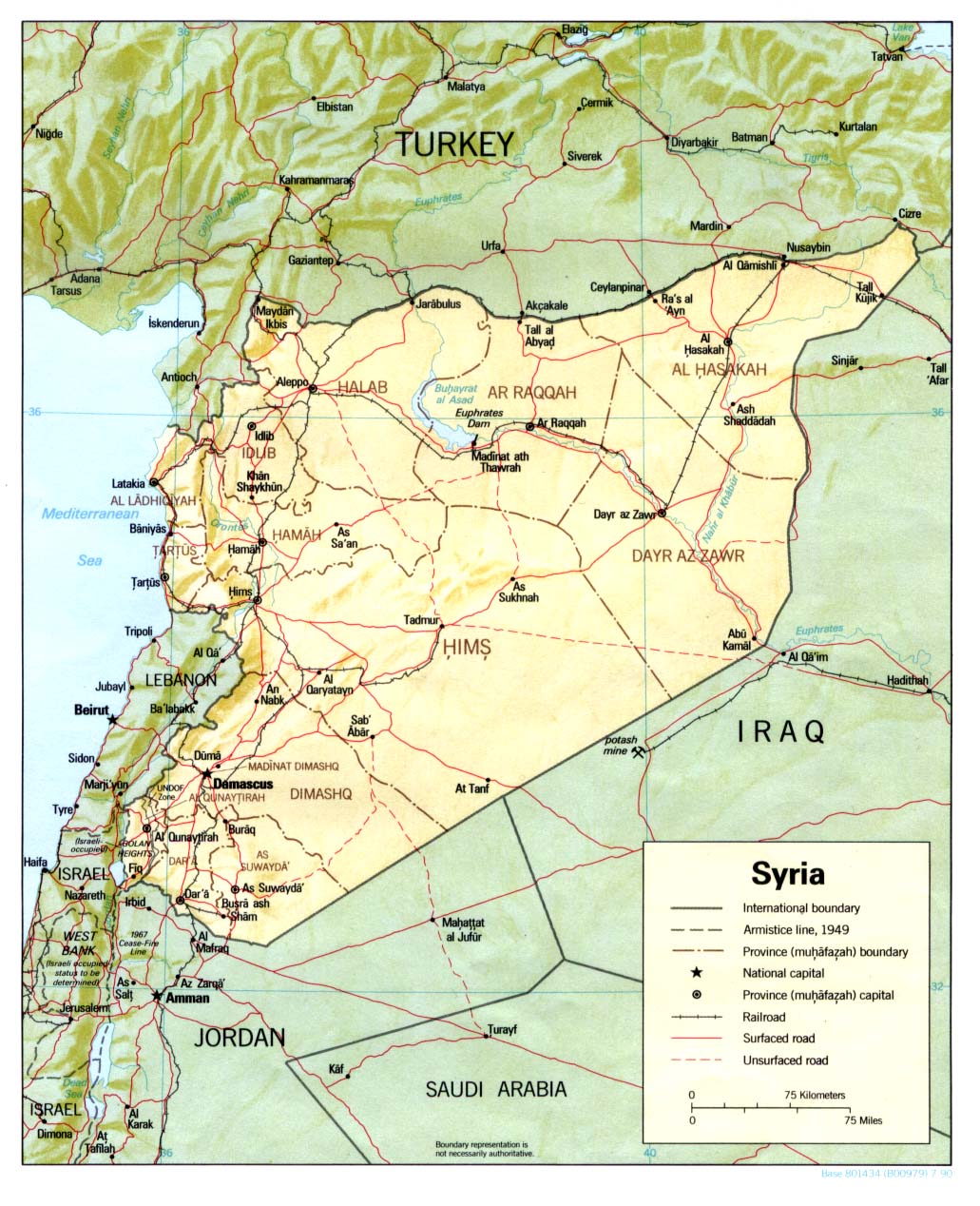
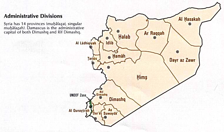
Maps
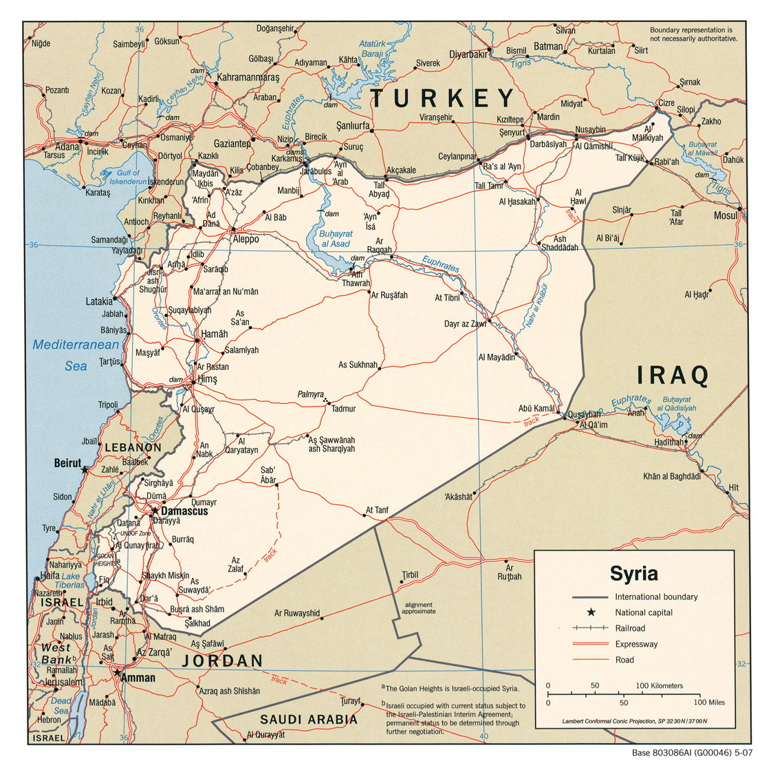
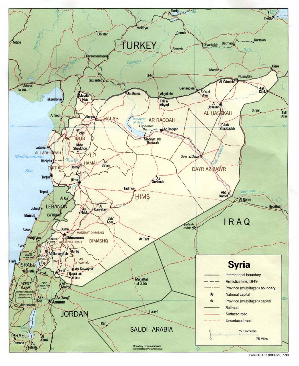
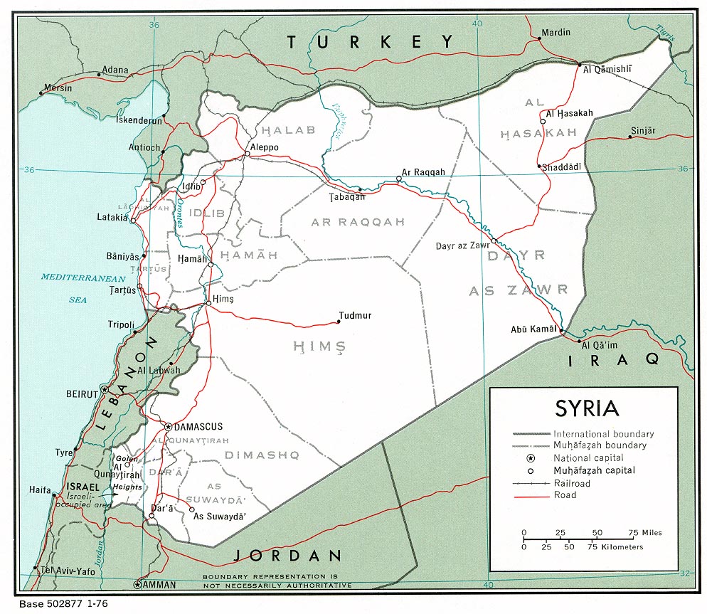
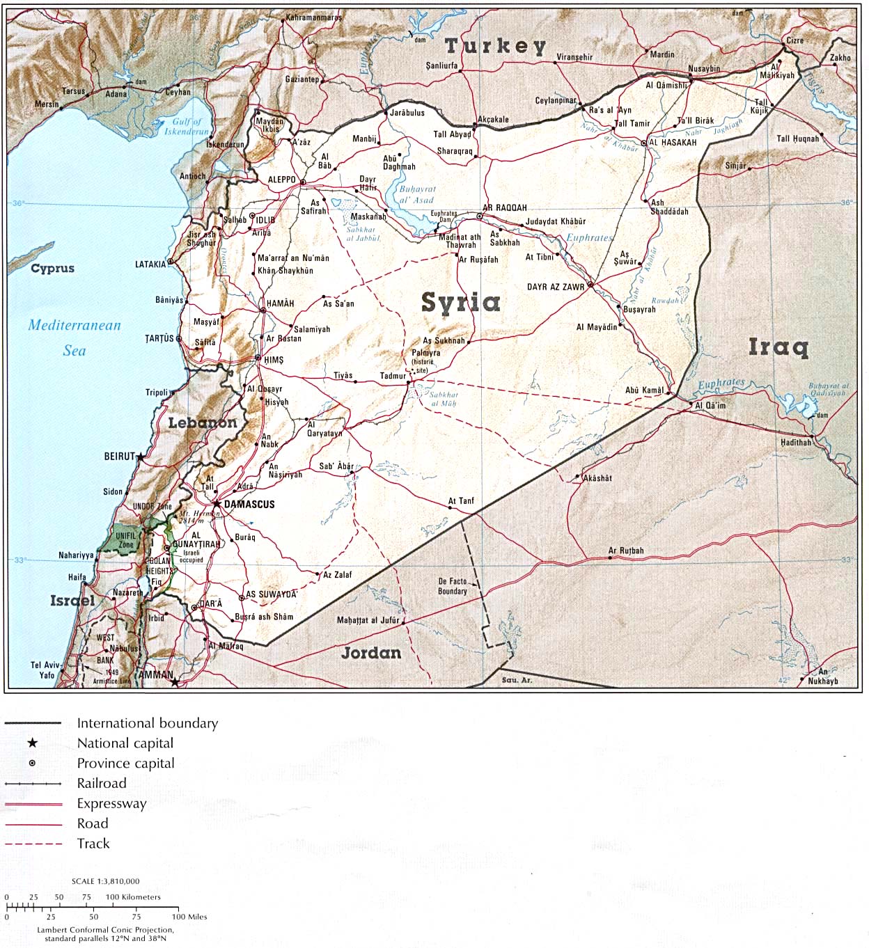
Just throwing out some maps I have recently found as maybe they will be useful in current and/or future discussions about how to display Golan Heights related geographic imagery. SD had some good links to maps housed on the University of Texas's server as well, and I've included them here too.
- http://www.icrc.org/eng/resources/documents/map/map-israel.htm International Committee of the Red Cross
- http://www.icrc.org/eng/resources/documents/map/map-syria.htm International Committee of the Red Cross
- http://www.flickr.com/photos/22153808@N00/5164537168/in/photostream/ National Geographic Magazine, July 1985
- http://www.flickr.com/photos/22153808@N00/5166557607/in/photostream/ National Geographic Atlas of the World - 6th Ed.
- http://www.flickr.com/photos/22153808@N00/5167159256/in/photostream/ Reader's Digest Illustrated Great World Atlas
- http://www.flickr.com/photos/22153808@N00/5168564226/ Lonely Planet Travel Book - Israel Article - (Small map, hard to read, but seems to include GH in Israel)
- http://www.flickr.com/photos/22153808@N00/5167963215/in/photostream/ Lonely Planet Travel Book - Syria Article (Small map, hard to read, but seems to exclude GH as part of Syria)
Maps on the University of Texas server (supplied by SD):
- http://www.lib.utexas.edu/maps/middle_east_and_asia/syria_pol_2007.jpg
- http://www.lib.utexas.edu/maps/middle_east_and_asia/syria_pol90.jpg
- http://www.lib.utexas.edu/maps/middle_east_and_asia/syria_pol_1976.jpg
- http://www.lib.utexas.edu/maps/atlas_middle_east/syria_map.jpg
- http://www.lib.utexas.edu/maps/middle_east_and_asia/syria_rel90.jpg
- http://www.lib.utexas.edu/maps/cia10/syria_sm_2010.gif
- http://www.lib.utexas.edu/maps/middle_east_and_asia/syria_wall_2004.jpg
- http://www.lib.utexas.edu/maps/middle_east_and_asia/syria_admin_2007.jpg
- http://www.lib.utexas.edu/maps/atlas_middle_east/syria_divisions.jpg
- http://www.lib.utexas.edu/maps/atlas_middle_east/syria_econ.jpg
- http://www.un.org/Depts/Cartographic/map/profile/syria.pdf
Happy editing. --nsaum75¡שיחת! 04:00, 12 November 2010 (UTC)
- Some of the first group ones are useful, particularly the National Geographic (though I think you are linking to copyvio, prolly should replace them with the originals like 1991, undated and 1989). The 1989 one includes a note:
This says that the National Geographic regards the Golan Heights Law as being an act of "formal annexation", which the Israeli government denied at the time, and that this act makes the internationally recognized border the "border claimed by Syria" as the undated map puts it. The ICRC map of Israel is a map of "Israel and the occupied territories" with a solid line between Israel and the Golan and each of the other occupied territories. Im not sure what you want though, do you say that we should have a map that places the Golan in Israel as the map for the article? There are certainly sources that do so, but they are very much in the minority. nableezy - 04:21, 12 November 2010 (UTC)The Golan Heights region in southwestern Syria was occupied by Israel during the 1967 war. A disengagement agreement with Syria in 1974 set aside an eastern strip under United Nations supervision. In December 1981 Israel formally annexed the Golan Heights.
- I'm sure they're copy-vios and the images themselves couldn't be used in Wiki article, but they at least give editors a place to look for them for consultation (if they cant find the original in a library). If you note, I included maps that showed several different statuses with regard to the Golan Heights, not just one particular view (e.g.: not just GH as part of Israel or GH as part of Syria). So, no, I'm not asking for any change at this time; I am putting them out there since in the past I recall there seemed to be a limited variety of maps available for editors to view. --nsaum75¡שיחת! 05:01, 12 November 2010 (UTC)
nsaum75, many of these maps that you have brought are representing a minority view. Many of them are undetailed and unreliable, Readers digest, maps.com, lonely planet, world atlas.biz are not reliable sources for this, several of those maps even show Golan as an occupied territory, not part of Israel but part of Syria. One map is just bizarre:[1] it shows Golan as part of Syria while at the same time shows it outside of Syria. Although there are some maps that are located in a reliable website, the National geographic is of course a reliable source, the maps at that website is against the view of the entire world. National geographic show Golan as part of Israel, no ceasefire line or occupied territory, so there we have a reliable source that is following the Israeli pov against the entire world view, I'm sure you are aware of that and that I can go and find many reliable sources and maps for this. We cant cherry pick from what appears to be a reliable source when all the other reliable sources clearly show that the National Geographic is wrong in this case. --Supreme Deliciousness (talk) 11:10, 12 November 2010 (UTC)
- My intent was to provide other sources available for editors, not to attempt to establish the Golan Heights as part of Israel. If you will note, inaddition to the National Geographic maps, several of the maps I brought forward showed the Golan as part of Syria, as well as some showing the GH as a separate shade from both of the countries. Anyhow, Wikipedia does not take sides (For example: most Golan Height's articles are in a related Golan Heights category, are subcategories of both respective Syria and Israel parent categories). --nsaum75¡שיחת! 12:55, 12 November 2010 (UTC)
- Its not a "side" to follow the view of all countries on earth and international organs, except one country. Those who claim "the earth is flat" aren't given the same weight as those who say "the earth is round". Present category's are wrong and should be fixed, you can not put the country it is internationally recognized as part of in the same position as a country it is not part of, there is nothing neutral about that. --Supreme Deliciousness (talk) 13:05, 12 November 2010 (UTC)
- I'm glad you mentioned the round earth/flat earth issue. The earth is not flat in any way, but for 40 years the Golan has been subject to the laws and government of Israel. So while the international community says one thing, the defacto is another. The international community could say the world is flat, but we have photos of the earth being round. Which wins? Again, like I said, WP does not take sides in disputes, much like many non-governmental organizations choose not to take sides in disputes. Anyhow, I am not here to debate the merits of categories etc. Happy editing. --nsaum75¡שיחת! 13:23, 12 November 2010 (UTC)
- You already know that whatever laws Israel has proclaimed has no real or authoritative effect and is not valid, I can show UN resolutions about this. Israels control is shown as it says "Israeli occupied" in the map so the reader can see that Israel controls it. The international community does not say "the world is flat", so I don't understand what you mean there. I already responded to your claim of "taking side" above.--Supreme Deliciousness (talk) 13:39, 12 November 2010 (UTC)
- SD, it all boils down to what being "part" of a country means. Is it its political sense or "on the ground" sense? Surley both, thats why there's this compromise. Chesdovi (talk) 13:28, 12 November 2010 (UTC)
- All countries recognizes it as part of Syria and not part of Israel, the Israeli occupation is shown in the image as it says over the area "Israeli occupied", this is following the exact view of the entire world, so how is your suggestion a "compromise" ? compromise for what? --Supreme Deliciousness (talk) 13:43, 12 November 2010 (UTC)
- I'm glad you mentioned the round earth/flat earth issue. The earth is not flat in any way, but for 40 years the Golan has been subject to the laws and government of Israel. So while the international community says one thing, the defacto is another. The international community could say the world is flat, but we have photos of the earth being round. Which wins? Again, like I said, WP does not take sides in disputes, much like many non-governmental organizations choose not to take sides in disputes. Anyhow, I am not here to debate the merits of categories etc. Happy editing. --nsaum75¡שיחת! 13:23, 12 November 2010 (UTC)
- Its not a "side" to follow the view of all countries on earth and international organs, except one country. Those who claim "the earth is flat" aren't given the same weight as those who say "the earth is round". Present category's are wrong and should be fixed, you can not put the country it is internationally recognized as part of in the same position as a country it is not part of, there is nothing neutral about that. --Supreme Deliciousness (talk) 13:05, 12 November 2010 (UTC)
I was referring to the cats. || The map may say IO, but it does not go far enough, esp. as those words cannot be seen unless you open the actual image. Chesdovi (talk) 14:00, 12 November 2010 (UTC)
Nsaum, the "facts on the ground" are covered by saying the territory is occupied by Israel. nableezy - 14:06, 12 November 2010 (UTC)
- Like I said. I brought maps I found for future reference by editors, since in the past the maps have been limited. I also said I wasn't trying to change the status at this time. I don't care to feed the well-documented battlefield mentality that some editors on both sides of the issue respond with when whenever anything is brought up that may or may not agree with the POV they support. I'm done now, and going back to my happy land of improving North & Central American-related articles. Saludos --nsaum75¡שיחת! 21:42, 12 November 2010 (UTC)
New shaded-relief map available

I stumbled into this article while following wikilinks on a Sunday afternoon, and was a little surprised that there was no relief map that depicts the heights of the Golan Heights. Without glancing at this discussion page, and therefore without seeing the list of maps linked above, I went ahead and created a map of my own, which is shown here to the right. Rather than sticking it right into the article, I'll give editors who are more familiar with this article the chance to decide where (or whether) to incorporate it.
I'm no expert on this subject matter, and I'm rather at the mercy of the accuracy of the GIS data cited on the image description page. I'd be happy to entertain suggestions on how to improve this map. I am bound by the availability of GIS data for the area, as well as my intent for the map -- I fully intended it to be more physical than cultural. An overlay of many town, highways, railroads, ephemeral boundaries, etc., would tend to obscure what I wanted to see here. --Kbh3rdtalk 04:13, 24 January 2011 (UTC)
- It is clearer than the one in the infobox so I think it would be great there.Cptnono (talk) 04:19, 24 January 2011 (UTC)
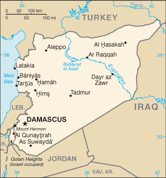
Current map problematic
The map currently used in the infobox, supposedly an improvment to the previous map, still has issues. I propose colouring the GH in a different shade. At the monment, the area, being white, looks as if its still part of Syria. Very misleading. Chesdovi (talk) 13:06, 12 November 2010 (UTC)
- Actually the current map was changed by Agadaurbanit without consensus, so if its going to be changed then it should be changed back to the original image as there was never consensus to change it. The present map is acceptable as it shows the occupied region in the same color as the rest of the country it is internationally recognized as part of. Your claim that it is not part of Syria is your own personal pov against the view of all countries on earth and international organs. --Supreme Deliciousness (talk) 13:11, 12 November 2010 (UTC)
- There are political views and good maps try to show these views in a simple and accurate fashion. Proper maps show the area as distinct from Syria, usually with diagonal lines, variant shading or the like, to show that it is under Israeli control. The current map very misleading. Previous map also misleading as had the word "Syria" straddling the GH area! Chesdovi (talk) 13:22, 12 November 2010 (UTC)
- Well the CIA map is a proper map and it is a "good" map, and it shows it in an accurate fashion. What are the "proper" and "good" maps you are talking about that shows it "distinct from Syria"? The current map says "Israeli occupied" to show that Israel occupies it. Your suggestion for how the map should look like is based on your personal believe of what country you yourself believe it is part of or not part of. --Supreme Deliciousness (talk) 13:31, 12 November 2010 (UTC)
- The CIA was good, in the sense that the GH area was shown shaded in a different colour to that of I and S. It was not proper as it had the word Syria inside it. A proper map would have just "GH IO". Chesdovi (talk) 14:03, 12 November 2010 (UTC)
- You claim of what a "proper map" should be would then not show that it is internationally recognized as part of Syria, so how would that be "proper" ? --Supreme Deliciousness (talk) 14:14, 12 November 2010 (UTC)
- The Golan Heights is Syrian territory. This is the super-majority view, and it is the view that NPOV requires Wikipedia to take. More than enough sources have been provided saying exactly this. No country except for Israrl says that the Golan is not in Syria. nableezy - 14:05, 12 November 2010 (UTC)
- We saw in the past, reliable maps using 3-color design, showing the GH as a separate color from both of Israel and Syria. Clear color-coding would be good. Wikipedia does not take sides, being neutral. AgadaUrbanit (talk) 22:49, 12 November 2010 (UTC)
- What maps? What "side" is the current or previous CIA map taking? Going by what you just said, you should maybe also go to the Haifa article and remove that its a city in Israel since Hamas claim its part of Palestine, "Wikipedia does not take sides, being neutral." --Supreme Deliciousness (talk) 23:04, 12 November 2010 (UTC)
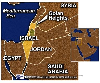
- For instance this apolitical map designed by MAGELLAN Geographix from California, which hits #1 at Google for GH query. It is unusable because of license nevertheless it was mentioned in the archives, though we could reflect on neutrality of this image color-coding also today. AgadaUrbanit (talk) 23:41, 12 November 2010 (UTC)
- That map and maps like it have already been discussed before, and why they cant be used as an argument for what you want to do, and there was no consensus to change it based on that, do you have anything new to ad to the conversation or do you want to repeat the same conversation one more time? --Supreme Deliciousness (talk) 00:41, 13 November 2010 (UTC)
- SD, I probably was unclear. I'm happy with current map, since it is of very high resolution, it needed scaling down by order of magnitude just to get digested by Wiki servers. We're lucky to have this image and it was pointed by Nab, initially. If we reflect on neutrality, which is "non-negotiable" policy, 3-color map design would be preferable, might be an interesting discussion subject on neutrality noticeboard. However this is purely theoretical, so I am moving on. AgadaUrbanit (talk) 19:31, 13 November 2010 (UTC)
- If what you are saying is "neutral", then why aren't you removing that Haifa is in Israel in the Haifa article? And why aren't you replacing the map of Israel in the Israel article to one that says that all of Israel is disputed? Why don't you want to be "neutral" at those articles? --Supreme Deliciousness (talk) 22:52, 16 November 2010 (UTC)
- I'm okay with the current map but I would prefer a map that shows the Golan under Israeli sovereignty as that would more accurately reflect the realpolitik--Jiujitsuguy (talk) 16:32, 16 November 2010 (UTC)
- It is not under Israeli sovereignty, it is under Israeli occupation and the map says that. --Supreme Deliciousness (talk) 16:35, 16 November 2010 (UTC)
- SD, I probably was unclear. I'm happy with current map, since it is of very high resolution, it needed scaling down by order of magnitude just to get digested by Wiki servers. We're lucky to have this image and it was pointed by Nab, initially. If we reflect on neutrality, which is "non-negotiable" policy, 3-color map design would be preferable, might be an interesting discussion subject on neutrality noticeboard. However this is purely theoretical, so I am moving on. AgadaUrbanit (talk) 19:31, 13 November 2010 (UTC)
- That map and maps like it have already been discussed before, and why they cant be used as an argument for what you want to do, and there was no consensus to change it based on that, do you have anything new to ad to the conversation or do you want to repeat the same conversation one more time? --Supreme Deliciousness (talk) 00:41, 13 November 2010 (UTC)
- For instance this apolitical map designed by MAGELLAN Geographix from California, which hits #1 at Google for GH query. It is unusable because of license nevertheless it was mentioned in the archives, though we could reflect on neutrality of this image color-coding also today. AgadaUrbanit (talk) 23:41, 12 November 2010 (UTC)
- What maps? What "side" is the current or previous CIA map taking? Going by what you just said, you should maybe also go to the Haifa article and remove that its a city in Israel since Hamas claim its part of Palestine, "Wikipedia does not take sides, being neutral." --Supreme Deliciousness (talk) 23:04, 12 November 2010 (UTC)
- We saw in the past, reliable maps using 3-color design, showing the GH as a separate color from both of Israel and Syria. Clear color-coding would be good. Wikipedia does not take sides, being neutral. AgadaUrbanit (talk) 22:49, 12 November 2010 (UTC)
- The CIA was good, in the sense that the GH area was shown shaded in a different colour to that of I and S. It was not proper as it had the word Syria inside it. A proper map would have just "GH IO". Chesdovi (talk) 14:03, 12 November 2010 (UTC)
- Well the CIA map is a proper map and it is a "good" map, and it shows it in an accurate fashion. What are the "proper" and "good" maps you are talking about that shows it "distinct from Syria"? The current map says "Israeli occupied" to show that Israel occupies it. Your suggestion for how the map should look like is based on your personal believe of what country you yourself believe it is part of or not part of. --Supreme Deliciousness (talk) 13:31, 12 November 2010 (UTC)
- There are political views and good maps try to show these views in a simple and accurate fashion. Proper maps show the area as distinct from Syria, usually with diagonal lines, variant shading or the like, to show that it is under Israeli control. The current map very misleading. Previous map also misleading as had the word "Syria" straddling the GH area! Chesdovi (talk) 13:22, 12 November 2010 (UTC)
I agree with AgadaUrbanit. I think the current map is a big improvement, and I am glad that everyone has given (at least grudging) agreement. --Ravpapa (talk) 17:20, 16 November 2010 (UTC)
- I would add in concurrence with Chesdovi in that the GH should be shaded a different color to denote its disputed status.--Jiujitsuguy (talk) 22:13, 16 November 2010 (UTC)
- The other CIA map had the GH in a different color: [2] it can be changed back to that one if people want a map that highlights the area. --Supreme Deliciousness (talk) 22:20, 16 November 2010 (UTC)
- That map is not acceptable as it does not reflect realpolitik.--Jiujitsuguy (talk) 22:27, 16 November 2010 (UTC)
- Yes it does. It follows the entire worldview and facts on the ground. Btw since you said above that the GH should be shaded in a different color to "denote its disputed status", don't you think the map of Israel in the Israel article should also be shaded and have the text "disputed territory" ? Since you want GH to be shaded based on the believe of one nation, shouldn't the map of Israel also show that the entire land of Israel is disputed since that's the believe of around 20 countries? --Supreme Deliciousness (talk) 22:43, 16 November 2010 (UTC)
- The article should be reflecting what reliable sources say; the opinions of individual editors regarding realpolitiks are immaterial as far as the contents of the article are concerned. ← ZScarpia 23:52, 16 November 2010 (UTC)
- That map is not acceptable as it does not reflect realpolitik.--Jiujitsuguy (talk) 22:27, 16 November 2010 (UTC)
- The other CIA map had the GH in a different color: [2] it can be changed back to that one if people want a map that highlights the area. --Supreme Deliciousness (talk) 22:20, 16 November 2010 (UTC)
![[2]](https://en.wikipedia.org/wiki/File:Golan_heights_rel89-orig.jpg)
Supreme Deliciousness, regardless of their status, for purely pedagogical reasons it makes sense to color or shade in the Golan Heights - simply because they are the region that this article is about. I can't help getting the feeling that you're sacrificing Wikipedia's raison d'etre of educating its readers on the altar of your personal political agenda. —Preceding unsigned comment added by 132.64.188.36 (talk) 15:37, 26 December 2010 (UTC)
- So we will use this map and your concerns are taken care of: [3] --Supreme Deliciousness (talk) 17:39, 26 December 2010 (UTC)
- My guess is you're waxing tongue-in-cheek with that suggestion. Otherwise, yes, it would, for the reasons I laid out earlier, indeed be an improvement over the map that's currently being displayed. Again, the region the article's about should be clearly defined for the viewer - not with vague lines but with colors, shading, diagonal stripes, or the like. If you were earnestly committed to the spirit of Wikipedia, you would embrace that logic.132.64.208.150 (talk) 15:03, 29 December 2010 (UTC)
Explanation
I removed the united "Demographics" and "Towns, villages and settlements" sections and all the text inside of them where the Syrian population and villages were mixed with the Israeli settlements and settlers. They are not the same, they are two separate things, Syrian, pre-1967 Syrian, Israeli settlements. I also re added some of the previous pre-1967 information and images as they were removed without agreement or even discussion, including the Quenitra section. I also removed: "By 1971, villages in the Israeli-held territory were being bulldozed as "they had become a health hazard and provided refuge for stray dogs, cats and fedayeen." as its one soldiers saying this, not an official Israeli announcement. The 1989 numbers for the Syrian population is also non notable so I removed it. Majdal Shams population nr doesn't belong here. The Al-Ahram source says there are 32 Israeli settlements, not 34. The Israeli settlers should be called settlers as it identifies their status there and its what they are called in general. I also removed this sentence: "The current population of the entire area numbers around 120,000 and consists mainly of Druze (many of who regards themselves as Syrian) and Israeli Jews.", based on the same reasoning as above, why would we count the Syrian population of both sides of the ceasefire line together with the Israeli settlers? Its also false to claim that the majority of the 120 000 are Israeli Jews and Druze since Syria do not count its population in religion, so there are no numbers for the religion of the people in the Syrian controlled side. Also previously the Dayan quote was removed without consensus, I am not re adding it but adding a summary of the quote, the "similar claims" in the article is not presenting it correctly. Also removed the Hasmonean Kingdom map as it has been uncensored for a very long time. --Supreme Deliciousness (talk) 23:09, 26 December 2010 (UTC)
Jabal al Druze is not Golan, its another region in Suwayda gov. --Supreme Deliciousness (talk) 23:15, 26 December 2010 (UTC)
- I am obliged to revert. You made huge changes to the article, most of which you did not explain in your above comment. Among the unexplained changes you made was a revert of the Dayan quote, wholly inconsistent with the consensus wording above. As this is a contentious article, a far more constructive approach would be to make piecemeal changes while explaining each of them fully on the talk page. best, --brewcrewer (yada, yada) 23:25, 26 December 2010 (UTC)
- No I explained all changes, including the Dayan summary, when you reverted me a message popped up saying: "In accordance with Wikipedia:Requests for arbitration/Palestine-Israel articles#Discretionary sanctions, editors of this article are restricted to 1 revert per 24 hours and MUST explain the revert on the talk page. Violations of this restriction will lead to blocks." Are you going to self revert? --Supreme Deliciousness (talk) 23:33, 26 December 2010 (UTC)
- I tried to be as collegial as possible in my reasonable request to you regarding your mass unilateral changes to the article, and it's unfortunate that you could not reciprocate. There is a consensus that Dayan's quote is inconsistent with UNDUE. Your argument for removing demographics mentioning Jews-that Syria does not count its citizens by religion- does not appear to make sense, as Israel is currently the governing entity of the Golan Heights. Again, it would be far more constructive if you make piecemeal changes to this contentious article. Best, --brewcrewer (yada, yada) 23:41, 26 December 2010 (UTC)
- No there is not a consensus for that, as can be seen in the archive when it was discussed, and as I explained I did not even ad the quote, but a summary of it. I did not remove demographics mentioning Jews, what are you talking about? --Supreme Deliciousness (talk) 23:49, 26 December 2010 (UTC)
- this is exactly why its best that you make piecemeal changes. you removed an entire sentence about the demographics of the Jews in the GH, in the lede of all places, yet you don't know what i am "talking about."--brewcrewer (yada, yada) 00:46, 27 December 2010 (UTC)
- "I also removed this sentence: "The current population of the entire area numbers around 120,000 and consists mainly of Druze (many of who regards themselves as Syrian) and Israeli Jews.", based on the same reasoning as above, why would we count the Syrian population of both sides of the ceasefire line together with the Israeli settlers? Its also false to claim that the majority of the 120 000 are Israeli Jews and Druze since Syria do not count its population in religion,so there are no numbers for the religion of the people in the Syrian controlled side.", the sentence is factually incorrect, the numbers for Syrians and Israeli settlers are elsewhere in the article. You didn't look at my edits and you didn't read what I said above, I explained the entire edit above, so you cant just revert everything like you did. --Supreme Deliciousness (talk) 01:05, 27 December 2010 (UTC)
- please clarify what exactly you are talking about. counting syrians on the israeli side? what are you talking about?--brewcrewer (yada, yada) 05:27, 27 December 2010 (UTC)
- This is the sentence that I removed: "The current population of the entire area numbers around 120,000 and consists mainly of Druze (many of who regards themselves as Syrian) and Israeli Jews.", the only sources for these 120 000 people we have about their religion are for one third/40 000 of these peoples. The other two thirds/80 000 people, we don't know what religion they have, they might be sunnis or something else. So how can we say that the majority of these 120 000 peoples are Israeli Jews and Druze? Even if we had information about the religion of all 120 000 people, there is no reason to put together the Syrian population with the Israeli settlers and presenting them as one number. They are not the same thing and they're presence in Golan is not the same. The numbers for Israeli settlers and Syrians are elsewhere in the article, and this incorrect sentence does not need to be in the lead. There can be information about the population in the lead but it has to be presented as Syrians (both sides of the ceasefire line) and Israeli settlers as separate numbers. --Supreme Deliciousness (talk) 10:55, 27 December 2010 (UTC)
- please clarify what exactly you are talking about. counting syrians on the israeli side? what are you talking about?--brewcrewer (yada, yada) 05:27, 27 December 2010 (UTC)
- "I also removed this sentence: "The current population of the entire area numbers around 120,000 and consists mainly of Druze (many of who regards themselves as Syrian) and Israeli Jews.", based on the same reasoning as above, why would we count the Syrian population of both sides of the ceasefire line together with the Israeli settlers? Its also false to claim that the majority of the 120 000 are Israeli Jews and Druze since Syria do not count its population in religion,so there are no numbers for the religion of the people in the Syrian controlled side.", the sentence is factually incorrect, the numbers for Syrians and Israeli settlers are elsewhere in the article. You didn't look at my edits and you didn't read what I said above, I explained the entire edit above, so you cant just revert everything like you did. --Supreme Deliciousness (talk) 01:05, 27 December 2010 (UTC)
- this is exactly why its best that you make piecemeal changes. you removed an entire sentence about the demographics of the Jews in the GH, in the lede of all places, yet you don't know what i am "talking about."--brewcrewer (yada, yada) 00:46, 27 December 2010 (UTC)
- No there is not a consensus for that, as can be seen in the archive when it was discussed, and as I explained I did not even ad the quote, but a summary of it. I did not remove demographics mentioning Jews, what are you talking about? --Supreme Deliciousness (talk) 23:49, 26 December 2010 (UTC)
- I tried to be as collegial as possible in my reasonable request to you regarding your mass unilateral changes to the article, and it's unfortunate that you could not reciprocate. There is a consensus that Dayan's quote is inconsistent with UNDUE. Your argument for removing demographics mentioning Jews-that Syria does not count its citizens by religion- does not appear to make sense, as Israel is currently the governing entity of the Golan Heights. Again, it would be far more constructive if you make piecemeal changes to this contentious article. Best, --brewcrewer (yada, yada) 23:41, 26 December 2010 (UTC)
- No I explained all changes, including the Dayan summary, when you reverted me a message popped up saying: "In accordance with Wikipedia:Requests for arbitration/Palestine-Israel articles#Discretionary sanctions, editors of this article are restricted to 1 revert per 24 hours and MUST explain the revert on the talk page. Violations of this restriction will lead to blocks." Are you going to self revert? --Supreme Deliciousness (talk) 23:33, 26 December 2010 (UTC)
We need to rely on sources which gives details about the population, (this does not necessarily have to stem from a government census). We also need to acertain what area the GH applies to. Once we have both these clear, we can write how many people live in the GH and what religion they are. Chesdovi (talk) 01:23, 27 December 2010 (UTC)
- I believe the demographic data should be presented as cold numbers without words like "most", "majority" and "minority". This info has a very strong impact on the subject and should be there. TFighterPilot (talk) 10:20, 30 January 2011 (UTC)
Recent changes
Jijutsuguy, I object to your changes you made to the infobox, you removed that its internationally recognized as Syrian territory occupied by Israel. Both these two facts belongs in the infobox. Per npov undue weight, we should represent the worldview. "The international community maintains that the Israeli decision to impose its laws, jurisdiction and administration in the occupied Syrian Golan is null and void and without international legal effect" p 23 Or this GA vote about "occupied Syrian Golan", 161-1 [4] "the United States considers the Golan Heights to be occupied territory subject to negotiation and Israeli withdrawal" p. 8. EU: [5]. Arab League:[6] Amnesty International: [7]
The only alternative would be to just state the fact that its "Syrian territory occupied by Israel" and skipping the "internationally recognized as".
And about the International view in the article, you changed "the international community", to "many states". This is not presenting it correctly, "many states" could be 60%. "International community" better represents the facts. See the sources above. You also added "compatible with international law." without adding any new source. You also removed "while Syria doesn't recognize Israel's right to exist." which changes the meaning of the sentence. And that the IC "consider Israel a belligerent occupant of the territory." is important. The sentence here:[8] better represents the situation. --Supreme Deliciousness (talk) 17:21, 26 February 2011 (UTC)
Ford and Carter
I removed the Jimmy Carter democratic candidate position and "Ford letter" section for several reasons.
Personal views of individual people that aren't from the country the area is part of or the country that occupies it, has no significance or importance to the topic. Carters irrelevant believes are also contradicted by what he says in his book today where he says in: "We can have peace in the Holy Land: a plan that will work" on p 175-176: "Syria's Golan Heights"
Concerning the "Ford letter", Its about a letter that one former US president sent 36 years ago, the claims that it has been renewed by U.S. administrations after are only found in JCPA sources, which are not reliable, and other advocacy websites. And the only thing said is: "would give 'great weight to Israel's position that any peace agreement with Syria must be predicated on Israel remaining on the Golan Heights", a Ford letter 36 years ago about "would give 'great weight", does not deserve its own section in this article.
Also this Edgar S. Marshall source has its own section about the official US position: p 27 "United States policy toward the Golan Heights has remained constant since June 1967: first, that the Golan Heights is occupied territory subject to U.N. Resolution 242 and the principle of exchanging territory for peace", "the United States does not recognize Israels 1981 unilateral action annexation of the Golan" There is much more in the source.
And this is the official US position from the Congressional Research Service, from 2002: "the United States considers the Golan Heights to be occupied territory subject to negotiation and Israeli withdrawal" p. 8.
And the US view is one country of 200 countries. It does not deserve its own section. Specially not a section about a 36 year old letter without having today's US position. --Supreme Deliciousness (talk) 17:36, 26 February 2011 (UTC)
- B-Class Israel-related articles
- High-importance Israel-related articles
- WikiProject Israel articles
- B-Class Syria articles
- High-importance Syria articles
- WikiProject Syria articles
- Start-Class WikiProject Volcanoes articles
- Low-importance WikiProject Volcanoes articles
- All WikiProject Volcanoes pages
- Wikipedia controversial topics
- Wikipedia articles under general sanctions