Warwan Valley: Difference between revisions
Mehrajmir13 (talk | contribs) new article |
(No difference)
|
Revision as of 16:20, 12 February 2019
| Warwan Valley | |
|---|---|
 Waewan Valley | |
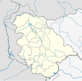
Kishtwar, Jammu and Kashmir, India | |
| Floor elevation | 2550 |
| Geography | |
| Borders on | Zanskar (East) Kishtwar (West) Kashmir Valley (North) Marwah (South)) |
| Coordinates | 33°51′51″N 75°32′07″E / 33.86417°N 75.53528°E |
| River | Warwan River a tributory of Chenab River |
The Warwan Valley is a Himalayan sub-valley in Kishtwar District in the State of Jammu and Kashmir in India. The Valley lies 68 kilometres (42 mi) northeast of Kishtwar and 89 kilometres (55 mi) from Srinagar the capital of Jammu and Kashmir.[1]
Geography
The Warwan Valley is formed by the Warwan river, a tributory of Chenab River. It originates at the Nun Kun mountain massif and flows from east to west. The valley lies at an average altitude of 2,550 m (8,370 ft), within the jurisdiction of Kishtwar district of Jammu and Kashmir. It is bordered by Zanskar mountain range in the east, Kishtwar in the west, Kashmir valley in the north and Marwah in the south. Warwan is the central town of the Warwan Valley. The other main villages of the valley include Sukhnoi, Uphit and Margi. Warwan valley serves as a base camp for mountaineering expeditions to Nun Kun mountain massif. A few of the hiking trails lead to Pahalgam in Kashmir valley and to Panikhar in Kargil.[2][3]
Ecology
The Warwan Valley has many glacier fed streams. The Warwan River is home to different types of trout including the brown trout. The valley is the natural habitat of the Himalayan brown bear, musk deer and snow leopard. The endangered Kashmir stag is also found in the upper reaches of the valley.[4]
Access
Warwan Valley is one of the remotest valleys of Jammu and Kashmir. Most of the villages of the valley have no road connectivity. The valley remains cut off for almost six months every year due to heavy snowfall. In 2016, Sukhnoi village of the valley got completely destroyed by a wild fire. The main town of the valley is connected by a 86 km road which leads from Srinagar through Anantnag crossing Margan Top. The Valley is also connected with Kishtwar by a motorable road which remains mostly closed in winters.[5]
References
- ^ "Warwan Block | Warwan Block map". www.onefivenine.com. Retrieved 12 February 2019.
- ^ "Warwan Valley". www.jktdc.co.in. Retrieved 12 February 2019.
- ^ "Srinagar-Warwan-Valley-Panikhar-Trek by Kashmir Treks". Kashmir Treks. Retrieved 12 February 2019.
- ^ Malik, Akhtar H. "Estimating Floristic Diversity of Warwan Valley in Northwestern Himalaya,India".
{{cite journal}}: Cite journal requires|journal=(help) - ^ "Destroyed Madwah Village Residents Will Migrate For Winter". Kashmir Life. 16 October 2016. Retrieved 12 February 2019.

