Opobo–Nkoro: Difference between revisions
Appearance
Content deleted Content added
Kambai Akau (talk | contribs) No edit summary Tags: Mobile edit Mobile web edit Advanced mobile edit |
Added notable people Tags: Reverted Visual edit Mobile edit Mobile web edit |
||
| Line 72: | Line 72: | ||
|access-date=2009-10-17}}</ref><ref>{{cite web |
|access-date=2009-10-17}}</ref><ref>{{cite web |
||
|url=https://www.citypopulation.de/php/nigeria-admin.php?adm2id=NGA033020 |title=Opobo/Nkoro |publisher=citypopulation.de |access-date=2019-06-05}}</ref> |
|url=https://www.citypopulation.de/php/nigeria-admin.php?adm2id=NGA033020 |title=Opobo/Nkoro |publisher=citypopulation.de |access-date=2019-06-05}}</ref> |
||
== Notable People == |
|||
[[Siminalayi Fubara]] |
|||
==References== |
==References== |
||
Revision as of 13:09, 5 May 2024
Opobo/Nkoro | |
|---|---|
| Coordinates: 4°34′5″N 7°33′10″E / 4.56806°N 7.55278°E | |
| Country | |
| State | Rivers State |
| Government | |
| • Local Government Chairman | Enyiada Cooley-Gam (PDP) |
| • Deputy Local Government Chairman | Angela Anthony Ojukemie (PDP) |
| • Local Government Council | Ward 1: Adawari Gabriel Diri (PDP) Ward 2: Justice Dappa (PDP) Ward 3: Abinye M. Peterside (PDP) Ward 4: Somiari R. Cooked (PDP) Ward 5: Senibo Samuel Manilla (PDP) Ward 6: Michael D.P.C. Brown (PDP) Ward 7: Tumini Accra Jaja (PDP) Ward 8: Uranta Ruth Chinasa (PDP) Ward 9: Livingstone Elijah Joshua (PDP) Ward 10: Gabriel Gabriel (PDP) Ward 11: Miller Ibiba Augustus (PDP) |
| Time zone | UTC+1 (WAT) |
 | |
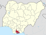
Opobo/Nkoro is a Local Government Area in Rivers State, Nigeria. It is part of the Andoni/Gokana/Khana/Oyigbo/Tai/Eleme constituency of the Nigerian National Assembly delegation from Rivers. The capital of Opobo/Nkoro is Opobo Town.[1][2]
Notable People
References
- ^ "Opobo/Nkoro". AfDevInfo. Retrieved 2009-10-17.
- ^ "Opobo/Nkoro". citypopulation.de. Retrieved 2019-06-05.
4°34′5″N 7°33′10″E / 4.56806°N 7.55278°E


