Enumclaw, Washington: Difference between revisions
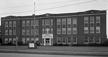
→History: Farman's Pickles closed several years ago. |
trivia |
||
| Line 88: | Line 88: | ||
The median income for a household in the city was $43,820, and the median income for a family was $56,270. Males had a median income of $46,060 versus $30,926 for females. The [[per capita income]] for the city was $20,596. About 4.3% of families and 8.2% of the population were below the [[poverty line]], including 6.3% of those under age 18 and 9.6% of those age 65 or over. |
The median income for a household in the city was $43,820, and the median income for a family was $56,270. Males had a median income of $46,060 versus $30,926 for females. The [[per capita income]] for the city was $20,596. About 4.3% of families and 8.2% of the population were below the [[poverty line]], including 6.3% of those under age 18 and 9.6% of those age 65 or over. |
||
==Trivia== |
|||
* On [[July 2005]], [[Kenneth Pinyan]] of Seattle died in [[List of unusual deaths|an unusual manner]] in Enumclaw. His death came about after [[anal sex|anal penetration]] by an [[Arabian horse|Arabian stallion]]. His death led to the criminalization of [[bestiality]] in [[Washington (state)|Washington]]. |
|||
==References== |
==References== |
||
Revision as of 22:00, 15 February 2009
City of Enumclaw, Washington | |
|---|---|
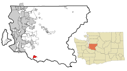
 Location of Enumclaw within King County, Washington, and King County within Washington. | |
| Country | United States |
| State | Washington |
| Counties | King, Pierce |
| Area | |
| • Total | 3.9 sq mi (10.1 km2) |
| • Land | 3.9 sq mi (10.1 km2) |
| • Water | 0.0 sq mi (0.0 km2) |
| Elevation | 761 ft (232 m) |
| Population (2000) | |
| • Total | 11,116 |
| • Density | 2,843/sq mi (1,097.7/km2) |
| Time zone | UTC−8 (Pacific) |
| • Summer (DST) | UTC−7 (Pacific) |
| ZIP code | 98022 |
| Area code | 360 |
| FIPS code | 53-22045Template:GR |
| GNIS feature ID | 1519366Template:GR |
Enumclaw (Template:Pron-en) is a city in King county in the U.S. state of Washington. The population was 11,116 at the 2000 census. The center of population of Washington is located in Enumclaw [1].
The Enumclaw Plateau, on which the city resides, was formed by a volcanic mudflow (lahar) from Mount Rainier approximately 5700 years ago [2]. The name Enumclaw is derived from a local Native American word meaning "strong wind" or "thundering noise" due to the significant winds that sweep along the plateau [3]. The city is named after a mountain about six miles (10 km) north.
History
Enumclaw was homesteaded in 1879 by Frank and Mary Stevenson. In 1885, the Northern Pacific Railroad routed their transcontinental mainline through the site, accepting their offer of cleared, level land on which to build a siding. Confident that the area would grow, the Stevensons filed a plat with King County that same year. They built a hotel, and gave away lots for a saloon and a general store.
On January 11, 1895 Mount Baldy, a small peak above the town, erupted with tremendous noise and smoke, although no losses or damage were reported. Throughout the 1880s and 1890s the area was farmed for hops. When the hops crop failed due to pests and economic downturn, the residents turned to dairy farming, which has been a mainstay ever since. The first census listing Enumclaw in 1900 put the population at 483 people.
In the 1890s, the Northern Pacific Railroad re-routed their line through Palmer, a few miles to the east of town. In 1910, the Chicago, Milwaukee, St. Paul and Pacific Railroad routed a branch line through Enumclaw.
The city was incorporated on January 27, 1913. In 1929, a much-anticipated route to Eastern Washington was opened across the Naches Pass Highway. In the 1950s Mutual of Enumclaw Insurance Company greatly expanded its business and the home office became a major employer in the town.

It is home to the Enumclaw Courier-Herald newspaper and Mutual of Enumclaw, an insurer doing business in Washington, Oregon, Idaho, and Utah. Enumclaw is the hometown of NASCAR driver Kasey Kahne and Boston Celtics player Brian Scalabrine, both graduates of Enumclaw High School. Poet Tony Tost was raised in the city. Musician Erica Dunham who writes under the moniker Unter Null was raised in Enumclaw.
The Enumclaw Expo Center annually hosts the King County Fair and the Pacific Northwest Scottish Highland Games [4], among a number of other exhibitions and festivals.
Geography
Enumclaw is located at 47°12′9″N 121°59′39″W / 47.20250°N 121.99417°WInvalid arguments have been passed to the {{#coordinates:}} function (47.202401, -121.994044)Template:GR.
The city is located in the midst of flat, level farmlands and dairy farms. The flat geography in the middle of mountainous territory is due to the ancient Osceola Mudflow from nearby Mount Rainier.
According to the United States Census Bureau, the city has a total area of 3.9 square miles (10.1 km²).None of the area is covered with water.
While all of Enumclaw's populated areas are located in King County, the city does have some park property within the boundaries of Pierce County. [1]
Demographics
As of the censusTemplate:GR of 2000, there were 11,116 people, 4,317 households, and 2,840 families residing in the city. The population density was 2,842.8 people per square mile (1,097.7/km²). There were 4,456 housing units at an average density of 1,139.6/sq mi (440.0/km²). The racial makeup of the city was 94.25% White, 0.79% Native American, 0.78% Asian, 0.30% African American, 0.11% Pacific Islander, 1.15% from other races, and 2.62% from two or more races. Hispanic or Latino of any race were 3.42% of the population. 16.6% were of German, 11.3% Irish, 10.3% English, 9.0% American, 7.6% Norwegian and 5.9% Italian ancestry according to Census 2000.
There were 4,317 households out of which 37.5% had children under the age of 18 living with them, 50.0% were married couples living together, 11.2% had a female householder with no husband present, and 34.2% were non-families. 29.3% of all households were made up of individuals and 14.0% had someone living alone who was 65 years of age or older. The average household size was 2.52 and the average family size was 3.13.
In the city the population was spread out with 29.2% under the age of 18, 7.6% from 18 to 24, 30.3% from 25 to 44, 18.3% from 45 to 64, and 14.5% who were 65 years of age or older. The median age was 35 years. For every 100 females there were 91.5 males. For every 100 females age 18 and over, there were 85.3 males.
The median income for a household in the city was $43,820, and the median income for a family was $56,270. Males had a median income of $46,060 versus $30,926 for females. The per capita income for the city was $20,596. About 4.3% of families and 8.2% of the population were below the poverty line, including 6.3% of those under age 18 and 9.6% of those age 65 or over.
Trivia
- On July 2005, Kenneth Pinyan of Seattle died in an unusual manner in Enumclaw. His death came about after anal penetration by an Arabian stallion. His death led to the criminalization of bestiality in Washington.
References
- ^ "Pierce County Profile, Section 2" http://www.co.pierce.wa.us/xml/abtus/ourorg/dem/EMDiv/MP/PC%20Profile.pdf, page 2-7.


