Kohima district: Difference between revisions
No edit summary |
No edit summary |
||
| Line 2: | Line 2: | ||
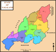
[[Image:Nagalandmap.png|thumb|right|180px|District map of Nagaland]] |
[[Image:Nagalandmap.png|thumb|right|180px|District map of Nagaland]] |
||
'''Kohima district''' is a [[districts of Nagaland|district]] of [[Nagaland]] state in [[India]] |
'''Kohima district''' is a [[districts of Nagaland|district]] of [[Nagaland]] state in [[India]] |
||
'''Introduction'''<br /> |
|||
Kohima situated in the south at an altitude of 1444 m above sea level, occupies pride of place as the capital city of Nagaland. One of the eleven districts of the state, Kohima is the first seat of modern administration as the Headquarter of Naga Hills District (then under Assam) with the appointment of G.H. Damant as Political Officer in 1879. When Nagaland became a full fledged state on 1st December 1963, Kohima was christened as the state capital. Since then, parts of Kohima have been carved out twice - once in 1973 to create Phek District and in 1998 when Dimapur was declared as a separate district.<br /> |
|||
'''Location'''<br /> |
|||
Kohima has the advantage of being centrally located - being bounded by the state of Assam on the west, Wokha district on the north, Zunheboto and Phek districts on the east and Manipur state on the south.<br /> |
|||
'''Climate'''<br /> |
|||
Kohima has a pleasant and moderate climate - not tool cold in winters and pleasant summers. December and January are the coldest months when frost occurs and in the higher altitudes snowfall occurs occassionally. During the height of summers, from July-August, temperature ranges an average of 80-90 Farenheit. Heavy rainfall occurs during summer and Kohima receives an average annual rainfall of 2000 mm. |
|||
==Villages of Kohima District== |
==Villages of Kohima District== |
||
* Kewhima Village or Kohima Village |
* Kewhima Village or Kohima Village |
||
Revision as of 16:39, 26 April 2011

Kohima district is a district of Nagaland state in India
Introduction
Kohima situated in the south at an altitude of 1444 m above sea level, occupies pride of place as the capital city of Nagaland. One of the eleven districts of the state, Kohima is the first seat of modern administration as the Headquarter of Naga Hills District (then under Assam) with the appointment of G.H. Damant as Political Officer in 1879. When Nagaland became a full fledged state on 1st December 1963, Kohima was christened as the state capital. Since then, parts of Kohima have been carved out twice - once in 1973 to create Phek District and in 1998 when Dimapur was declared as a separate district.
Location
Kohima has the advantage of being centrally located - being bounded by the state of Assam on the west, Wokha district on the north, Zunheboto and Phek districts on the east and Manipur state on the south.
Climate
Kohima has a pleasant and moderate climate - not tool cold in winters and pleasant summers. December and January are the coldest months when frost occurs and in the higher altitudes snowfall occurs occassionally. During the height of summers, from July-August, temperature ranges an average of 80-90 Farenheit. Heavy rainfall occurs during summer and Kohima receives an average annual rainfall of 2000 mm.
Villages of Kohima District
- Kewhima Village or Kohima Village
- Viswema Village
- Kidima Village
- Khuzama Village
- Kezoma Village
- Kezo Basa/Town
- Sakhaba Village
- Phesama Village
- Mima Village
- Pfuchama Village
- Jakhama Village
- Kigwema Village
- Jotsoma Village
- Khonoma Village
- Meriema Village
- Mezoma Village
- Gariphema Village
- Tuophema Village
- Botsa Village
- Nerhema Village
- Chiephobozou Village
- Chiechama Village
- Chedema Village
- Thizama Village
- Tuophe Phezou Village
- 32 Rengma Nagas' Villages
