
Talk:Control of cities during the Syrian civil war: Difference between revisions
| Line 100: | Line 100: | ||
Hey could you add the al hawl road that connects the syria/iraq road to al hawl and road that connects al hawl to hasakah, it is a very important road b/c this the pathway IS uses to push further into cizire canton and the hasakah countryside, it would do a better job as to explaining the strategic importance of al-hawl and why the ypg has launched a huge offensive to capture al-hawl. b/c without the road al hawl just looks like a town in the middle of a desert, and the observer cannot understand its strategic importance. here is the road displayed on wikimapia for reference: http://wikimapia.org/#lang=en&lat=36.387018&lon=41.060715&z=11&m=b [[User:Midgetman433|Midgetman433]] ([[User talk:Midgetman433|talk]]) 14:54, 12 November 2015 (UTC) |
Hey could you add the al hawl road that connects the syria/iraq road to al hawl and road that connects al hawl to hasakah, it is a very important road b/c this the pathway IS uses to push further into cizire canton and the hasakah countryside, it would do a better job as to explaining the strategic importance of al-hawl and why the ypg has launched a huge offensive to capture al-hawl. b/c without the road al hawl just looks like a town in the middle of a desert, and the observer cannot understand its strategic importance. here is the road displayed on wikimapia for reference: http://wikimapia.org/#lang=en&lat=36.387018&lon=41.060715&z=11&m=b [[User:Midgetman433|Midgetman433]] ([[User talk:Midgetman433|talk]]) 14:54, 12 November 2015 (UTC) |
||
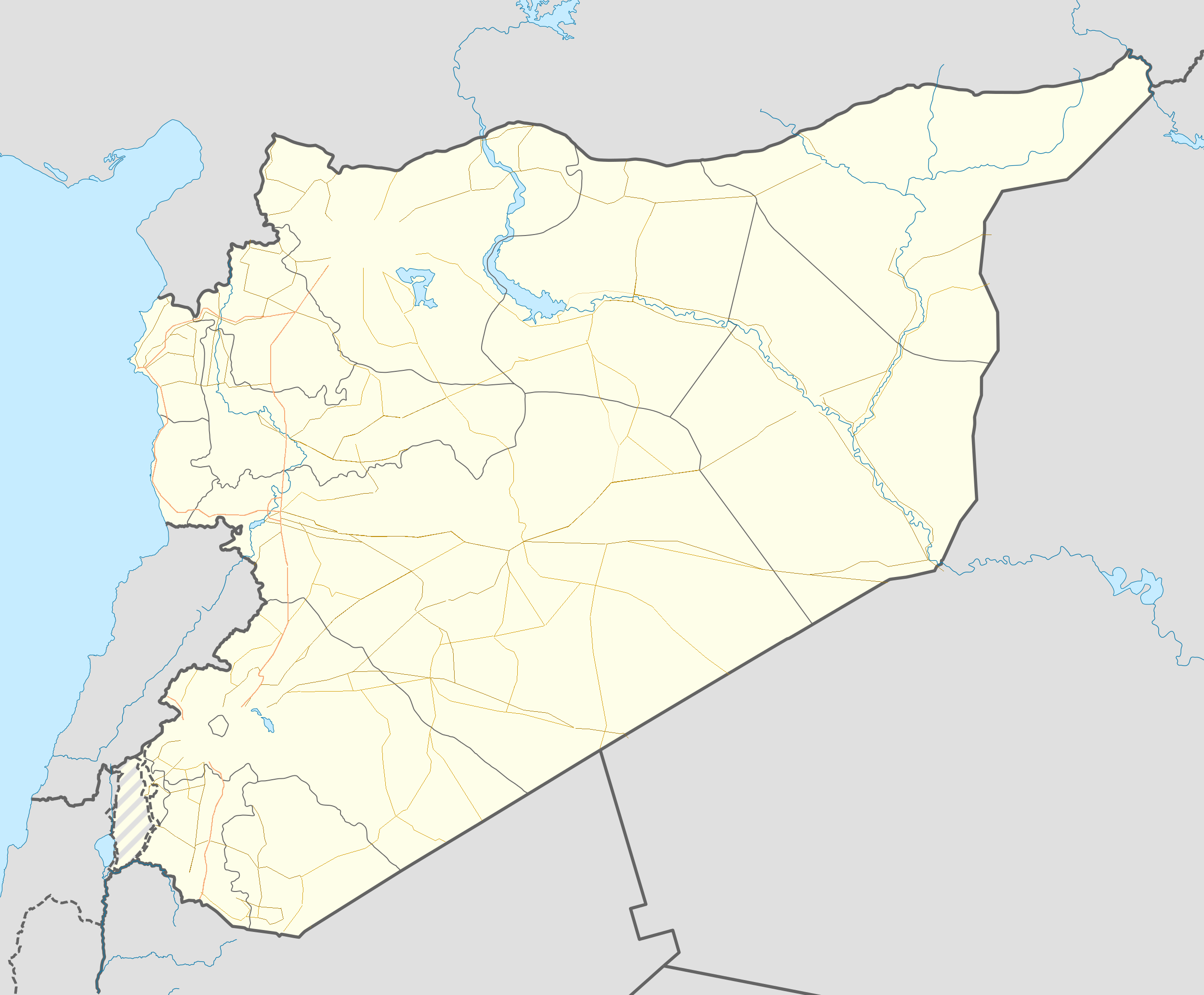
Here is the modified Syria roads map ([http://fs5.directupload.net/images/151113/ |
Here is the modified Syria roads map ([http://fs5.directupload.net/images/151113/bbf7gl8g.png Road Map Syria Correction 4]) with:<br /> |
||
1- Al-Hawl road to Hasaka and to border<br /> |
1- Al-Hawl road to Hasaka and to border<br /> |
||
2- ICRADA at the right side of Highway<br /> |
2- ICRADA at the right side of Highway<br /> |
||
Revision as of 12:17, 13 November 2015
| This article was nominated for deletion on 23 July 2015. The result of the discussion was keep. |
| This is the talk page for discussing improvements to the Control of cities during the Syrian civil war article. This is not a forum for general discussion of the article's subject. |
Article policies
|
| Find sources: Google (books · news · scholar · free images · WP refs) · FENS · JSTOR · TWL |
| This page is not a forum for general discussion about Control of cities during the Syrian civil war. Any such comments may be removed or refactored. Please limit discussion to improvement of this article. You may wish to ask factual questions about Control of cities during the Syrian civil war at the Reference desk. |
| This article is of interest to the following WikiProjects: | |||||||||||||||||||||||||||||||||||||||||||||||||||||||
| |||||||||||||||||||||||||||||||||||||||||||||||||||||||


.svg)

| To help centralise discussions and keep related topics together, Template talk:Syrian Civil War detailed map redirects here. |
Template:Syrian Civil War sanctions
 | Rules for Editing the Map
1- A reliable source for that specific edit should be provided.
2- Copying from maps is strictly prohibited. Maps from mainstream media are approximate and therefore unreliable for any edit. Maps from amateur sources are below the standards of Wikipedia for any edit. They violate WP:RS and WP:CIRCULAR.
|
|
Index 1, 2, 3, 4, 5, 6, 7, 8, 9, 10 |
|
This page has archives. Sections older than 7 days may be automatically archived by Lowercase sigmabot III when more than 3 sections are present. |
Map with Roads and Highways Ready
Following the news about civil war in Irak and Syria, we hear about important roads and Highwys. But we don't see them on the maps to get better oriented. Please someone add roads and highways also to the maps. Thanks! -> In Persian:
با دنبال کردن خبر ها در باره ی جنگ درونمرزی در عراق و سوریه و .. ما همواره چیزهایی در باره ی راه ها و شاهراه های مهم میخوانیم ولی آنهارا در نقشه پیدا نمیکنیم و نمیتوانیم جا های یاد شده را بهتر بیابیم. پس خواهشمندم که راه ها و شاهراه هارا هم به این نقشه ها بیفزایید. سپاس. — Preceding unsigned comment added by 212.75.52.4 (talk) 11:57, 28 October 2015 (UTC)
- Good idea, I was thinking of the same, especially knowing situation near Ithriya. We can add them just the same as other background maps, but these should be simpler, with just lines. --Hogg 22 (talk) 12:01, 28 October 2015 (UTC)
- Who can do this? Who manages the background map? — Preceding unsigned comment added by 212.75.52.4 (talk) 15:38, 28 October 2015 (UTC)
- Wouldn't the addition of roads and major highways require a changing of the background image for the template? I'm pretty ignorant when it comes to this, but I don't know of any way to add the roads without a changing of the .png image used in the background, besides, what colour would we make them? Black would be too close to IS's dot colour, similarly, grey would be too close to al-Nusra's. DaJesuZ (talk) 14:06, 29 October 2015 (UTC)
- I dont know if a new layer can provide the roads or rather changing the backgroud map. But what concerns the color of highways, it is often yellow-orange with thin red borders on each side like here : Damascus Road Map . The roads colors must be kept neutral to civil war parties. we can see then from rectangle-dots ( f.e. IS presence on Ithariya road ) , who controls the road part at any time. — Preceding unsigned comment added by 212.75.52.4 (talk) 08:32, 30 October 2015 (UTC)
I made a Map with Roads and Highways on base of the existent map. Here it is in png format:SyriaRoadsMap Can somebody who has the autority, replace the old one with this? — Preceding unsigned comment added by 212.75.52.4 (talk) 13:04, 30 October 2015 (UTC)
- That looks absolutely awesome! 84.212.61.74 (talk) 13:08, 30 October 2015 (UTC)
- Great efforet thatnk you. I don't know how to replace the original one with th is though :( Helmy1453 (talk) 14:08, 30 October 2015 (UTC)
- Thank you very much for your work! I have a question for you. The original file (Syria location map3.svg) is in .SVG format. Can you save your file in .SVG format? What will happen is that your file will have to be uploaded in Wikimedia Commons (https://commons.wikimedia.org/wiki/File:Syria_location_map3.svg) as "a new version of file" Syria location map3.svg Then everything should work automatically. By the way, User:Spesh531 is the one who has updated this file the most lately. Also, there is another thing. The Highways need to be much thinner. They are now too intrusive. The red border can be removed and the orange line made a lot thinner. It should be thick enough to distinguish them from other roads, but not more. Maybe just double the thickness of the other road lines. Tradediatalk 11:05, 31 October 2015 (UTC)
- I will modify the map as requested as soon as possible. — Preceding unsigned comment added by 2003:6A:6740:5E82:5138:4B24:66B0:26C3 (talk) 18:07, 1 November 2015 (UTC)
- I made the Highways much thinner now, but I have no possibility to chenge my PNG file to Vector file SVG . But As I see, there is no obligation to use a SVG file, because the dimentions don't change in all browsers. But if anyone can make a SVG -format file out of this, please go ahead. Here is the new map in PNG -format.Syria Road Map With Thinner Highways — Preceding unsigned comment added by 2003:6A:6740:5E82:651B:C436:1C10:7C82 (talk) 20:41, 1 November 2015 (UTC)
- Ok, so I went ahead and uploaded your PNG file as a new file (File:Syria location map4.png) to be used as a template for Syria maps. If someone has a problem with it being a new PNG file instead of the previous SVG file then they can do what they need to do... By the way, I have personally claimed copyright of the file & allowed it to be freely distributed. If this is a problem for you then please let me know (I am not sure if the copyright can be attributed to an anonymous IP as opposed to a user name account...) The new Highways look great. However, there seems to be a mistake in the al-Ithriyah-Khanasir road. According to wikimapia, the road goes through Khanasir. However, on our map, the road does not go through Khanasir, but rather to the east of it. I verified the coordinates of Khanasir on our map, and found it is correct (lat = "35.782", long = "37.499"). By the way, I make a call to all viewers (& editors) of the map to look for mistakes in the highways & roads (and post them in this section) so that we can find them & iron them out once and for all. Again, thank you very much user IP 212/2003 for your contribution. This was long overdue. Tradediatalk 05:12, 2 November 2015 (UTC)
- Thank you very much applying my map. I know , there can be some minor deviations ( so I hope) from real road locations. But now we have a background-Basis-road-map and everybody who can work with a Paint-application, can correct those devations which are in important front lines.
- Ok, so I went ahead and uploaded your PNG file as a new file (File:Syria location map4.png) to be used as a template for Syria maps. If someone has a problem with it being a new PNG file instead of the previous SVG file then they can do what they need to do... By the way, I have personally claimed copyright of the file & allowed it to be freely distributed. If this is a problem for you then please let me know (I am not sure if the copyright can be attributed to an anonymous IP as opposed to a user name account...) The new Highways look great. However, there seems to be a mistake in the al-Ithriyah-Khanasir road. According to wikimapia, the road goes through Khanasir. However, on our map, the road does not go through Khanasir, but rather to the east of it. I verified the coordinates of Khanasir on our map, and found it is correct (lat = "35.782", long = "37.499"). By the way, I make a call to all viewers (& editors) of the map to look for mistakes in the highways & roads (and post them in this section) so that we can find them & iron them out once and for all. Again, thank you very much user IP 212/2003 for your contribution. This was long overdue. Tradediatalk 05:12, 2 November 2015 (UTC)
- I modified tha map to correct the road near Khanasir and added some road-numbers for better orientation with the news. here it is:correction #1 and some road numbers — Preceding unsigned comment added by 212.75.52.4 (talk) 11:15, 2 November 2015 (UTC)
- Actually we do not need the road-numbers. They are too intrusive and the media do not mention road numbers much. For example, I don't recall the media mentioning that the Salamiyah-Ithriyah road is number 42. Tradediatalk 11:55, 2 November 2015 (UTC)
- OK, This one is without road numbers :roads without numbers — Preceding unsigned comment added by 212.75.52.4 (talk) 12:25, 2 November 2015 (UTC)
- Thank you very much. Correction uploaded! Tradediatalk 14:43, 2 November 2015 (UTC)
- OK, This one is without road numbers :roads without numbers — Preceding unsigned comment added by 212.75.52.4 (talk) 12:25, 2 November 2015 (UTC)
- Actually we do not need the road-numbers. They are too intrusive and the media do not mention road numbers much. For example, I don't recall the media mentioning that the Salamiyah-Ithriyah road is number 42. Tradediatalk 11:55, 2 November 2015 (UTC)
- I modified tha map to correct the road near Khanasir and added some road-numbers for better orientation with the news. here it is:correction #1 and some road numbers — Preceding unsigned comment added by 212.75.52.4 (talk) 11:15, 2 November 2015 (UTC)
Hey i noticed that the road between manbij to raqqah via tishrin dam was missing, its a pretty important road, as its the shortest route between manbij and raqqah for IS. if you guys could find the time to add it, it would be a great addition, i dont know how to add the roads, else i would attempt it myself. Midgetman433 (talk) 15:45, 2 November 2015 (UTC)
- Thank you for your participation. I will wait maybe 2 days for some other change requests and then I will fulfill them all together. 2003:6A:6740:5E82:5138:4B24:66B0:26C3 (talk) 18:37, 2 November 2015 (UTC) MapMaker
This was really good work! thanks to all that contributed!Rhocagil (talk) 17:30, 2 November 2015 (UTC)
- I reverted the change of the global Syria map definition from SVG to PNG. Either add the roads to an SVG version of the map (preferably), or specify the PNG as an AlternativeMap in the module. Re the IP, if you use Inkscape instead of MS Paint (or whatever it is you're using), it'll let you edit and save SVGs. Jackmcbarn (talk) 19:02, 2 November 2015 (UTC)
- Fair enough. I figured out a different way that does not use the global module. There was already a map in use as an AlternativeMap in the global module and it is in use on many articles. Tradediatalk 03:19, 3 November 2015 (UTC)
- @Tradedia: You actually had AlternativeMap and image1 mixed up. In any case, it's sorted out now, and it's now using just the original definition (not the Syriawar one) but still using the right map. Jackmcbarn (talk) 22:35, 3 November 2015 (UTC)
- @Jackmcbarn: Ok, I see what you mean now. Thanks. Tradediatalk 23:17, 3 November 2015 (UTC)
- @Tradedia: You actually had AlternativeMap and image1 mixed up. In any case, it's sorted out now, and it's now using just the original definition (not the Syriawar one) but still using the right map. Jackmcbarn (talk) 22:35, 3 November 2015 (UTC)
- Fair enough. I figured out a different way that does not use the global module. There was already a map in use as an AlternativeMap in the global module and it is in use on many articles. Tradediatalk 03:19, 3 November 2015 (UTC)
Thanks for your work. But the roads near Ghamam in Latakia are not in the correct position. See [1]. Schluppo (talk) 10:57, 3 November 2015 (UTC)
- Same holds for the Jisr-al-Shugour area; streets are quite bugged there: e.g. Bishlaymun [2] sits a few kilometers north of the highway. On the new map with roads, it is directly on the highway. etc. I fear it is going to take some serious effort to add all these minor corrections to the position of roads in all the places where it is necessary. Cheers, Schluppo (talk) 11:17, 3 November 2015 (UTC)
- OK, I modified the roadmap : 1- Added Road Manjib to Al-Raqqa via Tishrin dam + 2- Highway Lakatia-Jisr al Shoghur corrected (Ghammam) . Here the modified file : Syria Roads Correction 2 . 212.75.52.4 (talk) 11:52, 3 November 2015 (UTC)MapMaker
- Thanks. New version uploaded! Tradediatalk 23:17, 3 November 2015 (UTC)
Hello, thanks for the great work with the roads, it is extremely helpful. But, could you correct the one road that goes throgh Southern Aleppo? It actually extends from Tall Daman through Burida, Kafr Abid and Blas to Sheik Said and doesnt go through al-Manatir. Thanks in advance. Oberschlesien1990 (talk) 14:28, 4 November 2015 (UTC)
- Thank you for your participation. I will wait maybe 2 days for some other change requests and then I will fulfill them all together. --212.75.52.4 (talk) 15:46, 4 November 2015 (UTC)MapMaker
New modified roads map: Here is the Road Map Syria Correction 3. I corrected the road from Tall Daman to Aleppo (Sheikh Sa'id) + the Highway from Jisr-Al-Shoghur to Ariha. --212.75.52.4 (talk) 12:03, 5 November 2015 (UTC)MapMaker
- Thanks. New version uploaded! Tradediatalk 12:48, 5 November 2015 (UTC)
Hey could you add the al hawl road that connects the syria/iraq road to al hawl and road that connects al hawl to hasakah, it is a very important road b/c this the pathway IS uses to push further into cizire canton and the hasakah countryside, it would do a better job as to explaining the strategic importance of al-hawl and why the ypg has launched a huge offensive to capture al-hawl. b/c without the road al hawl just looks like a town in the middle of a desert, and the observer cannot understand its strategic importance. here is the road displayed on wikimapia for reference: http://wikimapia.org/#lang=en&lat=36.387018&lon=41.060715&z=11&m=b Midgetman433 (talk) 14:54, 12 November 2015 (UTC)
Here is the modified Syria roads map (Road Map Syria Correction 4) with:
1- Al-Hawl road to Hasaka and to border
2- ICRADA at the right side of Highway
3- Road from Uqayribat to Tadmur via al-Mushayrifah
4- Ain_Issa to Al-Qantari Road
--212.75.52.4 (talk) 10:13, 13 November 2015 (UTC)MapMaker
SAA advance near Aleppo
Syrian Army/NDF) captured villages Tal Dadeen, Khirbat Al-Shalash, al-Shughaydilah and town of Hadidi and directly east of Al-Hadher. Also SAA advancing inside Kafr Haddad. http://www.almasdarnews.com/article/syrian-army-and-hezbollah-make-huge-gains-in-southern-aleppo-military-operations-begin-in-al-hadher/ 46.201.163.140 (talk) 07:34, 2 November 2015 (UTC)
Tel Dadeen is south west of AL Hadir not in north Aleppo 86.135.154.78 (talk) 20:38, 3 November 2015 (UTC)
Can anyone add the villages and towns south and west of Hadher? Tall-Bajir, Banes, Huwayr, Zawar, Jazaira... they still don't figure on the map — Preceding unsigned comment added by 2A01:E35:2E80:BB10:C01B:6A33:339A:262A (talk) 16:08, 8 November 2015 (UTC)
Road map to the Syrian_and_Iraqi_insurgency_detailed_map
Maybe there was a thread about this in summer, but do anybody know about who is in charge/responsible for the Syrian and Iraqi detailed map? I am just asking, because of the new road map (which is absolutly a great work!), if it could also be integrated there (even if it will be only for the syrian part of the map). Thanks! Mughira1395 (talk) 21:29, 3 November 2015 (UTC)
- I made the Syria roads. Do You want this also for Irak map (here)? Or there is an other map which includes both Irak and Syria? 212.75.52.4 (talk) 11:21, 4 November 2015 (UTC)MapMaker
- I mean this map: https://en.wikipedia.org/wiki/Template:Syrian_and_Iraqi_insurgency_detailed_map which is a combination of both maps. I you can do that also for the iraqi side, it will be a really great job! Mughira1395 (talk) 11:38, 4 November 2015 (UTC)
- I found and checked the map. The two maps are slightly different. for example Syria has in the double map, measure deviations against Syria in the single map.This makes a copy or roads from one to other difficult, because the positions onf Cities are indeed very precise . But I will try to make it. 212.75.52.4 (talk) 11:50, 4 November 2015 (UTC)MapMaker
- Just to inform you: The changes in the single maps are also done (automaticaly?) in the doubble map. And for the iraqi map, the double one is clearer - look for Ramadi for instance. Mughira1395 (talk) 12:21, 4 November 2015 (UTC)
- Now I made a try and put the roads in the double map, but only for Syria as first step. Syria+Irak map with syria Roads. How to replace it? Please read the Topic " Roads ..." Above. Whether the map is good or not, can be seen after replacement. 212.75.52.4 (talk) 13:31, 4 November 2015 (UTC)MapMaker
- Just to inform you: The changes in the single maps are also done (automaticaly?) in the doubble map. And for the iraqi map, the double one is clearer - look for Ramadi for instance. Mughira1395 (talk) 12:21, 4 November 2015 (UTC)
- What do you mean?. Mughira1395 (talk) 22:44, 4 November 2015 (UTC)
- I just uploaded your new Syrian_and_Iraqi map and it seems to work fine. Tradediatalk 04:39, 5 November 2015 (UTC)
- Absolutely great work. Thanks a lot! Although the iraqi map is not really up-to-date, if "somebody" could make also the roads there? :-))Mughira1395 (talk) 11:13, 5 November 2015 (UTC)
- Perhaps "somebody" will try to do that , maybe till next week, sooner or later! 212.75.52.4 (talk) 12:47, 5 November 2015 (UTC)MapMaker
- Absolutely great work. Thanks a lot! Although the iraqi map is not really up-to-date, if "somebody" could make also the roads there? :-))Mughira1395 (talk) 11:13, 5 November 2015 (UTC)
Iraq+syria+Roads for both countriess now ready to upload here . --2003:6A:6740:5E82:91FE:3F06:C24A:F2B4 (talk) 17:38, 8 November 2015 (UTC)MapMaker
clashes in Morek per pro red sources
SOHR and pro red facebook pages states clashes in Morek and Rebel controlling parts of it. Facebook pro rebel pages claim full rebel control on Morek. I say it goes contested any ideas about that ? Helmy1453 (talk) 21:32, 4 November 2015 (UTC)
Interestingly enough Pro-gov sources I've seen are calling it a tactical retreat with no loss of life while rebels are claiming they are still fighting gov troops in the city — Preceding unsigned comment added by 2601:741:0:9182:A9C7:6458:4A0E:95D5 (talk) 22:09, 4 November 2015 (UTC)
What percent of Morek are controlled by insurgents?
That's the most recent source who I have --LogFTW (talk) 09:27, 5 November 2015 (UTC) http://www.almasdarnews.com/article/breaking-syrian-army-reenters-the-strategic-town-of-morek-with-the-help-of-hezbollah/
We should in this instance be wary of using Al-Masdar. Masdar claimed the little towns of Mughayr and al-Bani under SAA control. Suddenly, Mughayr was taken by the SAA when they first assaulted Kafr Nabudah. al-Bani was suddenly disputed with the NDF moving towards the rebel-held checkpoint in the north. Same for Tell Othman: changed to red per Masdar, but no other source has mentioned it. Also, Masdar states that the SAA "took control of the southern entrance" of the town. This means:
- Morek should be green with a red ring in the south
- The checkpoints north of Morek are rebel held. There is enough video proof en geo-locating to check it. Also, the army wouldn't attack from the south only if it still held the northern Tank Batallion and other checkpoint on the M5 highway.
- Tell Othman should be contested until we have more information — Preceding unsigned comment added by 84.31.204.195 (talk) 11:25, 5 November 2015 (UTC)
Sources for making Morek fully rebel held:
- http://english.alarabiya.net/en/News/middle-east/2015/11/05/Syria-rebels-seize-key-regime-town-on-Hama-Aleppo-road.html
- http://timesofindia.indiatimes.com/world/middle-east/Syria-rebels-seize-key-regime-town-on-Hama-Aleppo-road-Monitor/articleshow/49672935.cms
- http://www.trust.org/item/20151105082609-rdtqm
- http://www.businessinsider.com/r-rebels-down-government-air-force-plane-in-western-syria-monitor-2015-11?IR=T — Preceding unsigned comment added by 84.31.204.195 (talk) 11:29, 5 November 2015 (UTC)
Clashes are still taking place inside Morek: [4] Schluppo (talk) 12:18, 5 November 2015 (UTC)
Alright, but that still leaves the northern and eastern checkpoints. They are shown as red, whilst both Masdar, SOHR and neutral sources mention only fighting in the south of the town. They should be green. — Preceding unsigned comment added by 84.31.204.195 (talk) 12:55, 5 November 2015 (UTC)
Pro-gov map of the area; Tall Sukayk and Tall Othman are both rebel controlled, https://twitter.com/PetoLucem/status/662345513342271492 — Preceding unsigned comment added by 199.67.17.19 (talk) 19:12, 5 November 2015 (UTC)
- twitter map this map is so poular now on twitter and facebook. I know twiter and specially maps are not reliable but, this map is in agreement with our map on every other portion, also it makes more sence than ours neer Morek . can we make an exception and use it for once ? Helmy1453 (talk) 19:49, 5 November 2015 (UTC)
Agreed. Peto Lucem is the head of Al-Masdar news channel. His maps are also published on that site. The fact that pro-SAA editors make maps that show Tell Otman as rebel held is enough for us. It would be impossible for rebels to attack al-Bani if they did not control the hill and the road alongside it. — Preceding unsigned comment added by 84.24.43.183 (talk) 10:52, 6 November 2015 (UTC)
Peto Lucem is not head of AL Masdar and has nothing to do with it .Al masdar just use his maps — Preceding unsigned comment added by 86.135.154.78 (talk) 15:31, 8 November 2015 (UTC)
- Here is another pro-SAA map showing Tell Otman under control of the rebels [5]. Schluppo (talk) 05:45, 11 November 2015 (UTC)
Damascus map
Damascus map is out of date due to advance of SAA norht of Douma and close to Merj al Sultan. It should be updated. tha talk page of the map is not used since months. I just reverted it to a more plausible map but is still incorrect.Paolowalter (talk) 23:01, 5 November 2015 (UTC)
Not just Damascus but DEZ as well, heck I'm pretty sure I've seen more up to date maps as the map than the current one from August, even pro-gov maps show Saqr island as ISIS held at this point — Preceding unsigned comment added by 2601:741:0:9182:3159:AE01:B1EA:1C2 (talk) 03:54, 6 November 2015 (UTC)
- Regarding Saqr island, even Al-Mazdar says ...but unfortunately for ISIS, they were given no relief from as the Russian Air Force chased them to Sakr Island.. --Hogg 22 (talk) 08:05, 6 November 2015 (UTC)
Aleppo detail map is also out of date; IS controls Tal Riman since a few weeks, yet the map shows it to be controlled by SAA. Schluppo (talk) 10:58, 6 November 2015 (UTC)
New icons for oil fields
![]()
![]()
![]()
![]()
![]()
What do You say? --Hogg 22 (talk) 13:40, 6 November 2015 (UTC)
- I think changing oil fields to a specific icon would be a good idea to distinguish them from other industrial complexes on the map as they hold their own unique strategical value - they're economic importance - particularly to opposition groups. However the icons you propose I would argue don't match the same standard of professionalism of the map. Instead may I suggest an icon based on the image of an oil pump?Prohibited Area (talk) 15:56, 6 November 2015 (UTC)
- Indeed, this seems like a good idea. 89.10.99.244 (talk) 18:03, 6 November 2015 (UTC)
- I agree as well (per all). It makes what kind of industrial complexes it is and such (in other words, being specific.) But yeah, try to make a more better icon so that readers can understand more. --Damirgraffiti |☺What's Up?☺ 22:51, 6 November 2015 (UTC)
- Indeed, this seems like a good idea. 89.10.99.244 (talk) 18:03, 6 November 2015 (UTC)
I think such things as oil platforms and roads must be neutral to civil war parties. One can easily guess who controls them . — Preceding unsigned comment added by 2003:6A:6740:5E82:2C7D:F594:9E86:6DB (talk) 19:29, 6 November 2015 (UTC)
I think it´s a go!Rhocagil (talk) 02:24, 7 November 2015 (UTC)
rebel controlled Ma'an
according to this pro-rebel map the rebels captured it https://pbs.twimg.com/media/CTIBXQ9W4AAAVfn.png
Draw maan on map again — Preceding unsigned comment added by 190.203.111.40 (talk) 16:19, 6 November 2015 (UTC)
No reliable source is indicationg this. clashes are still outside of Ma,an. Helmy1453 (talk) 18:01, 6 November 2015 (UTC)
But it's not on map draw it.
Ma'an is on the map just east to Morek , south of Atshan and north of Kubarriah.red and have agreen siege from the right. Helmy1453 (talk) 19:56, 6 November 2015 (UTC)
Ma'an is not controlled by rebels. They are 2 to 3 KM away, near the village of Mantana (which is not on this map, was taken by rebels yesterday). Tell Othman is, however. In another post here there was a map of Petro Lucem (Twitter, editor in chief of Al-Masdar) which showed Tell Othman as rebel held and an-Bani as contested. Archicivilians later confirmed this in his own map. The hill should be green. — Preceding unsigned comment added by 84.24.43.183 (talk) 12:26, 7 November 2015 (UTC)
I no see Maan on map atm btw — Preceding unsigned comment added by 190.203.111.40 (talk) 19:37, 7 November 2015 (UTC)
Southern Aleppo
Rebels have retaken hills south of Al-Wahidi town. They are also in firm control of Khan Tuman. Hadir is shown as contested, whist even Al-Masdar claims the SAA and Hezbollah are only "near Hadar city". Rebels have also retaken the village of Shugaydilah, near Hadir.
Sources:
- http://aranews.net/2015/11/al-nusra-front-allied-syrian-rebels-fight-back-in-aleppo/
- https://english.alarabiya.net/en/News/middle-east/2015/11/07/Despite-Russian-strikes-Syrian-rebels-hold-ground-.html
- https://now.mmedia.me/lb/en/commentary/566160-looking-to-lock-it-down — Preceding unsigned comment added by 84.24.43.183 (talk) 19:05, 7 November 2015 (UTC)
0 reliable source, none of the 3 articles are mentioning Shugaydilah nor any orc supporter claiming it, it still got edited. SAA/Hezbollah has taken Aziziyah and Tal Mamou south of Hader http://www.almasdarnews.com/article/breaking-syrian-army-and-hezbollah-capture-tal-mamou-and-aziziyah-in-southern-aleppo/ Totholio (talk) 09:38, 8 November 2015 (UTC)
Hasakah South Dam
Seeing as we have mapped both East and West Dams in near Hasakah city, the South Dam would be a welcome addition to the map in particular since it's likely to become a target for SDF/YPG if they advance further south, of course since it's deep inside Daesh controlled territories it can be added as black safely: http://wikimapia.org/#lang=en&lat=36.268082&lon=40.788116&z=11&m=b&permpoly=883098 186.119.61.232 (talk) 20:52, 7 November 2015 (UTC)
JAN in southern Hama
Four towns in southern Hama are now GREY JAN held is this a resent advance or has some one just added them ? 86.135.154.78 (talk) 14:15, 8 November 2015 (UTC)
- This four town were rebel held until JAN attacked and siezed them.SOHR.Lists129 (talk) 18:07, 8 November 2015 (UTC)
ISIL Supply route to East Homs/Hama
Is their a road which connects the ISIL presense in East Homs/Hama to the rest of the ISIL held territory? On the map their is an icon indicating a n ISIL supply route, does this supply route indicate a road used by ISIS to supply its forces or is it just a route used by ISIS across terrain? If there is a road can someone please add it to the map? Thanks.Prohibited Area (talk) 15:23, 8 November 2015 (UTC)
- There is a road there that leads from Mafkar al Gharbi to Fakhr, but it ends there, on our map, at least. If I were to guess, this road connects to the Al-Ithriyah-Palmyra highway, but I haven't looked at a map, so I don't know, exactly. DaJesuZ (talk) 20:16, 8 November 2015 (UTC)
- Yes There is a road branch via 'Al-Mushayrifah' and 'Bustan Sabih' to Palmyra road, but this part is under SAA. I will add the in the next correction-Map ---212.75.52.4 (talk) 12:31, 9 November 2015 (UTC)MapMaker
Semi-protected edit request on 8 November 2015
This edit request to Module:Syrian Civil War detailed map has been answered. Set the |answered= or |ans= parameter to no to reactivate your request. |
Please change the icon for the Morek tank brigade checkpoint from village to military base Oberschlesien1990 (talk) 22:38, 8 November 2015 (UTC)
 Done! Schluppo (talk) 12:50, 9 November 2015 (UTC)
Ma'an village no visible on map
Ma'an village no visible on map some one draw that — Preceding unsigned comment added by 190.203.111.40 (talk) 23:26, 8 November 2015 (UTC)
- Again: Ma'an is on the map, east of Morek. 109.43.3.206 (talk) 14:53, 9 November 2015 (UTC)
Thank you MapMaker!
for your map-improvement (roads) on this map: https://en.wikipedia.org/wiki/Template:Syrian_and_Iraqi_insurgency_detailed_map As somebody already said, it is maybe the most important map-improvement of the last years. Mughira1395 (talk) 07:05, 9 November 2015 (UTC)
- You are welcome. If there is any mistakes or other requests for improvement or railroads etc. , please ask that in the main topic for roads ('Map with Roads and Highways Ready' ) and I will check it. --212.75.52.4 (talk) 12:01, 9 November 2015 (UTC)MapMaker
Military objects around Kweires
We have 2 objects near Kweires Airbase marked red: Military housing and air defense base. Do we have any recent proofs that they are really under SAA control? Even pro-SAA sources are giving distance estimates (between besieged and other forces) that makes me think they need to go all the way to the airbase perimeter, and not some objects outside the base. --Hogg 22 (talk) 15:05, 9 November 2015 (UTC)
Usually I would not say this but what a stupid question!!! It is well known these military housing (Which is ajoined to Kurweas Airbase) is under SAA control because it is all part of the same base, ISIS have had hundreds (575) of their men killed trying to penetrate the military housing, over the last 4 months. Now have you a legit source to show that it is not in SAA hands? produce it if so, it is hard to think that you are involved with a lot of editing on this map and you ask such a brainless question. — Preceding unsigned comment added by 193.1.100.66 (talk) 16:27, 9 November 2015 (UTC)
We shouldn't tolerate such insulting language here! Hogg22 posed his/her question in good faith. That "unsigned" has info on IS's numerous failed attempts at storming the military housing complex doesn't make it unreasonable to someone else without this info that it may not still be in the SAA's hands. The base is large enough for the IS to have possibly occupied peripheral structures over the years that it has been besieged, while the defending troops hold on to the core areas of the base. — Preceding unsigned comment added by 104.129.196.85 (talk) 00:37, 10 November 2015 (UTC)
- Dear Mr 193.1.100.66, who is unable to sign own comments, and yet call other people brainless :)...
- Air defense site and Military Housing are administratively part of the Airbase, but not phisically. They are both separated from the walled compound by empty fields, just like nearby village Karkiz that used to be under SAA control, but it isn't anymore. I believe IS suicide bombers have more respect for walls then for administrative borders. What I was saying is Shekh-Ahmad is only 1.4 km from Military housing and 2.5 km from walls of the Airbase and yet none ot the pro-SAA sources that reported capture of Shekh-Ahmad don't say SAA neds only 1.4 km to lift the siege. Did You get my point now? --Hogg 22 (talk) 08:06, 10 November 2015 (UTC).
- I have no idea how anyone could get reasonable info on those sites, you'll found out in the coming hours/days if SAA makes the final push I guess.Totholio (talk) 08:58, 10 November 2015 (UTC)
- I found one recent info that says "#SAA cadets attacking #ISIS from the north: military housing of #Kuweires #Kweires". Also, one old (9 May 2015) source Oryx Blog: Battlefront Syria: Kweres airbase mentions street battles inside compound that seams to be walled and says it's fall would endanger the airbase. This article seams interesting, but I didn't have time to read it to the end. Anyway, seams to be under SAA control. --Hogg 22 (talk) 09:21, 10 November 2015 (UTC)
- Well, Kuweires siege is broken now if the housing and base was captured it should be liberated in the coming hours.Totholio (talk) 15:46, 10 November 2015 (UTC)
Syrian Arab Army Capture Sheikh Ahmad, Aleppo Governorate less than 2 km from Kuweires Airbase
SAA capture Sheikh Ahmad: http://www.almasdarnews.com/article/cheetah-forces-advancing-to-the-kuweires-airport-after-capturing-the-strategic-town-of-sheikh-ahmad/ — Preceding unsigned comment added by 193.1.100.66 (talk) 16:32, 9 November 2015 (UTC)
In base of what it's make contested again ? — Preceding unsigned comment added by 200.84.36.197 (talk) 18:21, 9 November 2015 (UTC)
There have been a flurry of confusing edit about Sheikh Ahmad. It is taken by SAA but it must be marked so on the Aleppo map not on the main one. The main map reports only military site. In this regard I added the military housing that appear to be contested from AlMasdar article. Why was it changed to red? Please refrain from additional edit without consensus. Paolowalter (talk) 19:07, 9 November 2015 (UTC)
Map/Jinan
Regarding the map I think there are some mistakes in some places,example Jinan where it's shown goverment held since ever and now Al-Masdar report that this village is just captured by the syrian army from Isis.Lists129 (talk) 19:25, 9 November 2015 (UTC)
- Wrong city, this is the one: http://wikimapia.org/32720032/ar/%D8%AE%D8%B1%D8%A8%D8%A9-%D8%AC%D9%86%D9%8A%D9%86%D8%A9 MesmerMe (talk) 19:58, 9 November 2015 (UTC)
- MesmerMe thank you for your help :).Can I ask you if you have information on this villages Dukaylah,Sulaytiyah,Tall al Albawi,Tayyibah,Rasm ad Dab,Mukaymin al Qibli,Rasm al Ahmar,Jubb al Abyad,Rujm al Kharaf beacause this areais empty on the map.Lists129 (talk) 20:27, 9 November 2015 (UTC)
- This area has so incredibly little information coming out if, it'll nearly impossible until one of the parties makes any movement towards the frontlines. MesmerMe (talk) 17:41, 10 November 2015 (UTC)
- MesmerMe thank you for your help :).Can I ask you if you have information on this villages Dukaylah,Sulaytiyah,Tall al Albawi,Tayyibah,Rasm ad Dab,Mukaymin al Qibli,Rasm al Ahmar,Jubb al Abyad,Rujm al Kharaf beacause this areais empty on the map.Lists129 (talk) 20:27, 9 November 2015 (UTC)
N Lattakia / Hasakah
A pro-SAA source Syrian Arab News Agency mentions list of rebel-controlled villages:
- dens of terrorists in al-Karoura Mountain, Arafeet, Okober, al-Zweik, al-Darmashliyeh, Deir Hanna, Kabaneh and katef al-Ghadr and Katef al-Ghanameh in the north eastern countryside of Lattakia.
Can someone help me find them and add them to the map? --Hogg 22 (talk) 09:41, 10 November 2015 (UTC)
Also on Al-Halw/Hasakah front: aranews.net reports:
- ...The SDF troops regained control of the villages of Zaniya, Yezidiya, Suwefat in the eastern countryside of Hasakah....
- ...have also recaptured the villages of Salaliya and Rajm Sharqi south of Hasakah...
--Hogg 22 (talk) 11:42, 10 November 2015 (UTC)
- Salaliya [13], Rajm Sharqi? [14] Schluppo (talk) 18:59, 10 November 2015 (UTC)
Clashes betwen pro ISIS forces against Al Nusra in Daraa province
SOHR: Clashes taking place between Jabhat al-Nusra and SHohadaa al-Yarmouk in Saham al-Jolan amid reports of advance the Shohadaa al-Yarmouk.http://www.syriahr.com/en/2015/11/clashes-in-dara-and-bombardment-on-the-yarmouk-camp/ So that the town of Saham al-Jolan conteted between JAN/ISIS. 95.135.243.88 (talk) 11:31, 10 November 2015 (UTC)
Hasakah Front
What source(s) were used to edit villages in the Haskah Province surrounding Al-Hawl? I say this as a reliable pro-Kurdish map maker, Cizire Canton has released a [[15]] for the 10 Nov which contradicts our map.Prohibited Area (talk) 13:54, 10 November 2015 (UTC)
![[15]](http://i.imgur.com/SFrTVzC.png%7Cmap)
- Prohibited Area unreliable facebook and pro-kurdish sources were used to edit this villages especially the oil fields.Another map realeasd about this issue agathocledesyracuse.Lists129 (talk) 21:20, 10 November 2015 (UTC)
The villages marked as YPG-held south of Al-Hawl are a particularly strange edits.Rhocagil (talk) 22:28, 10 November 2015 (UTC)
- Lists129 (talk)Rhocagil (talk) Tradediatalk Ok so the villages south of Hawl have been edited back to IS held; do you think this scenario is appropriate to use the Cizire Canton map to edit towns otherwise our portrayal of the situation is almost certainly flawed. Given CC is a pro-Kurdish source and is very reliable I would consider it reliable for editing however it would violate rule 2 of editing. However given that rule 2 states that maps are approximate and therefore unreliable, CC is generally very specific and therefore I would argue contradicts this. Opinions?Prohibited Area (talk) 20:07, 11 November 2015 (UTC)
I think the source is good enough to make a reverse-edit. Also ARA-news (pro-kurd) has not written anything about YPG/SDF presence south of Al-Hawl and in this interview (from today 11/11) SDF spokes-person says that they are to besiege Al-Hawl, not that it´s already under siege. A big problemm is that Al-masdar and SOHR are not writing to much about it, and when SOHR writes about it they hardly ever mention places only that there were progress.Rhocagil (talk) 22:13, 11 November 2015 (UTC)
- I was just about to complain about the same thing, when I saw this thread. user:LightandDark2000 stubbornly makes pro-yellow edits based on unreliable sources (random tweets, biased sources) or even change the map based on his interpretation of the source. For example, here he changed Khuytlh Khan and Sawi to yellow based on this source. I tried to translate it and from what I see, none of these villages is mentioned. The source does mention they are 3 km from "November field" (I guess it is former "November east station", but that information is far from enough to make any nearby village yellow. If someone here speaks Arabic, please read this article and check is there any mention of these villages or even some mountain where those villages are positioned.
- user:LightandDark2000 proved very stubborn in his pro-yellow edits and doesn't respond well to criticism. So, if You wandered why is our map so yellow-optimistic, I believe this user's edits might be the reason. Someone should talk to him. I tried, but with no success.
- Another thing, I'm not sure if this is part of the same problem, but it's at least geographically close: In Iraq, just opposite of Hasakah, NW from Sinjar mountain, there are villages marked yellow for months now. I just discovered that they are under Kurd control, but only since a few days ago. Thisa pro-yellow tweet says: 5 villages in Şengal #Sinjar liberated from #ISIS today - Faw, Zeko, Mujuli, Siheil, Bir Qasim - in ongoing ops (v @Rojnewsku) #Kurdistan. You can find some of these villages on Template:Syrian, Iraqi, and Lebanese insurgencies detailed map, just next to Syrian border, with names Al Faw, Zaku, Ber Qasim ... --Hogg 22 (talk) 08:43, 12 November 2015 (UTC)
- He did it again. I asked for explanation. If I don't get proper one, I will have to revert it, again. --Hogg 22 (talk) 10:26, 12 November 2015 (UTC)
Hogg 22 I reverted the edit by LightandDark2000 you referred to this time. Hopefully he can learn to start a discussion around biased sources before using them as edit-sources.Rhocagil (talk) 17:08, 12 November 2015 (UTC)
Kuweiris
Kuweiris is relieved, together with the towns of Rasm Abbud (which is on the map), and Umm Arkilah. And the SAA is currently on the outskrits of Tall al Ahmar. MesmerMe (talk) 17:40, 10 November 2015 (UTC)
- Furthermore, the map has to show more areas towards the east to Umm Arkilah. I do not know who is in charge of those in map pictures. MesmerMe (talk) 19:22, 10 November 2015 (UTC)
- confirmed by Al Masdar news .86.135.154.78 (talk) 19:46, 10 November 2015 (UTC)
- Rasm Abbud should be red .86.135.154.78 (talk) 11:02, 11 November 2015 (UTC)
- It is red. --Hogg 22 (talk) 11:17, 11 November 2015 (UTC)
Kuweires military housing
Shouldn't the icon of Kuweires military housing be a military base icon instead of a normal icon used for villages and cities? — Preceding unsigned comment added by 93.161.56.11 (talk) 21:44, 10 November 2015 (UTC)
Tell Othman, Hama
Somebody deleted my post, so here it is yet again.
Tell Othman was taken by rebels a week ago. We reverted it to SAA-control because of one Al-Masdar source. And what happens today? Excactly: Al-Masdar releases an article with a map, and it shows Tell Otman well behind rebel lines. So the hill should be green.
Source: http://www.almasdarnews.com/article/understanding-the-syrian-armys-strategic-loss-at-morek-where-do-they-go-from-here/ — Preceding unsigned comment added by 84.24.43.183 (talk) 11:18, 11 November 2015 (UTC)
Tel Othman, Hama
Recently, rebels took Tell Othman near Kafr Nabudah. The hill was then changed back to red because Al-Masdar (as only source) reported that the SAA had retaken the hill. And what do we see today? An Al-Masdar article, showing a map in which Tell Otman is several kilometers behind rebel lines in Al-Bani. So the hill should be green, as was pointed out a week ago.
Source: http://www.almasdarnews.com/article/understanding-the-syrian-armys-strategic-loss-at-morek-where-do-they-go-from-here/ — Preceding unsigned comment added by 84.24.43.183 (talk) 10:06, 11 November 2015 (UTC)
Also, somebody changed Mugahyr, the grain silos and Tell Sakhr to red. The Al-Masdar map also shows those locations as rebel-held. Change it back. There have been no sources given on this page that justify the change! — Preceding unsigned comment added by 84.24.43.183 (talk) 11:20, 11 November 2015 (UTC)
- After publishing the map that you refer to, al-Masdar reported in another article that Mugahyr, the grain silos and Tell Sakhr were taken by SAA. This report was given as a source for the edit, so the edit is perfectly fine. 109.43.2.191 (talk) 12:00, 11 November 2015 (UTC)
Then it should be contested? If one source reports on the same day that a village is rebel held and loyalist held, something is amiss. Since no other sources are reporting anything about a SAA counterattack, we should be cautious. Also, the hill is still not edited? — Preceding unsigned comment added by 84.24.43.183 (talk) 16:56, 11 November 2015 (UTC)
- The latest reliable source wins. Also we cannot rely on maps. 109.43.0.239 (talk) 22:33, 11 November 2015 (UTC)
The latest reliable source is the map from al-Masdar? The article doesn't mention tell Otman as retaken. so, edit the hill! — Preceding unsigned comment added by 84.31.204.195 (talk) 13:56, 12 November 2015 (UTC)
- Regarding Mugahyr, the grain silos and Tell Sakhr, the latest reliable source appears to be [17], stating that these places are under SAA control. Regarding Tell Othman, we cannot rely on maps, so we have to rely on the latest reliable source with text about Tell Othman. This appears to be [18] which was used to color Tell Othman red about one week ago. Since then, there was apparantly no reliable source stating that rebels retook Tell Othman. However, if you have a newer RELIABLE source that is NOT A MAP and states that the rebels retook Tell Othman, Mugahyr, the grain silos or Tell Sakhr, please provide it. Schluppo (talk) 16:04, 12 November 2015 (UTC)
Villages and Checkpoints on detail maps
Is it a correct observation that only military checkpoints get an extra symbol in areas that are covered by a detail map? Villages and hills do not get marked when they are located in an area that is covered by a detail map, right? I removed Tall Riman and Salihiyah which are covered by the Aleppo detail map, but my changes have been reverted. Schluppo (talk) 10:48, 11 November 2015 (UTC)
Tips on loading into google earth?
I hope this is the right place to discuss this. I am a longtime editor with journalistic and academic interest in the region; I believe this page is one of the most important publicly accessible references anywhere in the world apropos of the Syrian civil war. It would be even more useful if anyone were able to figure out how to make the current version (and possibly archived old versions) exportable as a Google Earth layer. I understand that this is not strictly speaking a purely wikipedia question, but I believe this map's importance is such that the possibility of layering it in Google Earth should be seriously discussed. I am going to have a go, but suspect there are others here who could do it easier and better than I. jackbrown (talk) 18:05, 11 November 2015 (UTC)
Fajdan
Fajdan, south of Safira, has had a green half circle for months, if not years, but I have absolutely never seen any reporting about this whatsoever. Could anybody provide a source, or remove the half circle. MesmerMe (talk) 11:30, 12 November 2015 (UTC)
Is there an admin familiar with rules for editing this map?
It seams we have a problem with one stubborn user: User:LightandDark2000. Multiple users complained about his editing of the map, but he ignored everything and even deletes all complaints from his talk page. Which admin should I contact to discipline him? --Hogg 22 (talk) 12:24, 12 November 2015 (UTC)
- Indeed, this user is repeatedly breaking the rules, e.g. using partisan tweets as source and re-reverting anyone that reverts such edits. User:LightandDark2000: Please, adhere to the rules or stop editing! Schluppo (talk) 16:08, 12 November 2015 (UTC)
- I raised this issue on Wikipedia:Administrators' noticeboard/Incidents. --Hogg 22 (talk) 11:45, 13 November 2015 (UTC)
Al-Hadhir
Please change the status for the Al-Hadir town from contested (red+green) to red. --212.75.52.4 (talk) 13:18, 12 November 2015 (UTC)MapMaker iranian source
- Confirmed by Reuters: http://www.dailystar.com.lb/News/Middle-East/2015/Nov-12/322778-pro-syrian-govt-forces-seize-aleppo-province-town-of-al-hader-near-kweires-airbase-from-isis.ashx MesmerMe (talk) 13:32, 12 November 2015 (UTC)
- DoneAriskar (talk) 13:43, 12 November 2015 (UTC)
- Pro-opposition sources also reported SAA captured Al Hadhir.hereherehere 37.52.25.102 (talk) 14:31, 12 November 2015 (UTC)
- DoneAriskar (talk) 13:43, 12 November 2015 (UTC)
Icarda is placed on the wrong side of the road .86.135.154.78 (talk) 17:27, 12 November 2015 (UTC)
- Probably the road is placed wrong side of Icarda. Rhocagil (talk) 19:37, 12 November 2015 (UTC)
Al-Eis with SAA confirmed by SOHR - http://www.syriahr.com/2015/11/%D8%AD%D8%B2%D8%A8-%D8%A7%D9%84%D9%84%D9%87-%D8%A7%D9%84%D9%84%D8%A8%D9%86%D8%A7%D9%86%D9%8A-%D9%88%D9%82%D9%88%D8%A7%D8%AA-%D8%A7%D9%84%D9%86%D8%B8%D8%A7%D9%85-%D9%8A%D8%B3%D9%8A%D8%B7%D8%B1%D8%A7/ Pro-SAA sources claiming that even Tall-Bajir (SW of Hadher) taken by the army. But wait for some confirmation. — Preceding unsigned comment added by 77.240.103.242 (talk) 20:16, 12 November 2015 (UTC)
SOHR said that the AA/Hezbollah and NDF regain control of the town of Al Eis and the surrounding countryside, after heavy fighting in the town, with Al-Nusra and rebels.SOHR So this means that town Al Eis and Al Eis mountain and Army Fuelling Base under SAA. 46.201.74.27 (talk) 21:18, 12 November 2015 (UTC)
- I will correct the map as soon as I can. --2003:6A:6740:5E82:D108:FF7:F61D:4E72 (talk) 21:40, 12 November 2015 (UTC)MapMaker
Hey, what do you think you are doing? There are already reports that the SAA did NOT, I repeat NOT, capture al-Eis and al-Hadir has already been captured back by the rebels. You are way to quick to change the map, even though the operations are still going on. Kolya60, 08:44 GMT, 12.November 2015 — Preceding unsigned comment added by Kolya60 (talk • contribs) 07:45, 13 November 2015 (UTC)
- Not even the "5000 hero reinforcement from Hama" is true, but they captured everything back right :D "reports" Actually there are pictured reports that Tel eiz(not Eis),Banes and Rasm al-Sahreej got captured. http://www.almasdarnews.com/article/islamist-rebel-defenses-collapsing-in-southern-aleppo-two-more-villages-captuted-by-the-syrian-army-and-hezbollah/Totholio (talk) 10:02, 13 November 2015 (UTC)
See [19], [20]. Schluppo (talk) 10:08, 13 November 2015 (UTC)
Could somebody add Tell Hadiya to the map as rebel held? It just south of the ICARDA base here. MesmerMe (talk) 10:47, 13 November 2015 (UTC)
Marj as-Sultan
Earlier reliable source said that the SAA captured Army base to west of town Deir Salman and entered to the Strategic Marj Al-Sultan Airbase.here
- Later pro opposition source said that the Assad-forces & Hezbollah take over most of Marj as-Sultan & Marj as-Sultan helicopter base.source 37.52.25.102 (talk) 14:44, 12 November 2015 (UTC)
- They probably refer to southern hellicopter base, not the northern one. --Hogg 22 (talk) 08:11, 13 November 2015 (UTC)
Mistake at drawing the roads
The road linking Al-Qantari to Ayn Issa in north is not accurate. It should pass through both towns, not north of them. Look for example at google maps. Roboskiye (talk) 11:07, 13 November 2015 (UTC)
- Thanks for your mention. I correct the map as soon as possible . --212.75.52.4 (talk) 12:09, 13 November 2015 (UTC)MapMaker
Southern Aleppo
I think some towns in villages in Southern Aleppo are displayed quite larger on the map than they are in reality. Could someone have a look on this? Oberschlesien1990 (talk) 11:44, 13 November 2015 (UTC)