La Fría Airport
Appearance
La Fría Airport Francisco García de Hevia Airport | |||||||||||
|---|---|---|---|---|---|---|---|---|---|---|---|
| Summary | |||||||||||
| Airport type | Public | ||||||||||
| Location | La Fria, Venezuela | ||||||||||
| Elevation AMSL | 323 ft / 98 m | ||||||||||
| Coordinates | 8°14′20″N 72°16′15″W / 8.23889°N 72.27083°W | ||||||||||
| Map | |||||||||||
 | |||||||||||
| Runways | |||||||||||
| |||||||||||
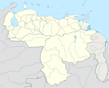
La Fría Airport (IATA: LFR, ICAO: SVLF), also known as Francisco García de Hevia International Airport, is an airport serving La Fría, a town in the Táchira state of Venezuela. The runway is 2 kilometres (1.2 mi) northwest of the town.
The La Fria VOR-DME (Ident: LFA) is located on the field.[3]
Airlines and destinations
[edit]| Airlines | Destinations |
|---|---|
| Conviasa | Caracas, Porlamar |
| LASER Airlines | Caracas |
See also
[edit]References
[edit]- ^ Airport information for LFR at Great Circle Mapper.
- ^ Google Maps - La Fria
- ^ LFA VOR
External links
[edit]

